2020s Maps of Franklin County, Nebraska
Explore 15 historic maps of Franklin County from the 2020s. These maps offer a rare glimpse into what life looked like during the 2020s — showing old roads, neighborhoods, homes, and landmarks that have changed or disappeared over time.
Whether you're researching your family's past, planning a metal detecting trip, or studying how Franklin County's landscape evolved across the 2020s, these high-resolution maps are a powerful tool for exploring the history of this region.
- Focus on a specific era: All maps on this page are from the 2020s, giving you a focused view of this time period.
- See what’s changed: Compare century-old streets, trails, and buildings to today's modern landscape using overlays and satellite layers.
- Research with precision: Use these maps for genealogy, historical research, land use analysis, or educational projects.
- View, download, or print: Maps are fully viewable online in high resolution, and can be downloaded or printed for your own records.
Start exploring Franklin County's history through authentic maps from the 2020s. This is your window into the past.
Franklin County, NE maps
(15)- 2021 Map of Franklin NE, 2021 Print
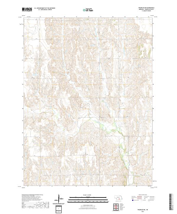 2021 Franklin NE2021 Print · USGSFranklin County's upland prairies and stream valleys are captured here in the early 2020s, showing a landscape defined by agriculture and drainage. Researchers can trace the path of Middle Br Thompson Cr and locate water features like Bartels Reservoir.
 - 2021 Map of Upland SE, 2021 Print
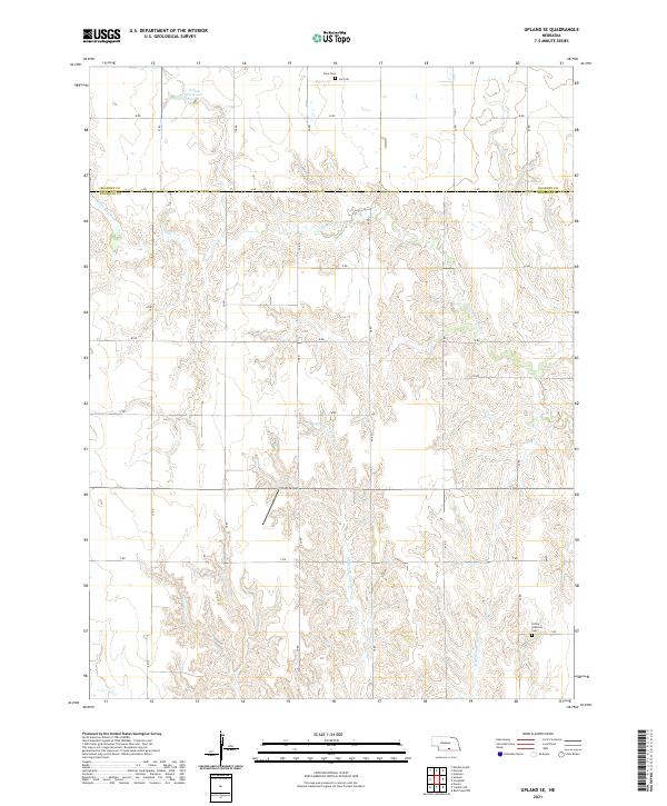 2021 Upland SE2021 Print · USGSThe rolling agricultural plains of south-central Nebraska are captured here in the early twenty-first century. Genealogists and local historians can trace the rural landscape across the county line to find Osco Cem, Trinity Lutheran Cem, and the Sindt Airport.
 - 2021 Map of Upland, 2021 Print
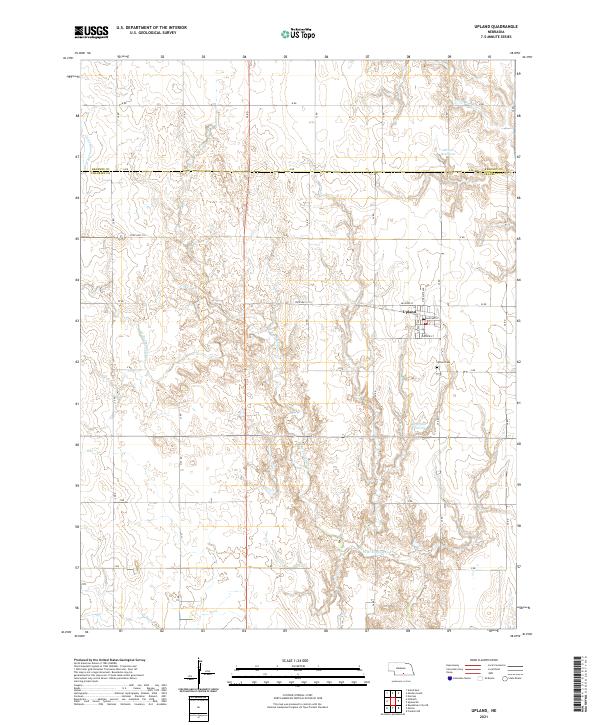 2021 Upland2021 Print · USGSUpland and the Nebraska plains are captured here in the early 2020s, showing the intersection of agricultural life and rural infrastructure. Genealogists and local historians can trace the streets of Upland and find local landmarks like Upland Cem and Olson Reservoir.
 - 2021 Map of Republican City NW, 2021 Print
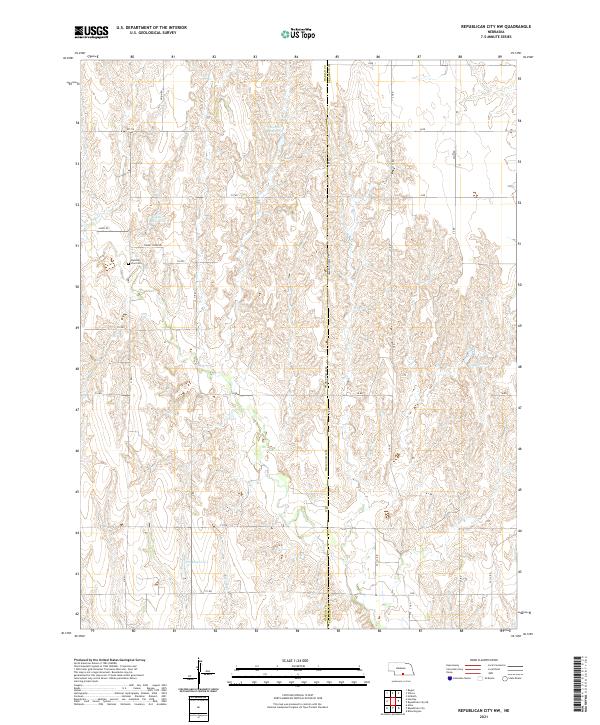 2021 Republican City NW2021 Print · USGSThe rural landscapes of south-central Nebraska are captured here in the early twenty-first century, centered on the community of Huntley. Local researchers can locate family sites near Zion Cem or trace the water systems of Eureka Cr and Harms Reservoir.
 - 2021 Map of Franklin, 2021 Print
 2021 Franklin2021 Print · USGSThe Republican River valley in southern Nebraska is captured here in modern detail, centered on the historic county seat of Franklin. Genealogists and historians can trace the town grid from the Franklin County Courthouse to Greenwood Cem and the surrounding reservoirs.
 - 2021 Map of Wilcox, 2021 Print
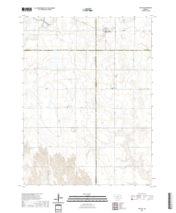 2021 Wilcox2021 Print · USGSWilcox and the surrounding Nebraska prairie are documented here in the early 2020s at the junction of four counties. Researchers can trace rural lineages through the Wilcox Cem, Freewater Cem, and Saint Johns Cem along the grid of section roads.
 - 2021 Map of Campbell, 2021 Print
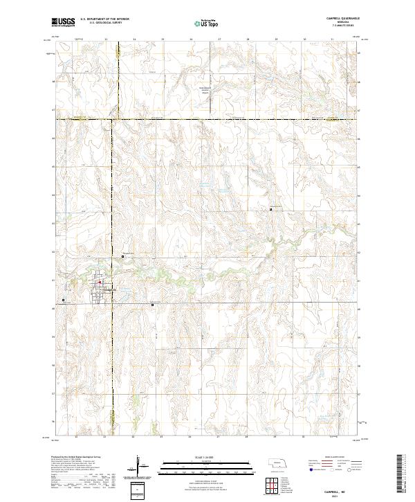 2021 Campbell2021 Print · USGSCampbell and the surrounding four-county borderlands appear here in the early twenty-first century, showcasing a landscape of managed water and rural transit. Genealogists can locate several local burial grounds including Koch Cem and Harmony Cem near the Little Blue River.
 - 2021 Map of Republican City NE, 2021 Print
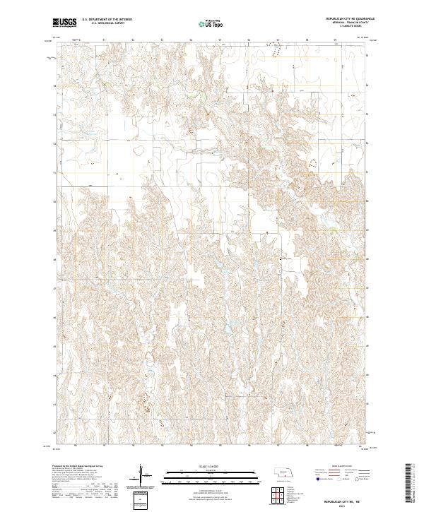 2021 Republican City NE2021 Print · USGSFranklin County's agricultural heartland is documented here in the early twenty-first century, showing the enduring grid of Nebraska's prairie sections. Genealogists and local historians can locate Bailey Cem and trace the drainage of Big Cottonwood Cr past Adam Reservoir.
 - 2021 Map of Macon, 2021 Print
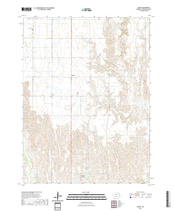 2021 Macon2021 Print · USGSFranklin County's agricultural landscape is documented here in the early 2020s, showing the intersection of rural township grids and natural waterways. Researchers can locate the Hauvelt Cem, the settlement of Macon, and Franklin's Plainview Airport along the southern border.
 - 2021 Map of Riverton, 2021 Print
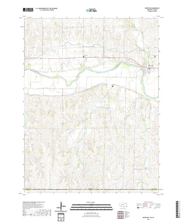 2021 Riverton2021 Print · USGSRiverton and the surrounding Republican River valley appear in detail at the turn of the decade. Genealogists and local historians can locate rural burial grounds like Stevens Cem and Fuller Cem, while tracing the vital irrigation routes of the Franklin Canal.
 - 2021 Map of Red Cloud NW, 2021 Print
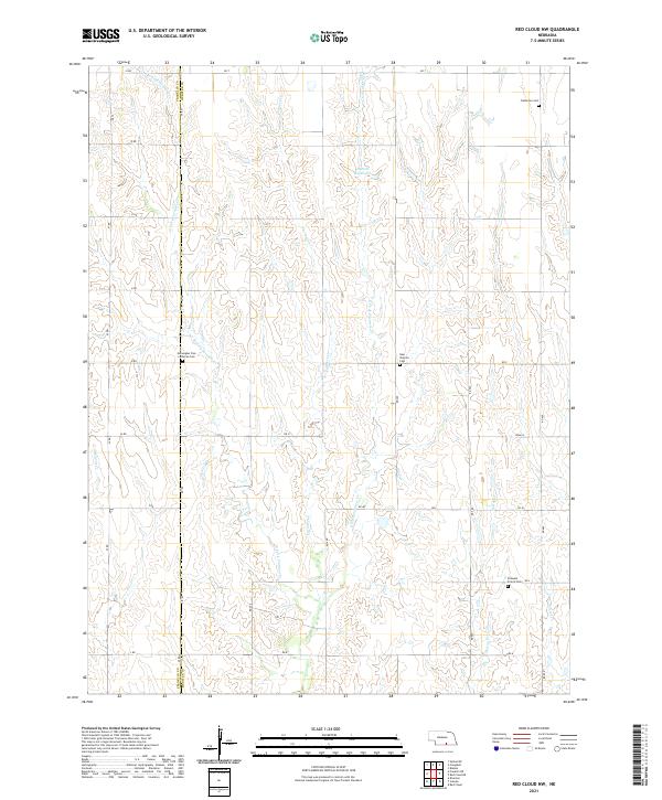 2021 Red Cloud NW2021 Print · USGSWebster and Franklin counties are shown here as the local landscape appeared in the early 2020s, dominated by prairie drainage and section roads. Researchers can locate family burial grounds including Catherton Cem and Pleasant Prairie Cem along the forks of Farmers Cr.
 - 2021 Map of Inavale, 2021 Print
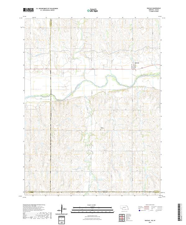 2021 Inavale2021 Print · USGSSouthern Nebraska at the Kansas border shows a landscape shaped by the Republican River and agricultural water management. Researchers can locate the Walnut Creek Cem and trace the path of the Franklin Canal near Inavale.
 - 2021 Map of Bloomington, 2021 Print
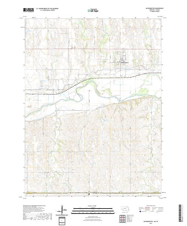 2021 Bloomington2021 Print · USGSFranklin County's irrigation and river landscape are captured in the early 2020s, showing the town of Bloomington and its surrounding agricultural tracts. Trace water management through the Franklin Canal and locate family history at Mount Olive Cem.
 - 2021 Map of Republican City, 2021 Print
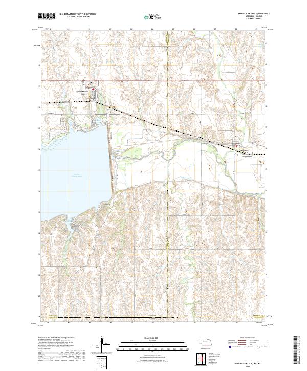 2021 Republican City2021 Print · USGSRepublican City and the surrounding reservoir country are documented here in the early twenty-first century. Genealogists and local researchers can trace the shorelines of Harlan County Lake and the street layouts of Republican City and Naponee.
 - 2021 Map of Hildreth, 2021 Print
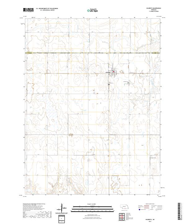 2021 Hildreth2021 Print · USGSThe village of Hildreth and its surrounding farmsteads appear here in a modern survey of the central Nebraska plains. Local historians can trace family roots at Saint Peters Cem, locate the remote Bunger Field, or follow the winding W Br Thompson Cr.
End of results
Showing maps 1-15 of 15
Top cities of Franklin County
- Franklin historical maps
- Campbell historical maps
- Hildreth historical maps
- Upland historical maps
- Naponee historical maps
- Bloomington historical maps
See more
Frequently asked questions
- What are the different types of historical maps available for Franklin County?
- What is the oldest map of Franklin County?
- Where can I purchase historical maps of Franklin County for my home or office?
- Where can I download high-res historical maps of Franklin County?
- Are there historical topographic maps available for Franklin County?
- Is there historical aerial imagery available for Franklin County?
- Where are historical maps of Franklin County sourced from?