1950s Maps of Furnas County, Nebraska
Explore 21 historic maps of Furnas County from the 1950s. These maps offer a rare glimpse into what life looked like during the 1950s — showing old roads, neighborhoods, homes, and landmarks that have changed or disappeared over time.
Whether you're researching your family's past, planning a metal detecting trip, or studying how Furnas County's landscape evolved across the 1950s, these high-resolution maps are a powerful tool for exploring the history of this region.
- Focus on a specific era: All maps on this page are from the 1950s, giving you a focused view of this time period.
- See what’s changed: Compare century-old streets, trails, and buildings to today's modern landscape using overlays and satellite layers.
- Research with precision: Use these maps for genealogy, historical research, land use analysis, or educational projects.
- View, download, or print: Maps are fully viewable online in high resolution, and can be downloaded or printed for your own records.
Start exploring Furnas County's history through authentic maps from the 1950s. This is your window into the past.
Furnas County, NE maps
(21)- 1954 Map of McCook, 1966 Print
 1954 McCook1966 Print · USGSSouthwest Nebraska in the mid-fifties reveals a landscape shaped by major water projects and the Chicago Burlington and Quincy RR. Trace ancestral roots and defunct rail stops in McCook, Wauneta, and along the shores of Swanson Lake.2 unique versions available
 - 1955 Map of Grand Island, 1967 Print
 1955 Grand Island1967 Print · USGSCentral Nebraska is seen here during a period of industrial and agricultural growth, centered on the vital Platte River corridor. Researchers can trace the mid-century footprints of the U S Naval Ammunition Depot and the Cornhusker Ordnance Plant.3 unique versions available
 - 1956 Map of Cambridge, 1957 Print
 1956 Cambridge1957 Print · USGSMid-century Furnas County comes alive in this survey of the river valley near the Red Willow and Frontier county lines. Genealogists can locate family-named landmarks like Mousel Sch and Harding Sch No 70 or trace the Republican River past Cambridge.3 unique versions available
 - 1957 Map of McCook
 1957 McCook1957 Print · USGSSouthwestern Nebraska in the mid-fifties is captured here during a period of significant water development and rail-based commerce. Researchers can trace the path of the Chicago Burlington and Quincy through Indianola and Bartley, or locate rural settlements like Chase Village and Ough near the Sand Hills.
 - 1957 Map of Grand Island
 1957 Grand Island1957 Print · USGSCentral Nebraska and Northern Kansas are shown here during a period of massive hydraulic and military expansion in the mid-fifties. Researchers can trace the development of the Harlan County Reservoir and the massive wartime legacy of the Cornhusker Ordnance Plant.
 - 1957 Map of Beaver City SW, 1958 Print
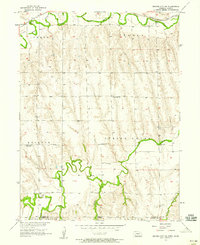 1957 Beaver City SW1958 Print · USGSThe Nebraska-Kansas borderlands were defined by the paths of Beaver Creek and the Chicago Burlington and Quincy rail line in the late fifties. Genealogists can trace early rural life through Lynden Cem, Spring Green Ch, and the site of School No 96 (Abandoned).
 - 1957 Map of Shippee, 1958 Print
 1957 Shippee1958 Print · USGSThe Nebraska-Kansas borderlands come alive in this mid-century survey of the Beaver Creek valley. Genealogists and historians can trace the Chicago Burlington and Quincy rail line through Shippee and locate the rural Tyrone Cem.2 unique versions available
 - 1957 Map of Wilsonville, 1958 Print
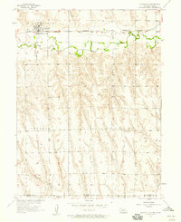 1957 Wilsonville1958 Print · USGSWilsonville stood as a vital rail and river hub on the Nebraska-Kansas border during the late fifties. Genealogists and historians can trace the town grid, the Chicago Burlington and Quincy rail line, and local landmarks like the Cem and Water Tank.2 unique versions available
 - 1957 Map of Precept, 1958 Print
 1957 Precept1958 Print · USGSFurnas County, Nebraska, near the Kansas state line is captured here in the late fifties as a landscape of established farmsteads and rural precincts. Genealogists can trace the exact locations of local landmarks like the Precept Sch, Bethel Ch, and Maple Creek Cem.
 - 1957 Map of Beaver City SE, 1958 Print
 1957 Beaver City SE1958 Print · USGSThe Nebraska-Kansas border comes into focus in the 1950s, showing a rural landscape defined by prairie creeks and steam-era rail lines. Researchers can trace family history through local landmarks like Needmore Sch, McCarty Sch, and the tiny settlement of Meents.
 - 1958 Map of McCook
 1958 McCook1958 Print · USGSSouthwest Nebraska during the late fifties reveals a landscape of massive new reservoirs and established rail hubs like McCook. Genealogists can trace family footprints through rural centers like St Johns Church and the many grain elevators along the Union Pacific RR.2 unique versions available
 - 1958 Map of Grand Island
 1958 Grand Island1958 Print · USGSSouth-central Nebraska thrived as a rail and industrial hub during the late fifties, shaped by the braided Platte River. Genealogists and historians can trace rail lines like the Union Pacific RR through towns such as Kearney or locate the sprawling Cornhusker Ordnance Plant.
 - 1958 Map of Edison, 1959 Print
 1958 Edison1959 Print · USGSThe village of Edison is documented here in the late fifties as a vital rail and river hub in Furnas County. Genealogists and researchers can trace the local landscape through the Edison Cem, the CHICAGO BURLINGTON AND QUINCY rail line, and the complex CAMBRIDGE CANAL irrigation system.2 unique versions available
 - 1958 Map of Wilsonville NW, 1959 Print
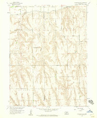 1958 Wilsonville NW1959 Print · USGSThe borderlands of Furnas and Red Willow counties are documented here in the late fifties as the Missouri River Basin project shaped the landscape. Genealogists can locate the Tyrone Cem and trace the sites of the East Valley Sch (Abandoned) and Plainview Sch No 62 (Abandoned).2 unique versions available
 - 1958 Map of Hollinger, 1959 Print
 1958 Hollinger1959 Print · USGSFurnas County during the late fifties reveals a landscape of prairie agriculture and rail-side villages. Genealogists and historians can trace the Chicago Burlington and Quincy line through Hollinger or locate burials at Turner Cemetery.
 - 1958 Map of Arapahoe, 1959 Print
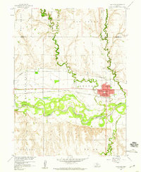 1958 Arapahoe1959 Print · USGSThe Republican River valley in the late fifties shows a landscape of steady agricultural growth and rail-dependent commerce. Trace local family history at Arapahoe Cemetery, locate St Matthews Ch, and follow the Cambridge Canal irrigation works.2 unique versions available
 - 1958 Map of Wilsonville NE, 1959 Print
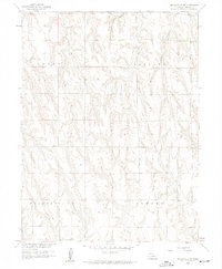 1958 Wilsonville NE1959 Print · USGSFurnas County, Nebraska, is documented here in the late fifties, showing the rural township structure and drainage systems of the Missouri River Basin. Genealogists and land researchers can trace property boundaries across Logan and Lynden townships or locate terrain markers like Horse Canyon.2 unique versions available
 - 1958 Map of Hendley, 1959 Print
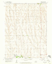 1958 Hendley1959 Print · USGSFurnas County agriculture and rail life are well-documented here in the late fifties as the town of Hendley sits along the southern hills. Researchers can trace family sites near Pleasantview Cem and the small crossing at Deerfield Corner.2 unique versions available
 - 1958 Map of Beaver City, 1959 Print
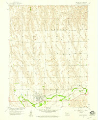 1958 Beaver City1959 Print · USGSBeaver City thrives as a plains rail hub during the late fifties, centered on the fertile valley of Beaver Creek. Researchers can trace the town's development through the local Fairground, the historic Mt Hope Cem, and the path of the Chicago Burlington and Quincy railroad.
 - 1958 Map of Oxford, 1960 Print
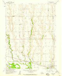 1958 Oxford1960 Print · USGSOxford and the Republican River valley are captured in the late fifties, showing a landscape defined by irrigation and rail. Genealogists can locate family-named sites such as Kellner Cem and several country schools including Hardscrabble Sch and Buffalo Sch.
 - 1958 Map of Holbrook, 1960 Print
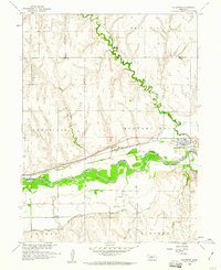 1958 Holbrook1960 Print · USGSThe Republican River valley in the late fifties shows a landscape reshaped by irrigation and rail. You can trace family plots at Miller Cem, locate the Lutheran Ch, or follow the Chicago Burlington and Quincy rail line through Holbrook.2 unique versions available
End of results
Showing maps 1-21 of 21
Top cities of Furnas County
- Cambridge historical maps
- Arapahoe historical maps
- Beaver City historical maps
- Holbrook historical maps
- Edison historical maps
- Wilsonville historical maps
See more
Frequently asked questions
- What are the different types of historical maps available for Furnas County?
- What is the oldest map of Furnas County?
- Where can I purchase historical maps of Furnas County for my home or office?
- Where can I download high-res historical maps of Furnas County?
- Are there historical topographic maps available for Furnas County?
- Is there historical aerial imagery available for Furnas County?
- Where are historical maps of Furnas County sourced from?