
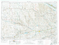
1954 Map of McCook
USGS Topo · Published 1966About this map
McCook serves as a regional hub in this mid-century portrait of southwest Nebraska, where the High Plains transition into the distinctive Sand Hills. The landscape is defined by the vital water systems of the Republican River and the Platte River, which supported the development of towns like Imperial, Gothenburg, and Cozad. This era shows the established footprint of the Chicago Burlington and Quincy RR and the Union Pacific, alongside a massive network of irrigation and water management infrastructure. Notable reservoirs such as Enders Reservoir, Swanson Lake, and Harry Strunk Lake appear as significant landmarks for both recreation and agriculture. Small settlements such as Wilsonville, Lamar, and Moorefield populate the grid of county lines, illustrating the density of rural communities before the late-century consolidation of farming operations.
Find a feature on this map
61 named features on this map. Tap any name to fly to it.
Don’t see what you’re looking for? This feature index may not catch every label — zoom into the map to look around manually.
Map Details
Editions of this 1954 McCook Map
2 editions found
Other maps of this area

1893 · Norton
USGS Topo · 1:125,000

1896 · Lexington
USGS Topo · 1:125,000

1896 · Arapahoe
USGS Topo · 1:125,000

1897 · Ogallala
USGS Topo · 1:125,000

1898 · Arapahoe
USGS Topo · 1:125,000

1898 · Paxton
USGS Topo · 1:125,000

1899 · Lexington
USGS Topo · 1:125,000

1899 · North Platte
USGS Topo · 1:125,000

1900 · Chappell
USGS Topo · 1:125,000

1900 · Ogallala
USGS Topo · 1:125,000