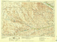
1954 Map of McCook
USGS Topo · Published 1977About this map
McCook serves as the focal point of this regional study, which captures the hydraulic and agricultural landscape of southwest Nebraska during the mid-twentieth century. The map documents a critical era of water management, showing major reservoirs such as Swanson Lake, Enders Reservoir, Hugh Butler Lake, and Harry Strunk Lake fully integrated into the local topography. These bodies of water, supported by the Enders Dam and Trenton Dam, reflect the significant post-war infrastructure developments that transformed the Republican River and Frenchman Creek basins.
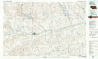
Find a feature on this map
119 named features on this map. Tap any name to fly to it.
Don’t see what you’re looking for? This feature index may not catch every label — zoom into the map to look around manually.
Map Details
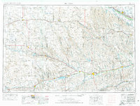
Editions of this 1954 McCook Map
2 editions found

Historical Maps of McCook Through Time
4 maps found