1980s Maps of Garfield County, Nebraska
Explore 9 historic maps of Garfield County from the 1980s. These maps offer a rare glimpse into what life looked like during the 1980s — showing old roads, neighborhoods, homes, and landmarks that have changed or disappeared over time.
Whether you're researching your family's past, planning a metal detecting trip, or studying how Garfield County's landscape evolved across the 1980s, these high-resolution maps are a powerful tool for exploring the history of this region.
- Focus on a specific era: All maps on this page are from the 1980s, giving you a focused view of this time period.
- See what’s changed: Compare century-old streets, trails, and buildings to today's modern landscape using overlays and satellite layers.
- Research with precision: Use these maps for genealogy, historical research, land use analysis, or educational projects.
- View, download, or print: Maps are fully viewable online in high resolution, and can be downloaded or printed for your own records.
Start exploring Garfield County's history through authentic maps from the 1980s. This is your window into the past.
Garfield County, NE maps
(9)- 1981 Map of Abbott Ranch
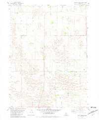 1981 Abbott Ranch1981 Print · USGSThe Nebraska Sandhills come into sharp focus in the early 1980s as ranching life follows the winding waters of Big Cedar Creek. Genealogists and local historians can trace legacy homesteads like Abbott Ranch and Price Ranch alongside rural landmarks like the Cedar Creek Ch.
 - 1981 Map of Miles Ranch, 1982 Print
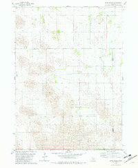 1981 Miles Ranch1982 Print · USGSGarfield and Wheeler counties are captured in the early eighties as a world of expansive ranching operations and isolated prairie outposts. Genealogists and historians can trace family landholdings like Miles Ranch, Schmidt Ranch, and the small settlement of Dumas.2 unique versions available
 - 1981 Map of Carson Lake, 1982 Print
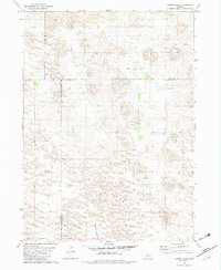 1981 Carson Lake1982 Print · USGSGarfield County ranching lands are captured in the early 1980s, documenting a remote landscape defined by wide meadows and creek beds. Genealogists and local historians can trace legacy holdings like Taylor Ranch and Noyes Ranch near the shores of Carson Lake.
 - 1981 Map of Chain Lake, 1982 Print
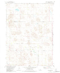 1981 Chain Lake1982 Print · USGSGarfield and Holt Counties are shown in the early eighties, capturing the ranching landscape of the Nebraska Sandhills. Genealogists and historians can trace family-named sites such as Ballagh Ranch and the community hub of Erina Ch near the banks of Big Cedar Creek.2 unique versions available
 - 1985 Map of O'Neill
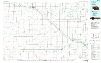 1985 O'Neill1985 Print · USGSThe Elkhorn River valley and its surrounding plains are captured in the mid-1980s, showing a landscape defined by rail lines and ranching hubs. Genealogists and local historians can trace the rail networks of the Chicago and North Western and find smaller locales like Knievels Corner, Amelia, and Venus.2 unique versions available
 - 1985 Map of Ord
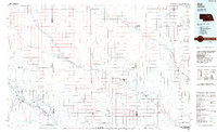 1985 Ord1985 Print · USGSCentral Nebraska's river valleys were defined by the rail and irrigation networks of the mid-1980s. Genealogists can trace family roots in towns like Ord and Albion or locate landmarks like Pilot Knob and the Pibel Lake State Recreation Area.2 unique versions available
 - 1985 Map of Rose
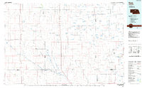 1985 Rose1985 Print · USGSNorth Central Nebraska in the mid-eighties shows a sprawling landscape of Sandhills lakes and remote ranching outposts. Genealogists and researchers can trace the rural crossroads of Rose, Duff, and Raven or locate landmarks along the Calamus River and Gracie Flats.2 unique versions available
 - 1985 Map of Burwell
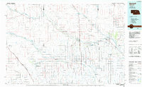 1985 Burwell1985 Print · USGSCentral Nebraska in the mid-eighties reveals a landscape shaped by the Middle Loup River and the Burlington Northern rail line. Researchers can trace the layout of small towns like Sargent, Anselmo, and Burwell or locate New Helena and Victoria Springs State Recreation Area.
 - 1989 Map of O'Neill
 1989 O'Neill1989 Print · USGSThe Nebraska-South Dakota borderlands are captured here in the late eighties, documenting the ranching and rail infrastructure of the High Plains. Genealogists and collectors can trace historic prairie towns like Monowi, Pishelville, and Santee along the Niobrara River.
End of results
Showing maps 1-9 of 9
Top cities of Garfield County
Frequently asked questions
- What are the different types of historical maps available for Garfield County?
- What is the oldest map of Garfield County?
- Where can I purchase historical maps of Garfield County for my home or office?
- Where can I download high-res historical maps of Garfield County?
- Are there historical topographic maps available for Garfield County?
- Is there historical aerial imagery available for Garfield County?
- Where are historical maps of Garfield County sourced from?