Old Maps of Garfield County, Nebraska for Genealogy
Trace your family roots with 91 historic maps of Garfield County. These high-res maps reveal old neighborhoods, homesites, landmarks, and streets — helping you uncover where your ancestors lived and how the area evolved over time.
- Explore historic neighborhoods: Identify where your relatives may have lived in the 1800s or 1900s.
- Compare maps over time: Trace the changes in streets, buildings, and landmarks for multi-generational research.
- Perfect for genealogy & ancestry research: Used by family historians and researchers to map out lineage and migration.
These maps are an incredible resource for exploring your personal connection to Garfield County's past.
Garfield County, NE maps
(91)- 1952 Map of Burwell, 1954 Print
 1952 Burwell1954 Print · USGSBurwell and the river valleys of Garfield County are shown in the early fifties as the region's agricultural and irrigation infrastructure matured. Genealogists and historians can trace local rural life through numerous sites like Gideon Sch, Banner Cem, and the Chicago Burlington and Quincy rail line.2 unique versions available
 - 1952 Map of Elyria, 1954 Print
 1952 Elyria1954 Print · USGSValley County farming and rail life are centered on the river in the early fifties. Genealogists and historians can locate the Site of Fort Hartsuff, the Elyria Cem, and rural schools like Sunnyside Sch or Goodenow Sch.2 unique versions available
 - 1952 Map of Burwell SE, 1954 Print
 1952 Burwell SE1954 Print · USGSGarfield County in the early fifties shows a landscape of river-valley farming and active prairie school districts. Researchers can trace the path of the Chicago and North Western rail line and locate community landmarks like West Side Cem and Willow Springs Sch.3 unique versions available
 - 1952 Map of Burwell NE, 1954 Print
 1952 Burwell NE1954 Print · USGSGarfield County was defined by its remote rural outposts and one-room schoolhouses in the years following the war. Researchers can trace the layout of early ranching life through local landmarks like Deverre, Kinkaid Sch, and Golden Standard Sch.3 unique versions available
 - 1952 Map of Comstock NW, 1954 Print
 1952 Comstock NW1954 Print · USGSThe high plains of central Nebraska were a patchwork of rural school districts and immigrant parish life in the early fifties. Genealogists can trace local roots through landmarks like the Bohemian Brotherhood Cemetery, Jungmann Hall, and the Boleszyn Church.2 unique versions available
 - 1952 Map of Burwell NW, 1954 Print
 1952 Burwell NW1954 Print · USGSGarfield and Loup Counties are shown at the height of the mid-century ranching era, defined by the isolated homesteads and dunes of the Nebraska Sandhills. Researchers can locate the Garska Ranch, trace the drainage of Dry Creek, and find School No 32 (Abandoned).3 unique versions available
 - 1954 Map of Gables SE, 1955 Print
 1954 Gables SE1955 Print · USGSThe Sandhills of Garfield and Wheeler counties are shown in the mid-1950s, revealing a landscape defined by ranching and small rural school districts. You can trace early 20th-century education sites like School No 10 and School No 10 (Abandoned) along the banks of Cedar Creek.2 unique versions available
 - 1954 Map of Gables SW, 1955 Print
 1954 Gables SW1955 Print · USGSGarfield County rangelands are shown here in the mid-1950s as the Missouri River Basin project documented the Nebraska interior. Genealogists and historians can locate numerous rural schoolhouses like School No 7 and School No 20, or trace the grounds of the HO Ranch.3 unique versions available
 - 1954 Map of Ord NE, 1955 Print
 1954 Ord NE1955 Print · USGSThe rural Nebraska prairie in the mid-1950s was a landscape defined by small township school districts and essential water infrastructure. Researchers can trace the locations of historic schools like Plain Valley and Brick Sch or follow the paths of Elm Creek and Spring Creek.2 unique versions available
 - 1954 Map of Ord NW, 1955 Print
 1954 Ord NW1955 Print · USGSThe North Loup River valley in Valley County is captured here in the mid-1950s during the development of the Missouri River Basin. Genealogists and local historians can locate several rural schoolhouses like Sunnyslope Sch and trace the Chicago Burlington and Quincy rail line.2 unique versions available
 - 1954 Map of Gables NW, 1956 Print
 1954 Gables NW1956 Print · USGSGarfield County ranching land is documented during the mid-fifties, showing the scattered schools and water sources of the Nebraska Sandhills. Genealogists and local historians can locate early rural landmarks like School No 34, School No 22, and several Windmill sites.3 unique versions available
 - 1954 Map of Gables, 1958 Print
 1954 Gables1958 Print · USGSGarfield County ranching country and the small outpost of Gables are shown here during the mid-fifties. Genealogists and local historians can trace rural school districts like School No 9 and locate scattered Windmill sites along Cedar Creek.3 unique versions available
 - 1955 Map of Broken Bow
 1955 Broken Bow1955 Print · USGSCentral Nebraska in the mid-fifties is defined by the sweeping Sand Hills and the vital river valleys that supported its ranching and rail towns. Researchers can trace the rail corridors of the Union Pacific RR and locate settlements like Dannebrog, Broken Bow, and Brewster.5 unique versions available
 - 1955 Map of O'Neill, 1974 Print
 1955 O'Neill1974 Print · USGSNorth-central Nebraska in the 1950s reveals a vast cattle-ranching landscape transitioning from the Missouri River breaks to the iconic Sand Hills. Researchers can trace the path of the Chicago and North Western rail line and locate rural landmarks like the Dustin Post Office and St Johns Lake Ch.2 unique versions available
 - 1956 Map of Broken Bow
 1956 Broken Bow1956 Print · USGSCentral Nebraska during the mid-fifties reveals a region defined by its river-valley railroads and the rolling Sand Hills. Genealogists and local historians can trace the paths of the Chicago Burlington and Quincy through towns like Broken Bow, Merna, and Anselmo.
 - 1959 Map of O'Neill
 1959 O'Neill1959 Print · USGSNorth-central Nebraska in the late fifties is defined by the vast Sand Hills and the vital Chicago and North Western rail line. Genealogists and researchers can trace family roots through settlements like Atkinson, Bassett, and Stuart or follow the waters of the Niobrara River.2 unique versions available
 - 1969 Map of O'Neill
 1969 O'Neill1969 Print · USGSCentral Nebraska in the mid-fifties is defined here by the expansive Sand Hills and the winding Niobrara River. Trace the Chicago and North Western rail line through cattle towns like O'Neill and Ainsworth.
 - 1981 Map of Abbott Ranch
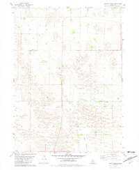 1981 Abbott Ranch1981 Print · USGSThe Nebraska Sandhills come into sharp focus in the early 1980s as ranching life follows the winding waters of Big Cedar Creek. Genealogists and local historians can trace legacy homesteads like Abbott Ranch and Price Ranch alongside rural landmarks like the Cedar Creek Ch.
 - 1981 Map of Miles Ranch, 1982 Print
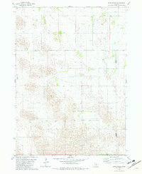 1981 Miles Ranch1982 Print · USGSGarfield and Wheeler counties are captured in the early eighties as a world of expansive ranching operations and isolated prairie outposts. Genealogists and historians can trace family landholdings like Miles Ranch, Schmidt Ranch, and the small settlement of Dumas.2 unique versions available
 - 1981 Map of Carson Lake, 1982 Print
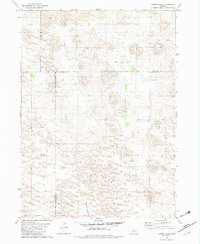 1981 Carson Lake1982 Print · USGSGarfield County ranching lands are captured in the early 1980s, documenting a remote landscape defined by wide meadows and creek beds. Genealogists and local historians can trace legacy holdings like Taylor Ranch and Noyes Ranch near the shores of Carson Lake.
 - 1981 Map of Chain Lake, 1982 Print
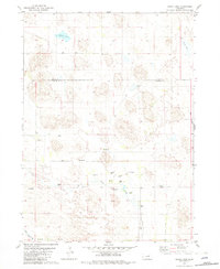 1981 Chain Lake1982 Print · USGSGarfield and Holt Counties are shown in the early eighties, capturing the ranching landscape of the Nebraska Sandhills. Genealogists and historians can trace family-named sites such as Ballagh Ranch and the community hub of Erina Ch near the banks of Big Cedar Creek.2 unique versions available
 - 1985 Map of O'Neill
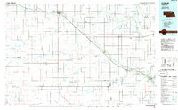 1985 O'Neill1985 Print · USGSThe Elkhorn River valley and its surrounding plains are captured in the mid-1980s, showing a landscape defined by rail lines and ranching hubs. Genealogists and local historians can trace the rail networks of the Chicago and North Western and find smaller locales like Knievels Corner, Amelia, and Venus.2 unique versions available
 - 1985 Map of Ord
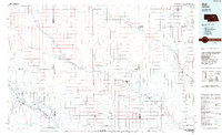 1985 Ord1985 Print · USGSCentral Nebraska's river valleys were defined by the rail and irrigation networks of the mid-1980s. Genealogists can trace family roots in towns like Ord and Albion or locate landmarks like Pilot Knob and the Pibel Lake State Recreation Area.2 unique versions available
 - 1985 Map of Rose
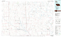 1985 Rose1985 Print · USGSNorth Central Nebraska in the mid-eighties shows a sprawling landscape of Sandhills lakes and remote ranching outposts. Genealogists and researchers can trace the rural crossroads of Rose, Duff, and Raven or locate landmarks along the Calamus River and Gracie Flats.2 unique versions available
 - 1985 Map of Burwell
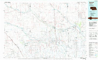 1985 Burwell1985 Print · USGSCentral Nebraska in the mid-eighties reveals a landscape shaped by the Middle Loup River and the Burlington Northern rail line. Researchers can trace the layout of small towns like Sargent, Anselmo, and Burwell or locate New Helena and Victoria Springs State Recreation Area.
Showing maps 1-25 of 91
Top cities of Garfield County
Frequently asked questions
- What are the different types of historical maps available for Garfield County?
- What is the oldest map of Garfield County?
- Where can I purchase historical maps of Garfield County for my home or office?
- Where can I download high-res historical maps of Garfield County?
- Are there historical topographic maps available for Garfield County?
- Is there historical aerial imagery available for Garfield County?
- Where are historical maps of Garfield County sourced from?