2020s Maps of Garfield County, Nebraska
Explore 16 historic maps of Garfield County from the 2020s. These maps offer a rare glimpse into what life looked like during the 2020s — showing old roads, neighborhoods, homes, and landmarks that have changed or disappeared over time.
Whether you're researching your family's past, planning a metal detecting trip, or studying how Garfield County's landscape evolved across the 2020s, these high-resolution maps are a powerful tool for exploring the history of this region.
- Focus on a specific era: All maps on this page are from the 2020s, giving you a focused view of this time period.
- See what’s changed: Compare century-old streets, trails, and buildings to today's modern landscape using overlays and satellite layers.
- Research with precision: Use these maps for genealogy, historical research, land use analysis, or educational projects.
- View, download, or print: Maps are fully viewable online in high resolution, and can be downloaded or printed for your own records.
Start exploring Garfield County's history through authentic maps from the 2020s. This is your window into the past.
Garfield County, NE maps
(16)- 2021 Map of Gables SW, 2021 Print
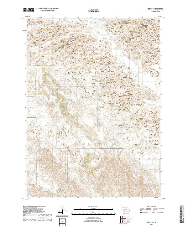 2021 Gables SW2021 Print · USGSGarfield County ranchlands are surveyed here in the early 2020s, showing the remote sandhill landscape of central Nebraska. Researchers can trace the drainage of Dry Cedar Cr and follow rural routes like Silver Rd and Haskell Creek Rd.
 - 2021 Map of Burwell NE, 2021 Print
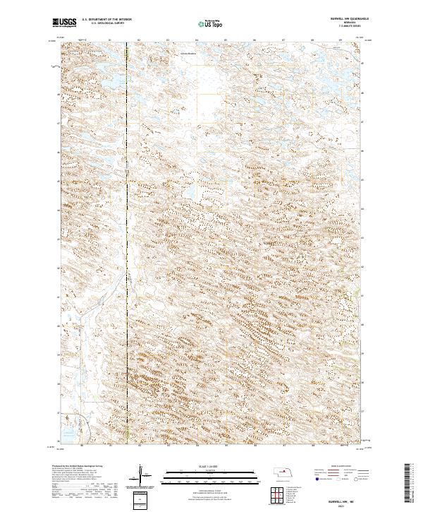
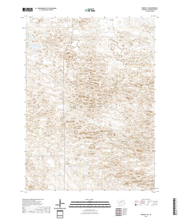 2021 Burwell NE2021 Print · USGSGarfield County in the early twenty-first century remains a landscape of sprawling ranch land and section-line roads. Genealogists and local historians can trace rural connections near Deverre or follow the terrain changes at Beat Flats and along 840th Rd.
 - 2021 Map of Gables, 2021 Print
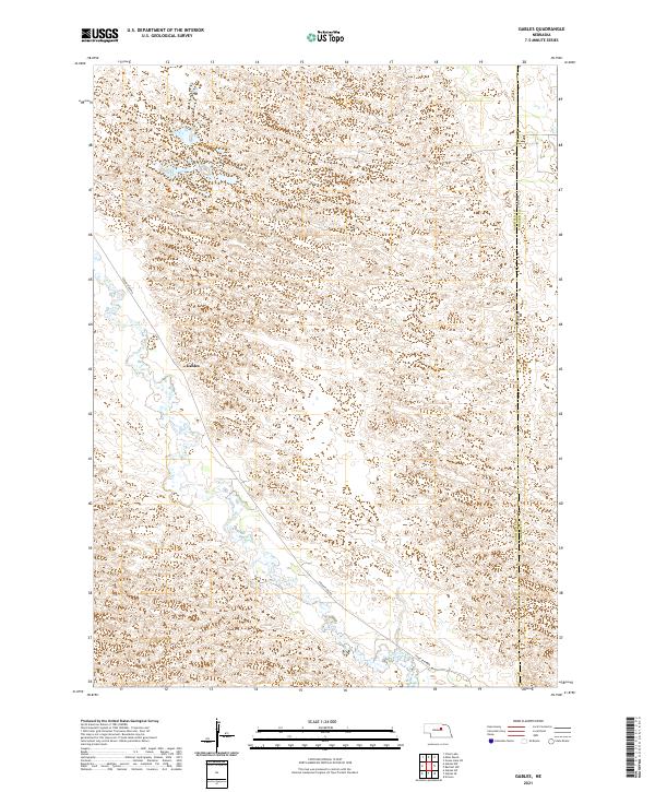 2021 Gables2021 Print · USGSGarfield County's rural prairie and wetland networks are documented in this recent survey. Local researchers can trace the course of Cedar Creek and identify the location of Gables along Cedar River Rd near the Wheeler County line.
 - 2021 Map of Comstock NW, 2021 Print
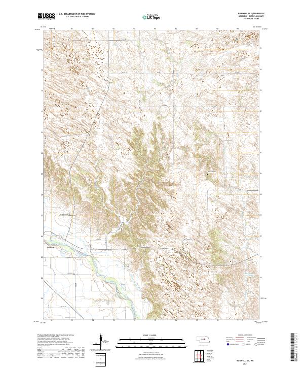
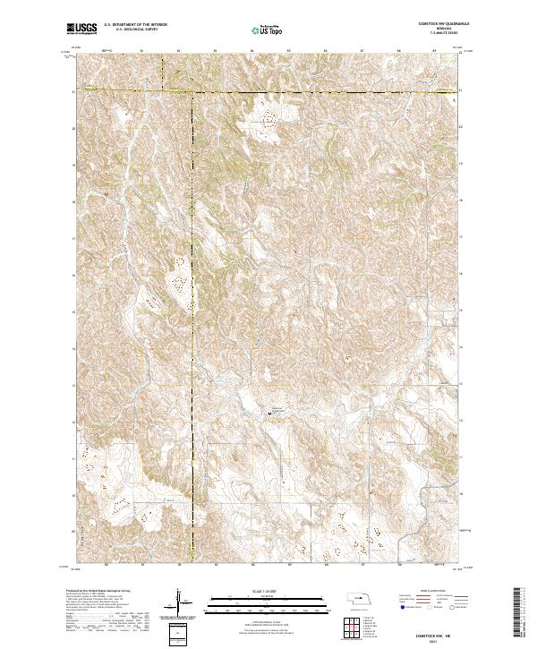 2021 Comstock NW2021 Print · USGSThe rural intersection of four Nebraska counties is captured in this recent survey of the central plains landscape. Genealogists and local historians can locate the Bohemian Brotherhood Cem and trace seasonal watercourses like Sioux Cr and N Br Turtle Cr.
 - 2021 Map of Burwell, 2021 Print
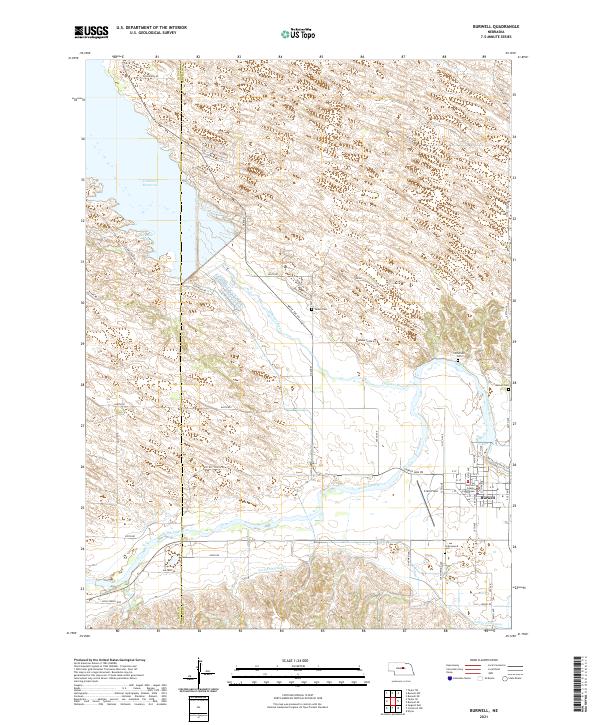 2021 Burwell2021 Print · USGSThe Garfield County seat thrives alongside the North Loup River during this recent survey of Nebraska's Sandhills edge. Genealogists and local historians can trace rural burial sites like Banner Cem or locate the Garfield County Courthouse and Cram Field in town.
 - 2021 Map of Gables SE, 2021 Print
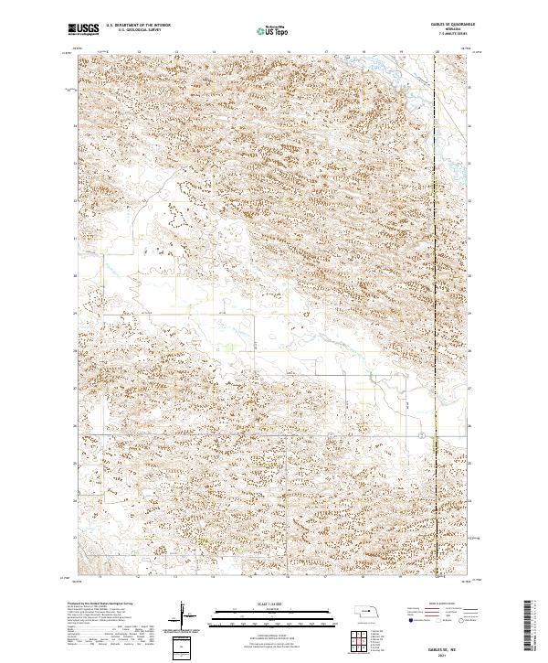 2021 Gables SE2021 Print · USGSGarfield and Wheeler counties in 2021 reveal the open sandhill ranching country of central Nebraska. Researchers can trace the path of Cedar Creek, follow the Garfield Co Wheeler Co line, and locate rural routes like Joint Loop.
 - 2021 Map of Gables NW, 2021 Print
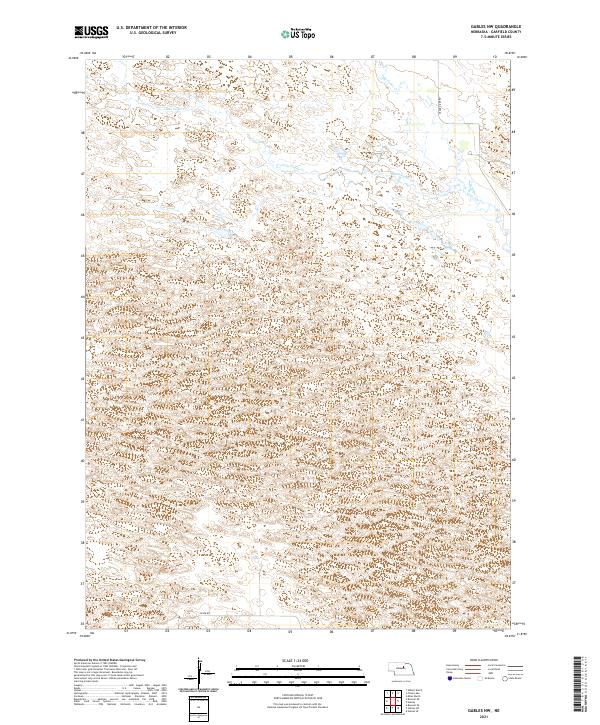 2021 Gables NW2021 Print · USGSGarfield County's rolling Sandhills are documented here in the early twenty-first century, showing a landscape shaped by water and ranching. Genealogists and researchers can trace local routes like Silver Rd and the drainage of Little Cedar Cr across the prairie.
 - 2021 Map of Elyria, 2021 Print
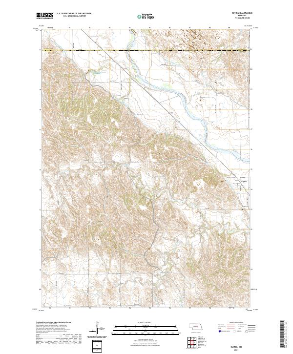 2021 Elyria2021 Print · USGSValley County farming and irrigation come into focus during the early 2020s near the village of Elyria. Genealogists and historians can trace local landmarks like Elyria Cem and the intricate flow of the Taylor-Ord Canal and North Loup River.
 - 2021 Map of Ord NW, 2021 Print
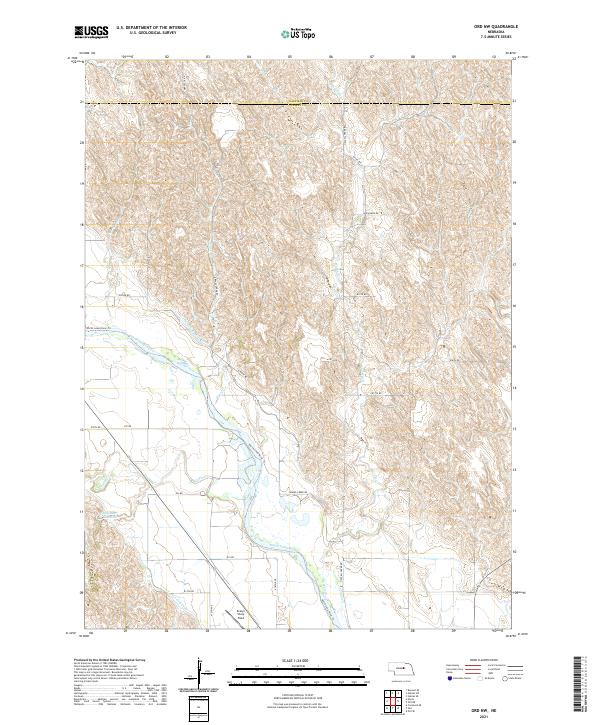 2021 Ord NW2021 Print · USGSThe North Loup River valley in Valley County is captured here in the early 2020s, showing a landscape defined by irrigation and aviation history. Researchers can trace the Burwell-Sumter Canal, locate the Oldfather Reservoir, and find the Evelyn Sharp Field airport.
 - 2021 Map of Ord NE, 2021 Print
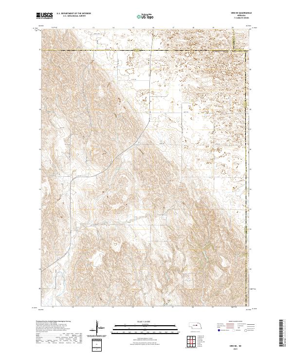 2021 Ord NE2021 Print · USGSThe Nebraska Sandhills borderlands come into focus in this recent survey of the Valley and Garfield county lines. Genealogists and land researchers can trace property boundaries along Amity Rd or follow the path of the Burwell-Sumter Canal and Miserable Cr.
 - 2021 Map of Abbott Ranch, 2021 Print
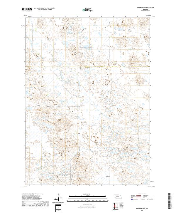 2021 Abbott Ranch2021 Print · USGSThe Nebraska Sandhills come into focus in this 2021 study of the Garfield and Holt County borderlands. Trace the winding paths of Big Cedar Creek and Little Cedar Creek or locate local landmarks like Beat Flats along the remote Cedar River Road.
 - 2021 Map of Burwell SE, 2021 Print
 2021 Burwell SE2021 Print · USGSGarfield County settlement and irrigation patterns are on display here in the early twenty-first century. Researchers can locate Burwell near the North Loup River, trace the path of the Burwell-Sumter Canal, or find family records at West Side Cem.
 - 2021 Map of Carson Lake, 2021 Print
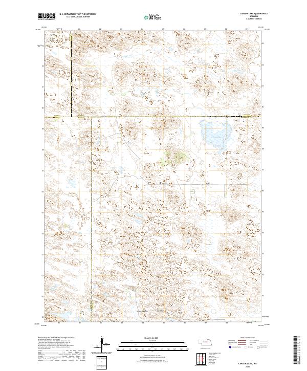 2021 Carson Lake2021 Print · USGSThe Nebraska Sandhills at the meeting of four counties are captured here in the early twenty-first century. Researchers can trace the hydrologic signatures of Carson Lake, follow the path of Big Cedar Cr, and locate family land near Garska Meadow.
 - 2021 Map of Burwell NW, 2021 Print
 2021 Burwell NW2021 Print · USGSThe Nebraska Sandhills come into sharp focus in the early 2020s, revealing a landscape of prairie meadows and seasonal lakes. Researchers can trace the north end of the Calamus Reservoir and find isolated water bodies like Nichol Lake and Bald Lake.
 - 2021 Map of Chain Lake, 2021 Print
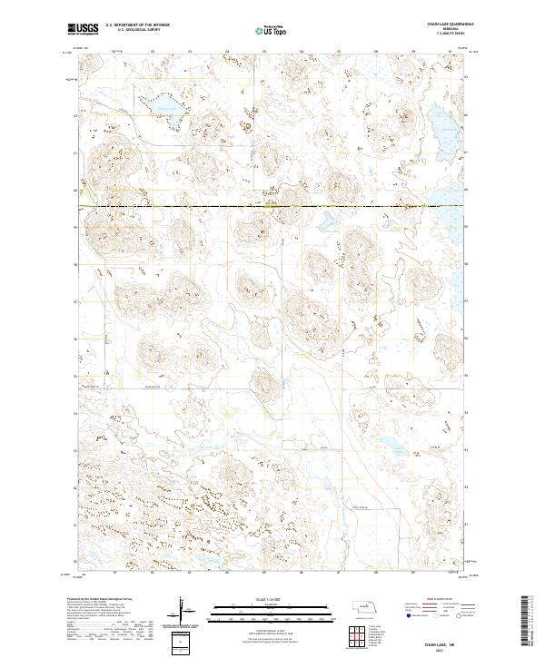 2021 Chain Lake2021 Print · USGSGarfield and Holt counties are shown here in the 2020s, capturing a remote stretch of the Nebraska sandhills defined by its namesake water bodies. Researchers can trace the drainage of Big Cedar Cr or locate specific holdings near Willow Lake and Sunfish Lake.
 - 2021 Map of Miles Ranch, 2021 Print
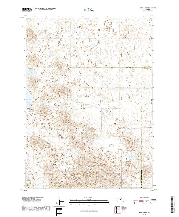 2021 Miles Ranch2021 Print · USGSThe Nebraska Sandhills come into focus in this recent survey of the rural ranchlands at the intersection of three counties. Researchers can trace the section-line roads and remote wetlands that define the area, including Rush Lake, Dumas Ave, and 848th Rd.
End of results
Showing maps 1-16 of 16
Top cities of Garfield County
Frequently asked questions
- What are the different types of historical maps available for Garfield County?
- What is the oldest map of Garfield County?
- Where can I purchase historical maps of Garfield County for my home or office?
- Where can I download high-res historical maps of Garfield County?
- Are there historical topographic maps available for Garfield County?
- Is there historical aerial imagery available for Garfield County?
- Where are historical maps of Garfield County sourced from?