2020s Maps of Grant County, Nebraska
Explore 24 historic maps of Grant County from the 2020s. These maps offer a rare glimpse into what life looked like during the 2020s — showing old roads, neighborhoods, homes, and landmarks that have changed or disappeared over time.
Whether you're researching your family's past, planning a metal detecting trip, or studying how Grant County's landscape evolved across the 2020s, these high-resolution maps are a powerful tool for exploring the history of this region.
- Focus on a specific era: All maps on this page are from the 2020s, giving you a focused view of this time period.
- See what’s changed: Compare century-old streets, trails, and buildings to today's modern landscape using overlays and satellite layers.
- Research with precision: Use these maps for genealogy, historical research, land use analysis, or educational projects.
- View, download, or print: Maps are fully viewable online in high resolution, and can be downloaded or printed for your own records.
Start exploring Grant County's history through authentic maps from the 2020s. This is your window into the past.
Grant County, NE maps
(24)- 2021 Map of Pratt Valley, 2021 Print
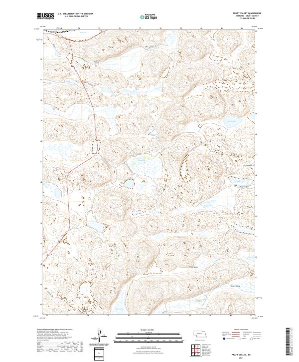 2021 Pratt Valley2021 Print · USGSThe Nebraska Sandhills near Hyannis are showcased here in the early twenty-first century, revealing a unique landscape of interdunal valleys and lakes. Researchers can trace the layout of water features like Muskrat Lake and the topography of Pratt Valley and Winnie Valley.
 - 2021 Map of Spring Valley, 2021 Print
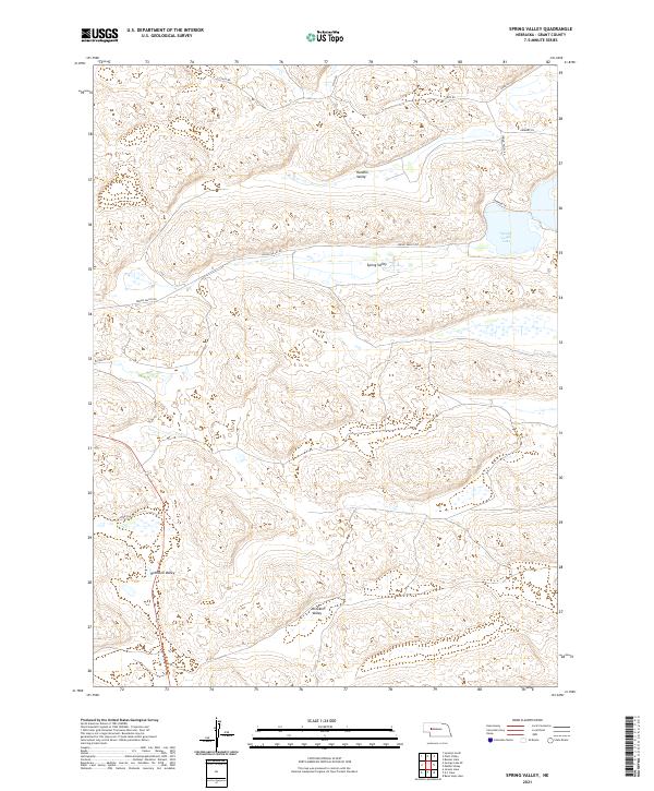 2021 Spring Valley2021 Print · USGSThe Nebraska Sandhills come to life in this recent survey of eastern Grant County, showing a landscape defined by cattle ranching and remote basins. Researchers can trace land ties and local routes like Spring Valley Rd through named areas such as Brooking Valley and Spring Valley Lake.
 - 2021 Map of Rosebud Lake, 2021 Print
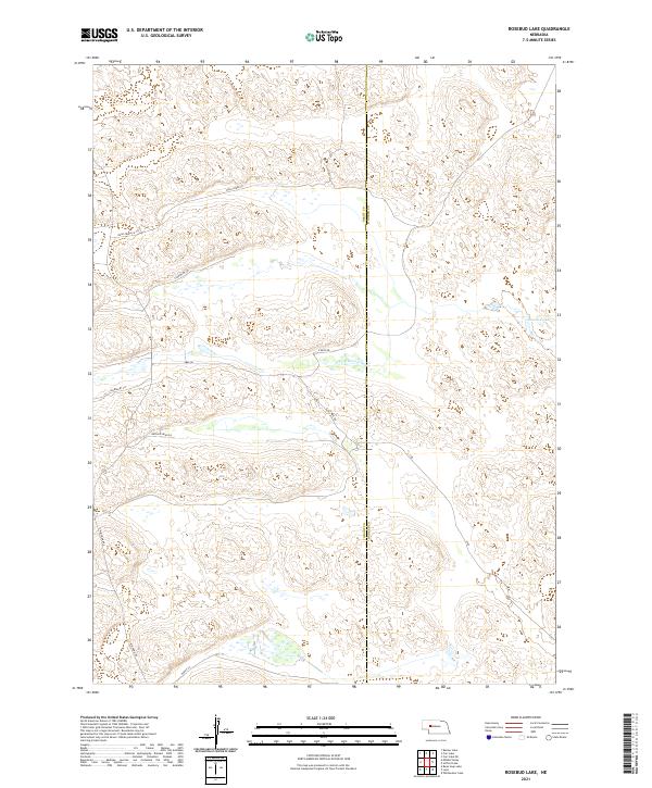 2021 Rosebud Lake2021 Print · USGSThe Nebraska Sandhills near the Grant and Hooker County line are captured in this contemporary survey of a sparse ranching landscape. Trace the course of the N Fork Dismal River and the rural network of Rush Creek Ln and Rosebud Lake.
 - 2021 Map of Carr Lake, 2021 Print
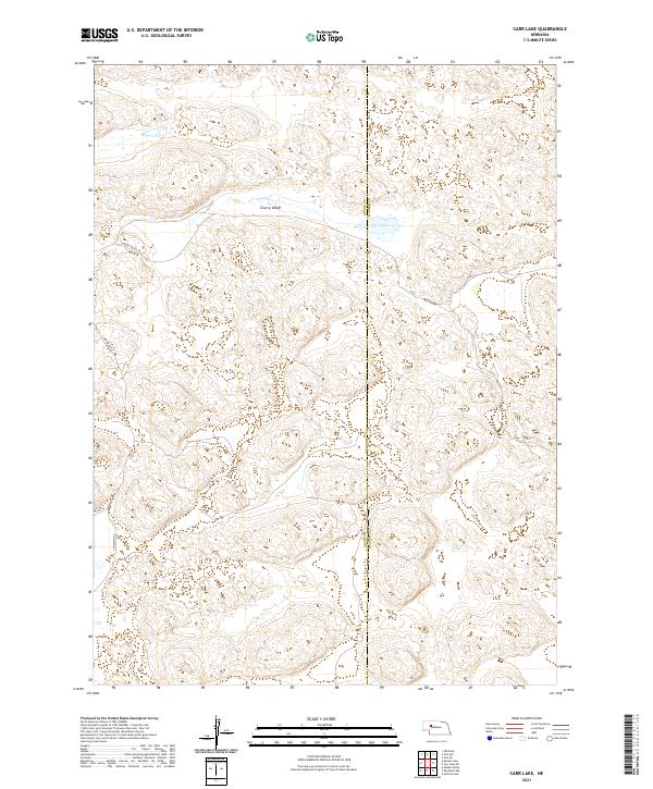 2021 Carr Lake2021 Print · USGSThe Nebraska Sandhills come into sharp focus in the early 2020s at the intersection of Grant and Hooker counties. Researchers can trace the sparse network of ranch roads like Cherry Valley Rd and Flats Ln near the waters of Carr Lake.
 - 2021 Map of Wild Horse Hill, 2021 Print
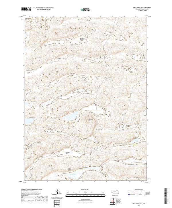 2021 Wild Horse Hill2021 Print · USGSThe Nebraska Sandhills of Grant County are shown in the modern era, revealing a landscape of interdunal valleys and remote ranch lands. Genealogists and local historians can trace family-named routes like S Ashby Rd and Burgess Ln near Swede Lake.
 - 2021 Map of Jensen Lake, 2021 Print
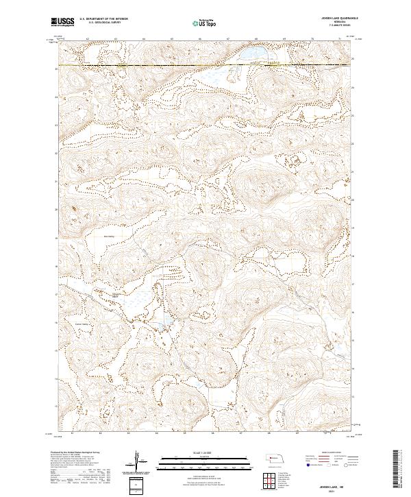 2021 Jensen Lake2021 Print · USGSArthur and Grant counties meet in this modern survey of the Nebraska Sandhills, revealing a remote ranching landscape of valleys and basins. Genealogists and local historians can trace family-named landmarks like Jensen Lake, Voss Valley, and Sillasen Rd.
 - 2021 Map of Bourquim Hill, 2021 Print
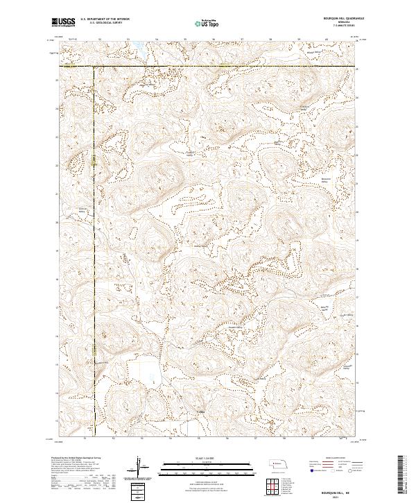 2021 Bourquim Hill2021 Print · USGSThe Nebraska Sandhills come into sharp focus in the 2020s at the junction of Arthur and Garden Counties. Researchers can trace rural routes like Sillassen Rd and Carlholm Dr while locating named family landmarks such as Velma and Bourquim Hill.
 - 2021 Map of George Lake SE, 2021 Print
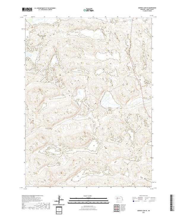 2021 George Lake SE2021 Print · USGSGrant County is revealed in the early 2020s as a landscape of remote sandhills and section-line roads. Researchers can trace land holdings and rural access routes like Spring Valley Rd, Kramer Ln, and Reynolds Ln.
 - 2021 Map of Lena, 2021 Print
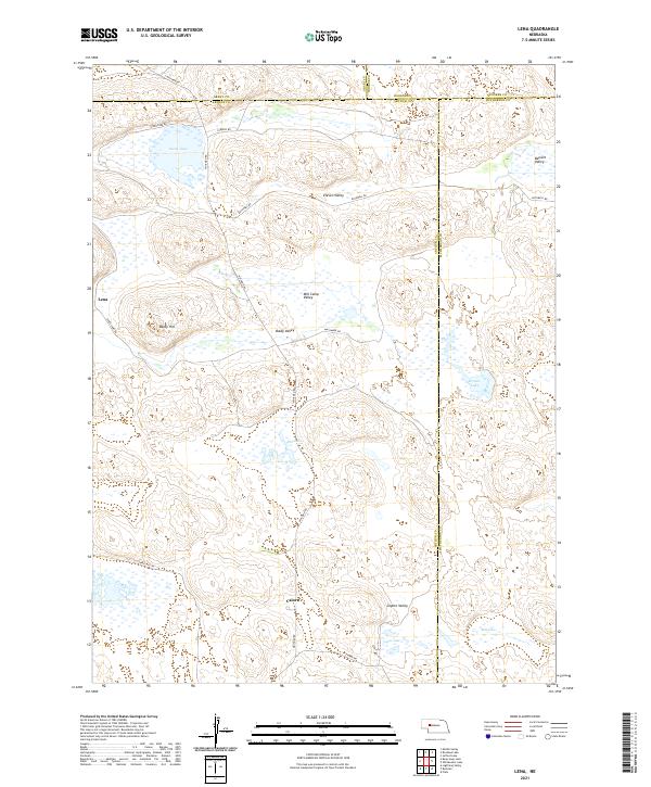 2021 Lena2021 Print · USGSArthur and Grant County ranching country is shown here in the modern era, revealing a landscape of remote dunes and valleys. Researchers can locate the settlement of Lena and trace old routes through Mill Camp Valley, Baldy Hill, and Swan Lake.
 - 2021 Map of Curry Lake, 2021 Print
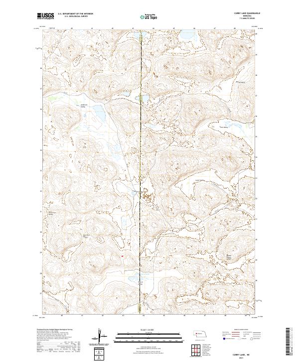 2021 Curry Lake2021 Print · USGSThe Nebraska Sandhills come into focus here during the early twenty-first century, revealing a landscape defined by its many named lowlands. Researchers can trace the layout of Curry Lake and local routes like S Ashby Rd through Anderson Valley and Leech Valley.
 - 2021 Map of Bean Soup Lake, 2021 Print
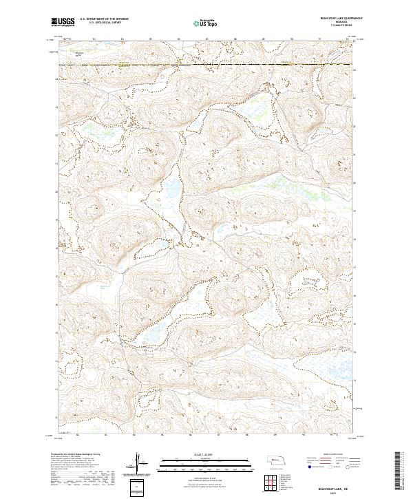 2021 Bean Soup Lake2021 Print · USGSThe Nebraska Sandhills come into sharp focus in the early twenty-first century as they span the Grant and Arthur county line. Researchers can trace the cattle-country geography of Winslow Valley and the roads serving remote homesteads like Kramer Rd and Bean Soup Lake.
 - 2021 Map of Bunner Lake, 2021 Print
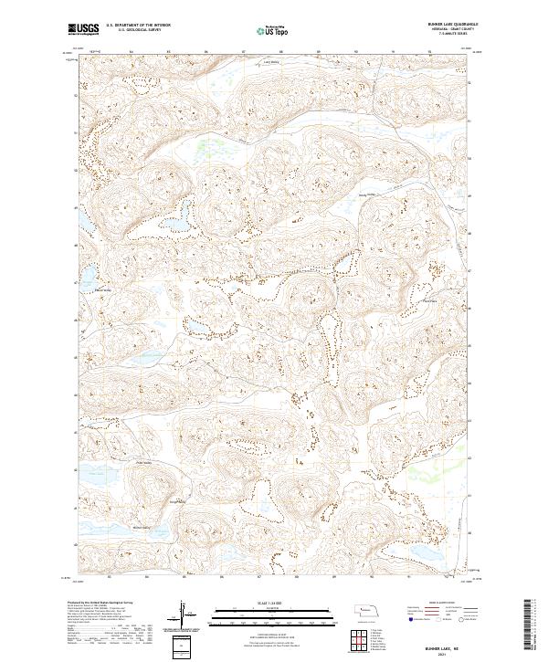 2021 Bunner Lake2021 Print · USGSGrant County's undulating Sandhills are documented in this recent survey, showcasing a landscape of isolated basins and ranch land. Researchers can trace the geography of naming in the region through landmarks like Bunner Lake, Flats Place, and Hardy Valley.
 - 2021 Map of Alkali Lake, 2021 Print
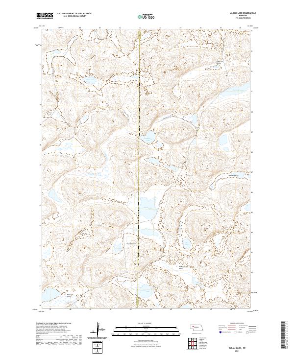 2021 Alkali Lake2021 Print · USGSGarden and Grant Counties exhibit a distinctive landscape of interdunal basins and lakes in this early 2020s survey. Researchers can trace the local hydrology through Alkali Lake and Groves Lake, or locate family landmarks in Diamond Valley.
 - 2021 Map of Well Valley, 2021 Print
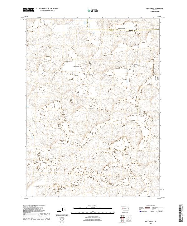 2021 Well Valley2021 Print · USGSGarden and Grant Counties are captured in this contemporary survey of the Nebraska Sandhills. Researchers can trace the quiet geography of this ranching region through landmarks like Well Valley, Ward Lake, and the isolated reaches of Green Valley.
 - 2021 Map of Middle Valley, 2021 Print
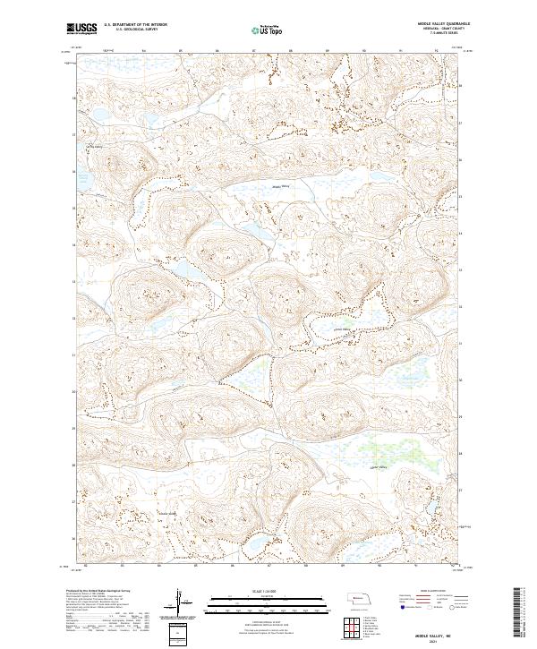 2021 Middle Valley2021 Print · USGSThe Nebraska Sandhills come into sharp focus in this recent survey of central Grant County. Genealogists and local historians can trace modern ranching routes along Simpson Ln and identify family-named landmarks like Egan Lake and Snyder Valley.
 - 2021 Map of Long Valley, 2021 Print
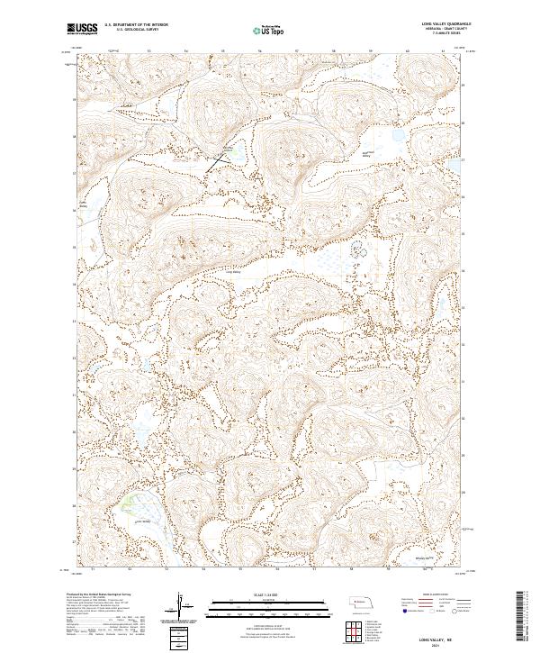 2021 Long Valley2021 Print · USGSThe Nebraska Sandhills come into focus here in the early twenty-first century, showing a remote landscape of ranching basins and sandy ridges. Researchers can trace the layout of family-named landmarks and rural infrastructure like Merrihew Airport and Gross Valley.
 - 2021 Map of Whitman, 2021 Print
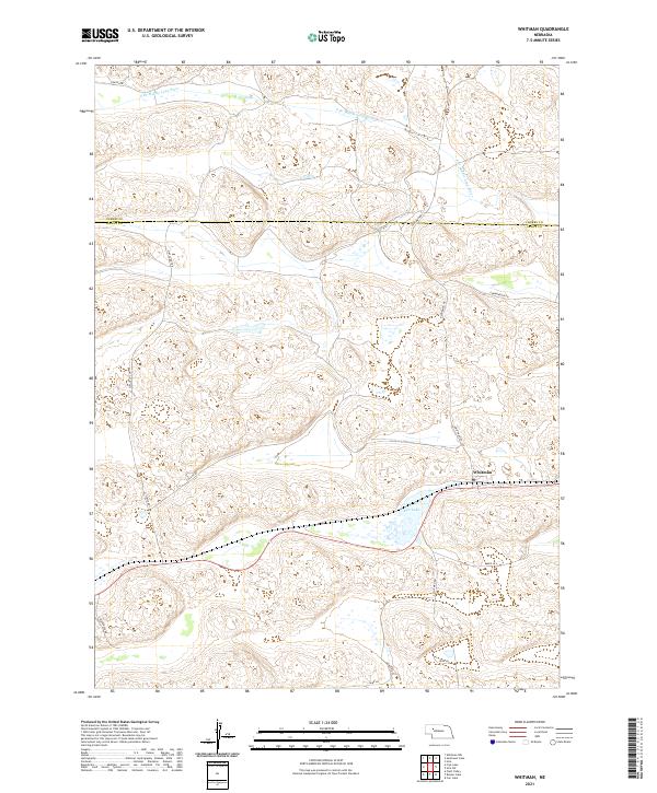 2021 Whitman2021 Print · USGSGrant County ranching country is documented here in the early 2020s, centered on the unincorporated community of Whitman. Genealogists and local historians can trace family land via rural routes like Gudmundsen Rd and landmarks such as Doc Lake.
 - 2021 Map of Frye Lake, 2021 Print
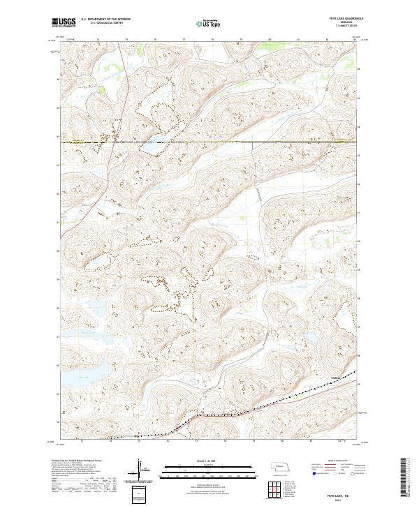 2021 Frye Lake2021 Print · USGSThe Nebraska sandhills around the Cherry and Grant county line are documented here in the early 2020s. Researchers can trace the drainage of the Middle Br Middle Loup River and locate remote sites like Duluth and Frye Lake.
 - 2021 Map of Hire SW, 2021 Print
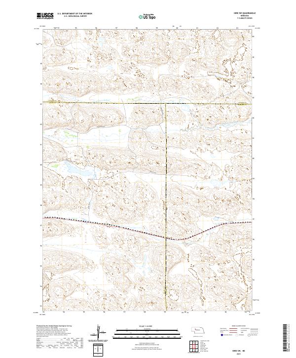 2021 Hire SW2021 Print · USGSThe Nebraska Sandhills in the early twenty-first century remain a vast expanse of ranchland defined by the S Br Middle Loup River. You can trace rural access along Gudmanson Rd and Emerson Rd through the intersecting corners of Grant, Hooker, and Cherry Counties.
 - 2021 Map of Hyannis North, 2021 Print
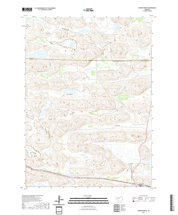 2021 Hyannis North2021 Print · USGSThe ranching country of Grant County is captured in the early 2020s, centered on the historic village of Hyannis. Genealogists and historians can trace family-named routes like Ashby Rd and locate landmarks such as the Grant County Airport and Wolfenberger Lakes.
 - 2021 Map of Ashby, 2021 Print
 2021 Ashby2021 Print · USGSAshby and the surrounding Sandhills are captured in this recent survey of the Grant County ranching country. Researchers can trace the layout of Ashby along Railroad Dr and locate water sources like Knox Lake and Hibbler Lake.
 - 2021 Map of Bingham, 2021 Print
 2021 Bingham2021 Print · USGSBingham sits at the heart of the Nebraska Sandhills in the early twenty-first century, marking a remote hub where four counties converge. Genealogists and local historians can trace the ranching landscape through Finnegan Lake, Larkin Valley, and the rural routes radiating from Bingham.
 - 2021 Map of K C Lake, 2021 Print
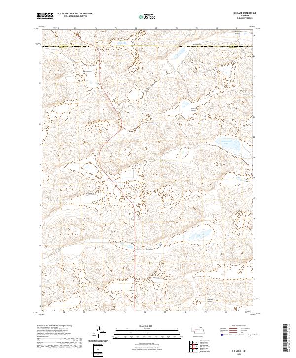 2021 K C Lake2021 Print · USGSThe Nebraska Sandhills come into focus here in the early 2020s, showing the intersection of Grant and Arthur counties. Researchers can trace family-named landforms and cattle-country routes like K C Valley, Kramer Rd, and Sand Puddin Lake.
 - 2021 Map of Hyannis South, 2021 Print
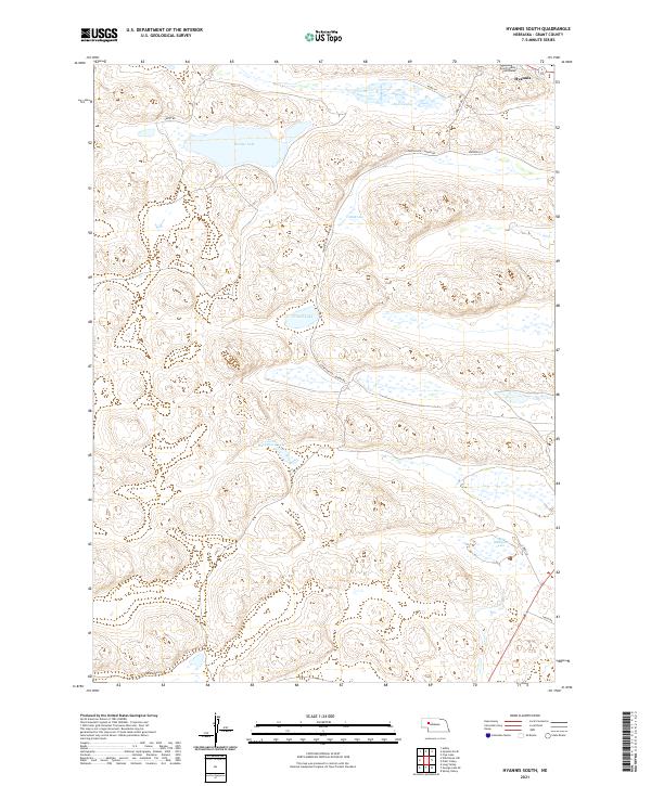 2021 Hyannis South2021 Print · USGSHyannis and the surrounding Nebraska Sandhills are shown in detail during the early twenty-first century. Genealogists and local historians can locate the Grant County Courthouse and trace rural routes past George Lake or Alkali Lake.
End of results
Showing maps 1-24 of 24
Top cities of Grant County
Frequently asked questions
- What are the different types of historical maps available for Grant County?
- What is the oldest map of Grant County?
- Where can I purchase historical maps of Grant County for my home or office?
- Where can I download high-res historical maps of Grant County?
- Are there historical topographic maps available for Grant County?
- Is there historical aerial imagery available for Grant County?
- Where are historical maps of Grant County sourced from?