Old Maps of Hamilton County, Nebraska for Academic Research
Study the evolution of Hamilton County with 60 high-resolution historic maps. Whether you're teaching, researching, or modeling changes in land use, these maps provide essential visual documentation of urban, environmental, and geographic change.
- Analyze long-term change: Track patterns in development, transportation, and natural features.
- Ideal for environmental or urban studies: Support academic projects with primary historical map data.
- Use in the classroom or lab: Educators and researchers rely on these maps to bring historical context to life.
These maps are a powerful tool for teaching, research, and visualizing how Hamilton County has changed over the decades.
Hamilton County, NE maps
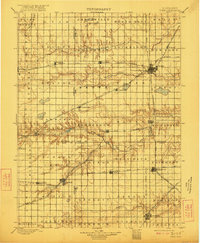
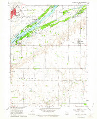
(60)- 1892 Map of Grand Island
 1892 Grand Island1892 Print · USGSCovers Hamilton County, including Grand Island, Doniphan, and other nearby areas
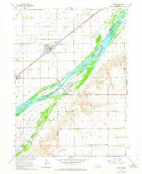
 - 1895 Map of Grand Island
 1895 Grand Island1895 Print · USGSCovers Hamilton County, including Grand Island, Doniphan, and other nearby areas
 - 1896 Map of Stromsburg
 1896 Stromsburg1896 Print · USGSCovers Hamilton County, including Central City, Fullerton, and other nearby areas5 unique versions available
 - 1898 Map of York
 1898 York1898 Print · USGSCovers Hamilton County, including York, Aurora, and other nearby areas4 unique versions available
 - 1898 Map of Grand Island
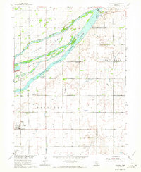
 1898 Grand Island1898 Print · USGSCovers Hamilton County, including Grand Island, Hastings, and other nearby areas4 unique versions available
 - 1899 Map of St. Paul
 1899 St. Paul1899 Print · USGSCovers Hamilton County, including Central City, Saint Paul, and other nearby areas4 unique versions available
 - 1899 Map of York, 1922 Print
 1899 York1922 Print · USGSCovers Hamilton County, including York, Aurora, and other nearby areas
 - 1955 Map of Broken Bow
 1955 Broken Bow1955 Print · USGSCovers Hamilton County, including Broken Bow, Central City, and other nearby areas5 unique versions available
 - 1955 Map of Fremont, 1966 Print
 1955 Fremont1966 Print · USGSCovers Hamilton County, including Omaha, Bellevue, and other nearby areas3 unique versions available
 - 1955 Map of Lincoln, 1967 Print
 1955 Lincoln1967 Print · USGSCovers Hamilton County, including Lincoln, Beatrice, and other nearby areas5 unique versions available
 - 1955 Map of Grand Island, 1967 Print
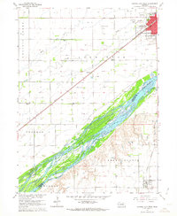
 1955 Grand Island1967 Print · USGSCovers Hamilton County, including Grand Island, Kearney, and other nearby areas3 unique versions available
 - 1956 Map of Broken Bow
 1956 Broken Bow1956 Print · USGSCovers Hamilton County, including Broken Bow, Central City, and other nearby areas
 - 1957 Map of Fremont
 1957 Fremont1957 Print · USGSCovers Hamilton County, including Omaha, Bellevue, and other nearby areas
 - 1957 Map of Lincoln
 1957 Lincoln1957 Print · USGSCovers Hamilton County, including Lincoln, Beatrice, and other nearby areas
 - 1957 Map of Grand Island
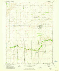
 1957 Grand Island1957 Print · USGSCovers Hamilton County, including Grand Island, Kearney, and other nearby areas
 - 1958 Map of Fremont
 1958 Fremont1958 Print · USGSCovers Hamilton County, including Omaha, Bellevue, and other nearby areas
 - 1958 Map of Grand Island
 1958 Grand Island1958 Print · USGSCovers Hamilton County, including Grand Island, Kearney, and other nearby areas
 - 1958 Map of Lincoln
 1958 Lincoln1958 Print · USGSCovers Hamilton County, including Lincoln, Beatrice, and other nearby areas
 - 1962 Map of Central City West, 1963 Print
 1962 Central City West1963 Print · USGSCovers Hamilton County, including Central City, Marquette, and other nearby areas2 unique versions available
 - 1962 Map of Polk, 1964 Print
 1962 Polk1964 Print · USGSCovers Hamilton County, including Polk, Arborville, and other nearby areas
 - 1962 Map of Phillips, 1964 Print
 1962 Phillips1964 Print · USGSCovers Hamilton County, including Phillips, Lockwood, and other nearby areas
 - 1962 Map of Central City East, 1964 Print
 1962 Central City East1964 Print · USGSCovers Hamilton County, including Central City, Hordville, and other nearby areas2 unique versions available
 - 1962 Map of Clarks, 1964 Print
 1962 Clarks1964 Print · USGSCovers Hamilton County, including Clarks, Polk County, and other nearby areas
 - 1962 Map of Doniphan, 1964 Print
 1962 Doniphan1964 Print · USGSCovers Hamilton County, including Grand Island, Doniphan, and other nearby areas3 unique versions available
 - 1962 Map of Grand Island, 1964 Print
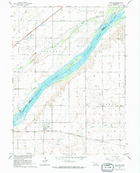
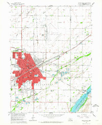 1962 Grand Island1964 Print · USGSCovers Hamilton County, including Grand Island, Kuesters Lake, and other nearby areas4 unique versions available
Showing maps 1-25 of 60
Top cities of Hamilton County
- Aurora historical maps
- Hampton historical maps
- Giltner historical maps
- Phillips historical maps
- Marquette historical maps
- Hordville historical maps
See more
Frequently asked questions
- What are the different types of historical maps available for Hamilton County?
- What is the oldest map of Hamilton County?
- Where can I purchase historical maps of Hamilton County for my home or office?
- Where can I download high-res historical maps of Hamilton County?
- Are there historical topographic maps available for Hamilton County?
- Is there historical aerial imagery available for Hamilton County?
- Where are historical maps of Hamilton County sourced from?