Old Maps of Hamilton County, Nebraska for Genealogy
Trace your family roots with 117 historic maps of Hamilton County. These high-res maps reveal old neighborhoods, homesites, landmarks, and streets — helping you uncover where your ancestors lived and how the area evolved over time.
- Explore historic neighborhoods: Identify where your relatives may have lived in the 1800s or 1900s.
- Compare maps over time: Trace the changes in streets, buildings, and landmarks for multi-generational research.
- Perfect for genealogy & ancestry research: Used by family historians and researchers to map out lineage and migration.
These maps are an incredible resource for exploring your personal connection to Hamilton County's past.
Hamilton County, NE maps
(117)- 1892 Map of Grand Island
 1892 Grand Island1892 Print · USGSGrand Island and the surrounding Hall County prairies are captured in the late nineteenth century as a vital rail junction. Genealogists and historians can trace early track layouts of the Union Pacific R. R. and locate old settlements like Alda and Doniphan.
 - 1895 Map of Grand Island
 1895 Grand Island1895 Print · USGSGrand Island emerged as a vital rail crossroads in central Nebraska during the late nineteenth century. Genealogists and historians can trace the early development of the city grid and surrounding settlements like Alda and Doniphan, or locate crossings such as the Island Bridge.
 - 1896 Map of Stromsburg
 1896 Stromsburg1896 Print · USGSEast-central Nebraska comes into focus during the late nineteenth-century rail boom, following the vital corridors of the Platte and Loup Rivers. Researchers can trace early township developments and the paths of the Union Pacific R. R. through Stromsburg, Fullerton, and Central City.5 unique versions available
 - 1898 Map of York
 1898 York1898 Print · USGSIn the late 1890s, the Nebraska plains were defined by a massive expansion of competing rail lines and growing farm towns. Trace the early township grids and historic rail hubs like York, Sutton, and the river crossing at McCool.4 unique versions available
 - 1898 Map of Grand Island
 1898 Grand Island1898 Print · USGSCentral Nebraska is captured in the late 1890s as a bustling rail and agricultural crossroads centered on the Platte River. Genealogists and historians can trace early settlements like Doniphan and Harvard or the grounds of the Insane Asylum outside Hastings.4 unique versions available
 - 1899 Map of St. Paul
 1899 St. Paul1899 Print · USGSCentral Nebraska's river valleys and rail hubs are preserved here during the expansion of the late 1890s. Researchers can trace the development of St. Paul and Central City alongside curious landmarks like Mumpumpey Hill and the Burlington and Missouri River R. R.4 unique versions available
 - 1899 Map of York, 1922 Print
 1899 York1922 Print · USGSSoutheast Nebraska was a burgeoning hub of rail and river commerce in the 1890s as homesteads solidified into permanent townships. Genealogists can trace family roots through early rail stops like Saronville, Lushton, and the county seats of York and Geneva.
 - 1955 Map of Broken Bow
 1955 Broken Bow1955 Print · USGSCentral Nebraska in the mid-fifties is defined by the sweeping Sand Hills and the vital river valleys that supported its ranching and rail towns. Researchers can trace the rail corridors of the Union Pacific RR and locate settlements like Dannebrog, Broken Bow, and Brewster.5 unique versions available
 - 1955 Map of Fremont, 1966 Print
 1955 Fremont1966 Print · USGSEastern Nebraska and the Missouri River border are captured during the mid-fifties, just as the interstate system began to emerge. Researchers can trace the development of Omaha, locate the sprawling Offutt Air Force Base, or study the river-bound ecology of the De Soto National Wildlife Refuge.3 unique versions available
 - 1955 Map of Lincoln, 1967 Print
 1955 Lincoln1967 Print · USGSSoutheast Nebraska in the mid-fifties presents a landscape of thriving railroad towns and the expanding footprint of the capital city. Researchers can trace the legacy of the pioneer era at the Homestead National Monument of America or locate mid-century military infrastructure like Lincoln Air Force Base.5 unique versions available
 - 1955 Map of Grand Island, 1967 Print
 1955 Grand Island1967 Print · USGSCentral Nebraska is seen here during a period of industrial and agricultural growth, centered on the vital Platte River corridor. Researchers can trace the mid-century footprints of the U S Naval Ammunition Depot and the Cornhusker Ordnance Plant.3 unique versions available
 - 1956 Map of Broken Bow
 1956 Broken Bow1956 Print · USGSCentral Nebraska during the mid-fifties reveals a region defined by its river-valley railroads and the rolling Sand Hills. Genealogists and local historians can trace the paths of the Chicago Burlington and Quincy through towns like Broken Bow, Merna, and Anselmo.
 - 1957 Map of Fremont
 1957 Fremont1957 Print · USGSEastern Nebraska and western Iowa thrive along the Platte and Missouri rivers during the mid-fifties. Genealogists can locate small rural schools like Fairview School and tracing the paths of the Union Pacific through towns like Albion and Humphrey.
 - 1957 Map of Lincoln
 1957 Lincoln1957 Print · USGSSoutheastern Nebraska at mid-century shows a landscape of thriving rail towns and expanding infrastructure centered on Lincoln. Researchers can trace the path of the Chicago Burlington and Quincy railroad through communities like Weeping Water, Fairmont, and Seward.
 - 1957 Map of Grand Island
 1957 Grand Island1957 Print · USGSCentral Nebraska and Northern Kansas are shown here during a period of massive hydraulic and military expansion in the mid-fifties. Researchers can trace the development of the Harlan County Reservoir and the massive wartime legacy of the Cornhusker Ordnance Plant.
 - 1958 Map of Fremont
 1958 Fremont1958 Print · USGSEastern Nebraska in the late fifties is captured here as a thriving corridor of river-valley commerce and rail transport. Researchers can trace the development of Omaha and Fremont or locate local landmarks like Midland College and Offutt Air Force Base.
 - 1958 Map of Grand Island
 1958 Grand Island1958 Print · USGSSouth-central Nebraska thrived as a rail and industrial hub during the late fifties, shaped by the braided Platte River. Genealogists and historians can trace rail lines like the Union Pacific RR through towns such as Kearney or locate the sprawling Cornhusker Ordnance Plant.
 - 1958 Map of Lincoln
 1958 Lincoln1958 Print · USGSSoutheast Nebraska at the end of the 1950s shows a region defined by agricultural trade and the expansion of the state capital. Genealogists can trace family footprints across the Blue Valley and locate landmarks like the Lincoln AFB or the U.S. Veterans Hospital.
 - 1962 Map of Central City West, 1963 Print
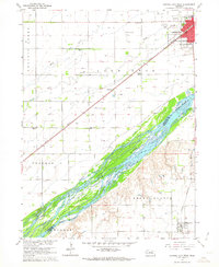 1962 Central City West1963 Print · USGSMerrick and Hamilton counties appear here in the early sixties as the rail-driven agricultural landscape of the Platte River valley reached its peak maturity. Genealogists and local historians can trace rural school districts from School No 8 to School No 3 and locate landmarks like Bushes Island and Paddock.2 unique versions available
 - 1962 Map of Polk, 1964 Print
 1962 Polk1964 Print · USGSMid-century Nebraska farm life is preserved here, centered on the Union Pacific rail line and the town of Polk. Genealogists can trace family footprints through several rural burial grounds like Laclede Cem and the Immanuel Lutheran Sch.
 - 1962 Map of Phillips, 1964 Print
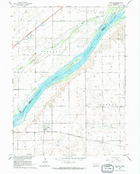 1962 Phillips1964 Print · USGSThe braided channels of the Platte River define this Hamilton County landscape during the early 1960s. Researchers can trace the railroad history of Phillips and Lockwood or locate local landmarks like School No 17 and Phillips Cem.
 - 1962 Map of Central City East, 1964 Print
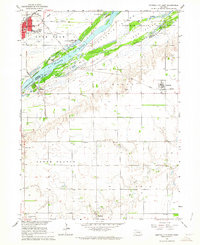 1962 Central City East1964 Print · USGSThe braided channels of the Platte River dominate this early 1960s survey of the Merrick and Hamilton county line. Genealogists and historians can trace the rural communities of Kronborg and Hordville, or locate landmarks like Mamre Ch and Hord Sch.2 unique versions available
 - 1962 Map of Clarks, 1964 Print
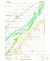 1962 Clarks1964 Print · USGSMerrick County farmland meets the braided channels of the Platte River in the early sixties. Genealogists and local historians can trace the town of Clarks, locate the Calvary Cem and Clarks Cem, or follow the Union Pacific rail line.
 - 1962 Map of Doniphan, 1964 Print
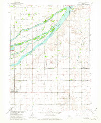 1962 Doniphan1964 Print · USGSDoniphan and the Platte River valley are captured here in the early sixties, showing a landscape defined by braided river channels and rural townships. Genealogists can locate family-named precincts and community landmarks like Cedarview Cem, School No 19, and the riverside Camp Augustine.3 unique versions available
 - 1962 Map of Grand Island, 1964 Print
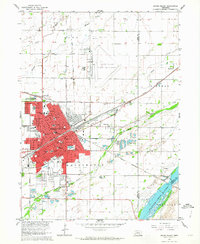 1962 Grand Island1964 Print · USGSGrand Island thrived as a major Nebraska rail hub in the early sixties, where the Union Pacific met the Burlington line. Genealogists and historians can locate dozens of neighborhood landmarks, from the East Grand Island Cem to Central High Sch and the Soldiers and Sailors Home.4 unique versions available
Showing maps 1-25 of 117
Top cities of Hamilton County
- Aurora historical maps
- Hampton historical maps
- Giltner historical maps
- Phillips historical maps
- Marquette historical maps
- Hordville historical maps
See more
Frequently asked questions
- What are the different types of historical maps available for Hamilton County?
- What is the oldest map of Hamilton County?
- Where can I purchase historical maps of Hamilton County for my home or office?
- Where can I download high-res historical maps of Hamilton County?
- Are there historical topographic maps available for Hamilton County?
- Is there historical aerial imagery available for Hamilton County?
- Where are historical maps of Hamilton County sourced from?