2020s Maps of Hooker County, Nebraska
Explore 24 historic maps of Hooker County from the 2020s. These maps offer a rare glimpse into what life looked like during the 2020s — showing old roads, neighborhoods, homes, and landmarks that have changed or disappeared over time.
Whether you're researching your family's past, planning a metal detecting trip, or studying how Hooker County's landscape evolved across the 2020s, these high-resolution maps are a powerful tool for exploring the history of this region.
- Focus on a specific era: All maps on this page are from the 2020s, giving you a focused view of this time period.
- See what’s changed: Compare century-old streets, trails, and buildings to today's modern landscape using overlays and satellite layers.
- Research with precision: Use these maps for genealogy, historical research, land use analysis, or educational projects.
- View, download, or print: Maps are fully viewable online in high resolution, and can be downloaded or printed for your own records.
Start exploring Hooker County's history through authentic maps from the 2020s. This is your window into the past.
Hooker County, NE maps
(24)- 2021 Map of Tryon NW, 2021 Print
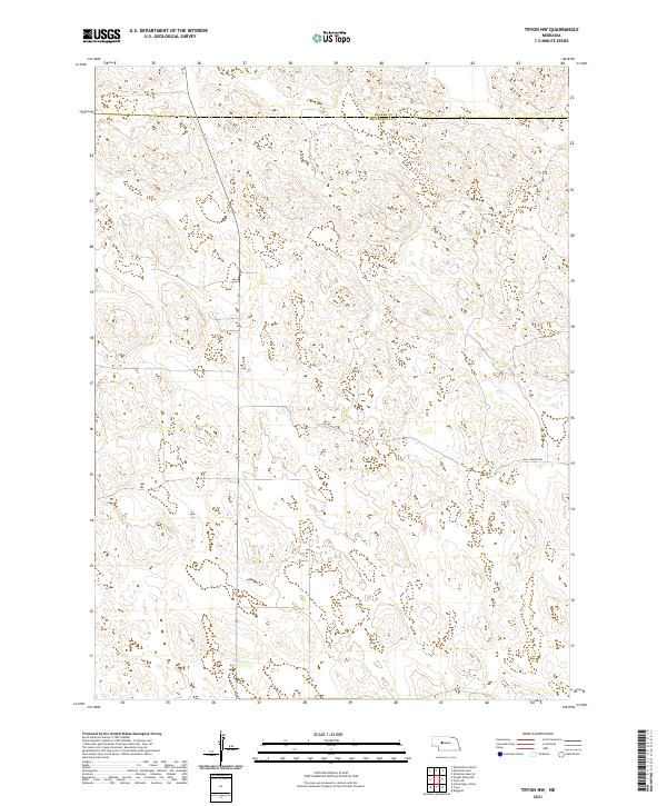 2021 Tryon NW2021 Print · USGSThe Nebraska Sandhills at the start of the 2020s remain a landscape of wide-open cattle country and remote section lines. Genealogists and local historians can trace the path of Hall Church Rd across the boundary of Hooker Co and Mcpherson Co.
 - 2021 Map of Dismal River Ranch NE, 2021 Print
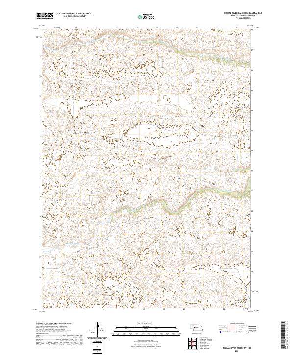
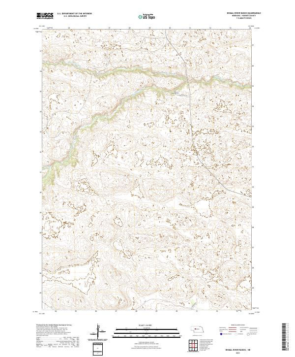
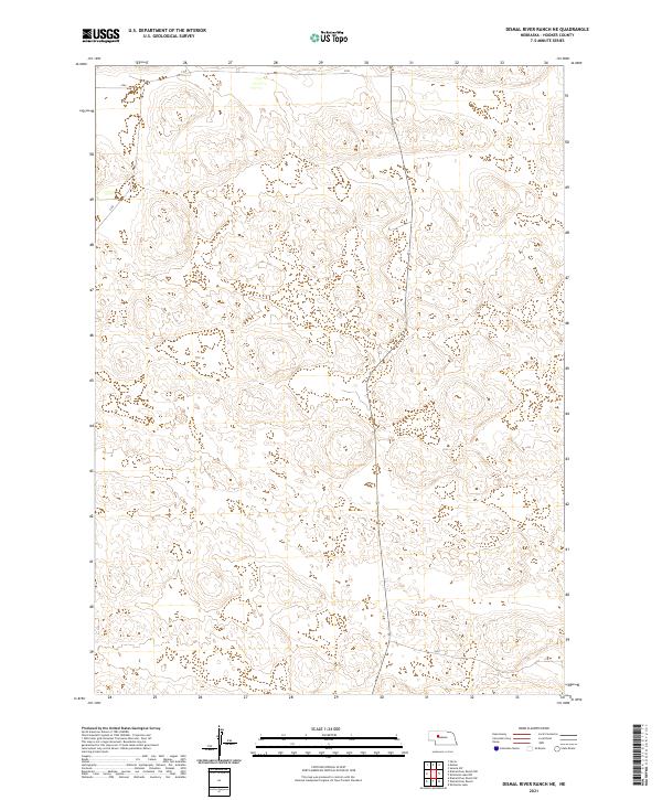 2021 Dismal River Ranch NE2021 Print · USGSThe Nebraska Sand Hills come into focus in this recent survey of Hooker County rangeland. Researchers can trace the foundational grid lines of T23N R33W and T22N R32W to understand the modern layout of ranching properties and the area's essential road network.
 - 2021 Map of Dismal River Ranch NW, 2021 Print
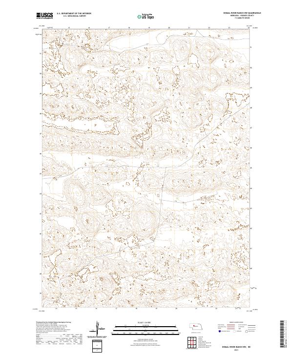 2021 Dismal River Ranch NW2021 Print · USGSHooker County in the early twenty-first century remains a landscape of open range and dramatic Sandhills topography. Modern township boundaries including T23N R34W and T22N R34W help researchers and land managers track the enduring ranching patterns of this Nebraska region.
 - 2021 Map of Tryon NE, 2021 Print
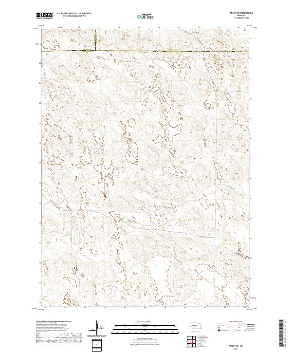 2021 Tryon NE2021 Print · USGSThe northern reaches of McPherson County are shown here in the early 2020s, highlighting the vast ranching sections at the junction of Thomas and Hooker counties. Local researchers can trace family land ties along rural routes like Cemetery Rd, Hall Church Rd, and Old Homestead Rd.
 - 2021 Map of Shimmins Lake NW, 2021 Print
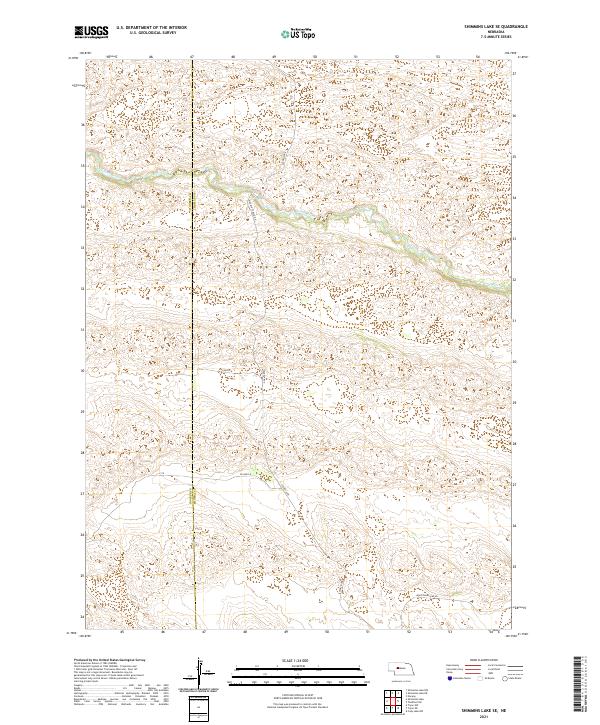
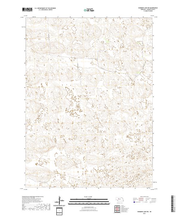 2021 Shimmins Lake NW2021 Print · USGSThe Nebraska Sandhills in Hooker County appear in high-resolution detail, showing the territory's transition into the current century. Trace the remote routes of Heritage Rd and Horseshoe Dr as they navigate the unique topography of this ranchland landscape.
 - 2021 Map of Rosebud Lake, 2021 Print
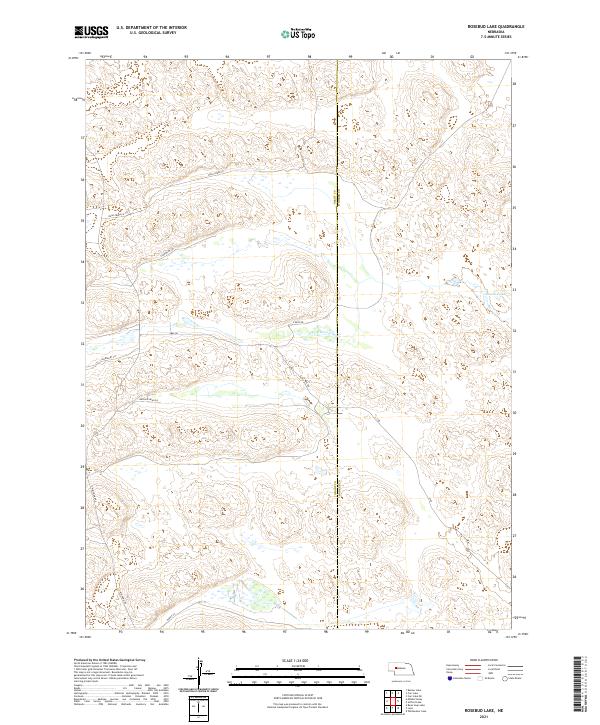 2021 Rosebud Lake2021 Print · USGSThe Nebraska Sandhills near the Grant and Hooker County line are captured in this contemporary survey of a sparse ranching landscape. Trace the course of the N Fork Dismal River and the rural network of Rush Creek Ln and Rosebud Lake.
 - 2021 Map of Jefford Lake, 2021 Print
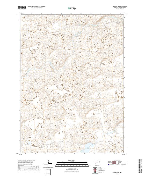 2021 Jefford Lake2021 Print · USGSHooker County’s Sandhills landscape is captured here in the early twenty-first century, showing a remote region defined by its seasonal waterways. You can trace the paths of the N Fork Dismal River and S Fork Dismal River or locate the Running Water Bridge crossing.
 - 2021 Map of Shimmins Lake NE, 2021 Print
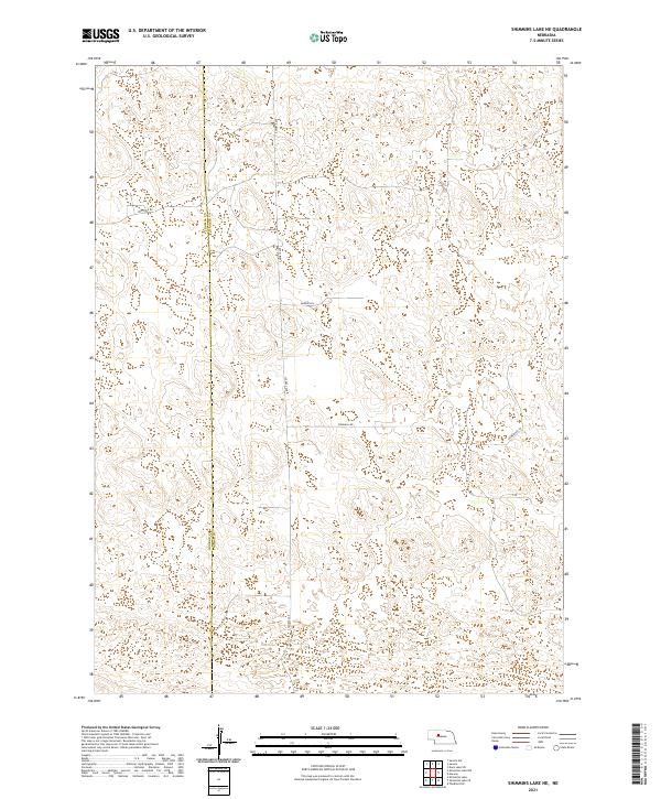 2021 Shimmins Lake NE2021 Print · USGSThe Thomas and Hooker County line is captured in the early 2020s, showing a landscape defined by the Nebraska Sandhills. Researchers can trace rural property access and grazing infrastructure along Heritage Rd, Homestead Ln, and Windmill Rd.
 - 2021 Map of Carr Lake, 2021 Print
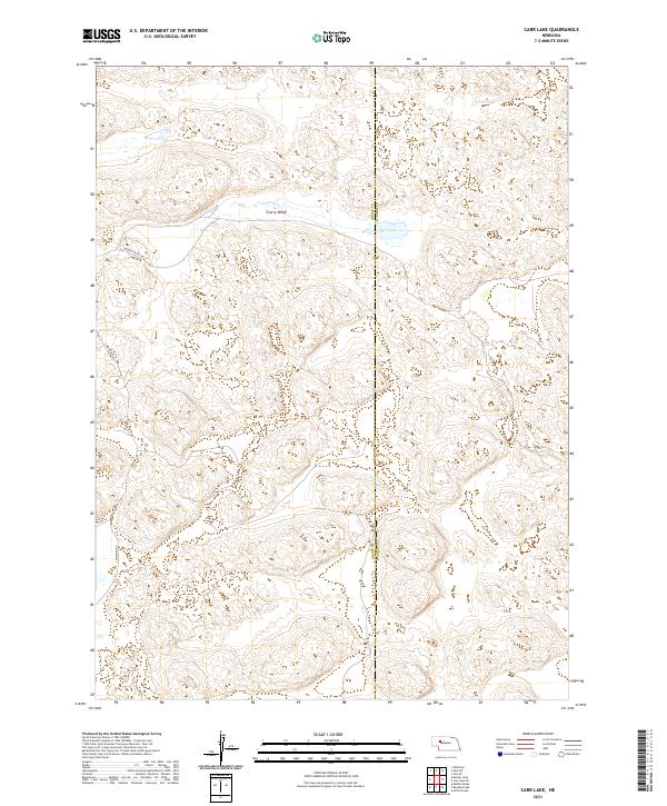 2021 Carr Lake2021 Print · USGSThe Nebraska Sandhills come into sharp focus in the early 2020s at the intersection of Grant and Hooker counties. Researchers can trace the sparse network of ranch roads like Cherry Valley Rd and Flats Ln near the waters of Carr Lake.
 - 2021 Map of Shimmins Lake SE, 2021 Print
 2021 Shimmins Lake SE2021 Print · USGSCentral Nebraska's ranching country is centered on the winding Dismal River at the turn of the decade. Researchers can trace land boundaries at the Hooker Co Thomas Co line and follow early transit routes like Ringold Seneca Rd.
 - 2021 Map of Shimmins Lake, 2021 Print
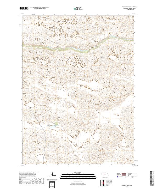 2021 Shimmins Lake2021 Print · USGSHooker County’s ranching heartland is documented here in the early twenty-first century, showing the enduring isolation of the Nebraska Sandhills. Researchers can trace the meandering course of the Dismal River and locate the remote Shimmins Lake.
 - 2021 Map of Carr Lake NE, 2021 Print
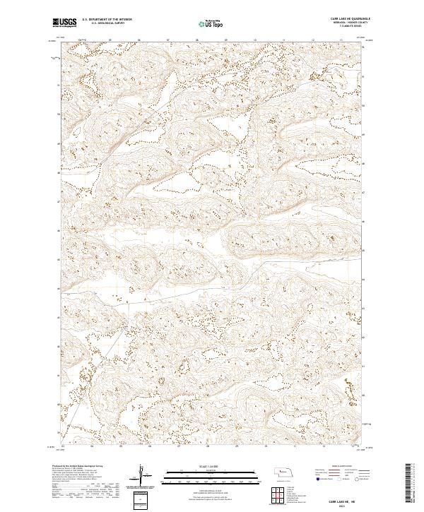 2021 Carr Lake NE2021 Print · USGSHooker County, Nebraska, remains a landscape of intricate Sandhills topography in this recent survey. Researchers can trace the precise boundaries between T23N R35W, T23N R34W, and T22N R35W across this open, wind-swept terrain.
 - 2021 Map of Dismal River Ranch SW, 2021 Print
 2021 Dismal River Ranch SW2021 Print · USGSHooker County ranch land is captured here in the early 2020s, showing the remote character of the Nebraska Sandhills. Researchers can trace the riparian corridors of the N Fork Dismal River, S Fork Dismal River, and Spring Cr across the terrain.
 - 2021 Map of Lena, 2021 Print
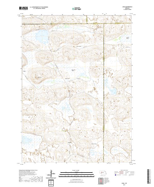 2021 Lena2021 Print · USGSArthur and Grant County ranching country is shown here in the modern era, revealing a landscape of remote dunes and valleys. Researchers can locate the settlement of Lena and trace old routes through Mill Camp Valley, Baldy Hill, and Swan Lake.
 - 2021 Map of Wright Valley NE, 2021 Print
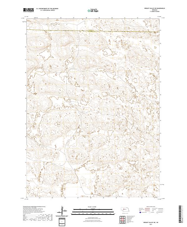 2021 Wright Valley NE2021 Print · USGSMcPherson County's northern edge is documented in the early twenty-first century, showing the remote Sandhills border with Hooker Co. Genealogists and land researchers can trace property locations using the clearly defined Public Land Survey System grids for T21N R33W and T20N R32W.
 - 2021 Map of Wright Valley, 2021 Print
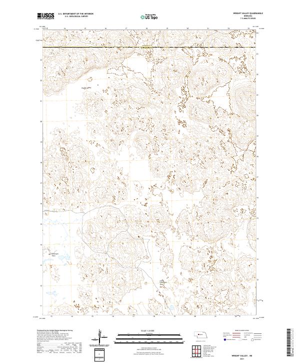 2021 Wright Valley2021 Print · USGSThe Nebraska Sandhills are documented in detail here during the early twenty-first century. Researchers can trace land boundaries across the Big Lamunyon Flats and Little Lamunyon Flats, or locate the wide basin of Wright Valley.
 - 2021 Map of Whitewater Lake, 2021 Print
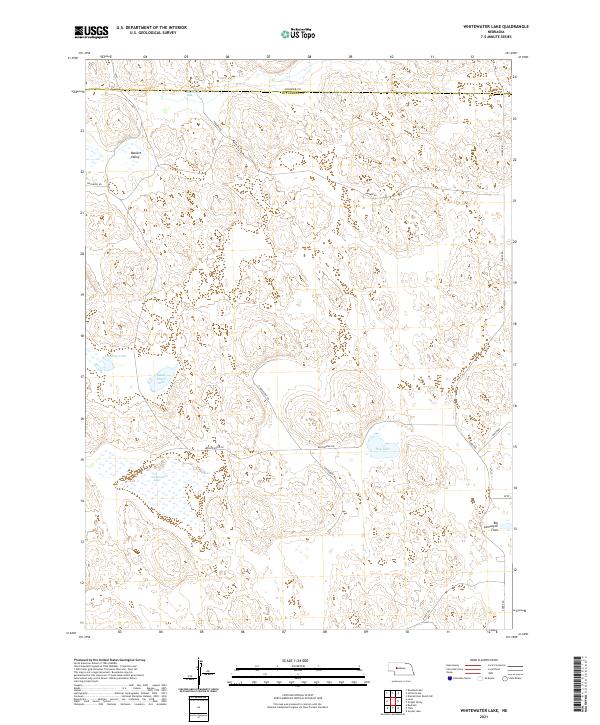 2021 Whitewater Lake2021 Print · USGSMcPherson County ranching country is shown here in the early twenty-first century, revealing the isolated basins and valleys of the Nebraska Sandhills. Researchers can trace remote property access via Soddy Rd and Kramer Rd or locate water features like Stickney Lake and Whitewater Lake.
 - 2021 Map of Dismal River Ranch, 2021 Print
 2021 Dismal River Ranch2021 Print · USGSHooker County ranch lands are documented in the early 2020s as the forks of the Dismal River carve through the Nebraska Sandhills. Local researchers can trace the ranching footprint at Dismal River Ranch and follow the paths of Spring Cr and Riverside Dr.
 - 2021 Map of Mullen, 2021 Print
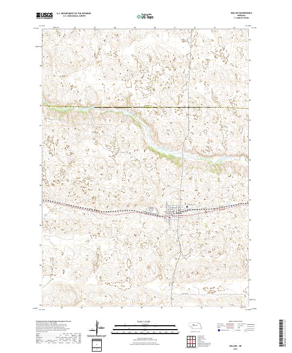 2021 Mullen2021 Print · USGSMullen and the surrounding Sandhills landscape come into focus in this recent survey of Hooker County. Local historians can trace the town’s civic layout from the Hooker County Courthouse to Cedarview Cem and the banks of the Middle Loup River.
 - 2021 Map of Hire SW, 2021 Print
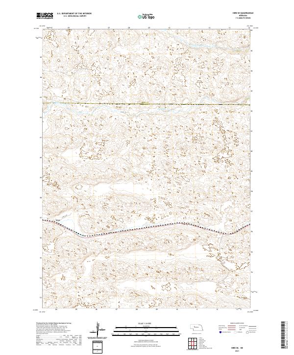
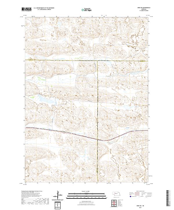 2021 Hire SW2021 Print · USGSThe Nebraska Sandhills in the early twenty-first century remain a vast expanse of ranchland defined by the S Br Middle Loup River. You can trace rural access along Gudmanson Rd and Emerson Rd through the intersecting corners of Grant, Hooker, and Cherry Counties.
 - 2021 Map of Hecla, 2021 Print
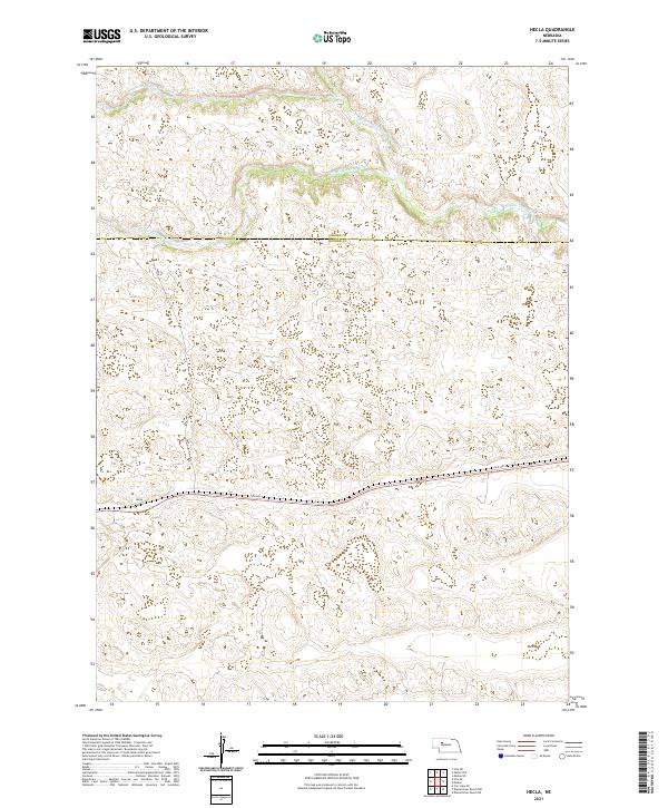 2021 Hecla2021 Print · USGSHooker County ranching country is documented here in the early 2020s, showing the high Sandhills terrain north of the Platte. Researchers can trace the isolated settlement of Hecla and the branching headwaters of the Middle Loup River near Old Hwy-2.
 - 2021 Map of Seneca, 2021 Print
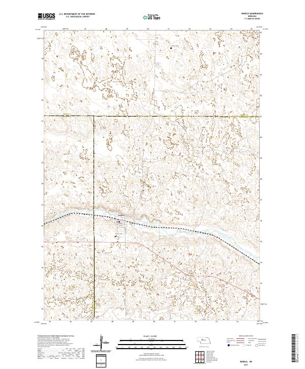 2021 Seneca2021 Print · USGSThe Nebraska sandhills surrounding Seneca are captured in the early 2020s as the Middle Loup River flows through Thomas and Hooker counties. Genealogists and local historians can pinpoint the Seneca Cemetery and the northern Jimtown Cemetery.
 - 2021 Map of Hire SE, 2021 Print
 2021 Hire SE2021 Print · USGSIn the Nebraska Sandhills during the early twenty-first century, the landscape is defined by the shifting waters of the Loup River system. Researchers can trace the path of the S Br Middle Loup River and the rural settlement of Weir near N Hecla Rd.
 - 2021 Map of Seneca SW, 2021 Print
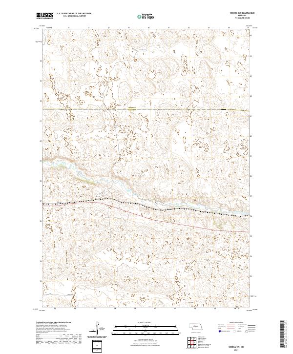 2021 Seneca SW2021 Print · USGSThe Nebraska Sandhills come into focus in this recent survey of the lands where the Cherry Co and Hooker Co lines meet. Local researchers can trace the course of the Middle Loup River past the settlement at Kelso.
End of results
Showing maps 1-24 of 24
Top cities of Hooker County
Frequently asked questions
- What are the different types of historical maps available for Hooker County?
- What is the oldest map of Hooker County?
- Where can I purchase historical maps of Hooker County for my home or office?
- Where can I download high-res historical maps of Hooker County?
- Are there historical topographic maps available for Hooker County?
- Is there historical aerial imagery available for Hooker County?
- Where are historical maps of Hooker County sourced from?