Old Maps of Hooker County, Nebraska for Metal Detecting
Plan your next treasure hunt with 145 historic maps of Hooker County. Find old homesites, ghost towns, trails, and gathering spots that may be lost to time — perfect for identifying promising metal detecting locations.
- Locate forgotten sites: Uncover places like long-lost settlements, abandoned rail lines, or gathering spots.
- Plan better hunts: Use map overlays combined with LiDAR or satellite views to narrow in on historically rich areas.
- Made for detectorists: Thousands of hobbyists use these maps to discover relics, coins, and hidden history.
Use these historic maps to boost your research and find new opportunities beneath the surface of Hooker County.
Hooker County, NE maps
(145)- 1947 Map of Dismal River Ranch, 1963 Print
 1947 Dismal River Ranch1963 Print · USGSHooker County ranching country is captured here just after the war, showing the vital water and school networks of the Nebraska Sandhills. Researchers can locate the Dismal River Ranch and trace the many family-named school sites like Maire Sch and Shimmin Sch.2 unique versions available
 - 1948 Map of Seneca, 1956 Print
 1948 Seneca1956 Print · USGSThe Middle Loup River valley in the late 1940s served as a lifeline for ranching and rail. Genealogists can trace family-named landmarks like Phillips Ranch and Simonson and Lowe Ranch or locate the old Virginia Sch.3 unique versions available
 - 1948 Map of Carr Lake, 1963 Print
 1948 Carr Lake1963 Print · USGSHooker and Grant Counties in the late 1940s remained a remote ranching landscape shaped by the Middle Loup and Dismal Rivers. Genealogists can trace early homesteads and family cattle operations like Carr Ranch or locate local landmarks including Eclipse Ch and Erny Sch.2 unique versions available
 - 1948 Map of Mullen, 1967 Print
 1948 Mullen1967 Print · USGSMullen and the surrounding Sandhills are captured in the late 1940s, showing a landscape shaped by ranching and the Chicago Burlington and Quincy line. Trace early schools and settlements like Hecla, Cherry Sch, and Reigle Sch.
 - 1949 Map of Dismal River Ranch
 1949 Dismal River Ranch1949 Print · USGSHooker County ranching country is captured here in the late Forties, showing the deep-cut river valleys of the Nebraska Sandhills. Genealogists can trace family footprints through a network of rural schoolhouses like Maire Sch, Haney Sch, and the Dismal River Ranch.2 unique versions available
 - 1949 Map of Flats, 1974 Print
 1949 Flats1974 Print · USGSMcPherson County ranching life is frozen in time during the late 1940s, showing a landscape defined by cattle operations and remote schoolhouses. Researchers can locate family landmarks like Bassett Ranch, Center Valley Church, and the Diamond Bar Ranch.
 - 1949 Map of Wright Valley, 1978 Print
 1949 Wright Valley1978 Print · USGSMcPherson County ranching country is captured here during the late 1940s, showing a landscape shaped by vast grazing lands and isolated homesteads. Researchers can trace family-named properties like the Huffman Ranch and find rural landmarks such as School No 62 and School No 36.
 - 1950 Map of Flats
 1950 Flats1950 Print · USGSMcPherson County and the surrounding Sandhills were defined by isolated cattle operations and small rural school districts at the midpoint of the century. Genealogists and local historians can trace family-named sites like Stickney Ranch, Wood Ranch, and School No 45.2 unique versions available
 - 1950 Map of Carr Lake
 1950 Carr Lake1950 Print · USGSHooker County ranching and the high plains water network are captured in this mid-century survey. Genealogists can locate family-named landmarks and rural hubs like E Carr Ranch, Eclipse Ch, and the Tucker Sch along the Dismal River.2 unique versions available
 - 1950 Map of Hire
 1950 Hire1950 Print · USGSThe Nebraska Sandhills come into focus in the early fifties, where the Loup River branches converge at the Cherry and Hooker county lines. Genealogists can locate rural institutions like Cox Sch and the siding at Weir along the Chicago Burlington and Quincy rail line.3 unique versions available
 - 1950 Map of Shimmins Lake
 1950 Shimmins Lake1950 Print · USGSThe Nebraska Sandhills come into focus in the years following the war, showing the rural school system and river valleys of the high plains. Genealogists can trace the location of family-named landmarks like McPherson Sch, Rodewald Sch, and the isolated Shimmins Lake.2 unique versions available
 - 1951 Map of Tryon
 1951 Tryon1951 Print · USGSThe McPherson County ranchlands are documented here at mid-century, showing a landscape of scattered family holdings and rural school districts. Genealogists and local historians can locate specific family landmarks like Waits Ranch or Kemp Ranch and trace the many country schools such as School No 25.2 unique versions available
 - 1951 Map of Wright Valley
 1951 Wright Valley1951 Print · USGSThe Nebraska Sandhills come into sharp focus in the early fifties, showing a ranching landscape defined by family names and remote school districts. Local historians can trace the precise boundaries of the Pinkerton Ranch, Huffman Ranch, and School No 58.2 unique versions available
 - 1951 Map of Mullen
 1951 Mullen1951 Print · USGSHooker County ranching country and the Sandhills are documented here just after the war, centered on the vital rail and river hub at Mullen. Genealogists and local historians can trace rural school districts like Delight Sch and Prentice Sch or follow the Chicago Burlington and Quincy line to Hecla.2 unique versions available
 - 1951 Map of Seneca
 1951 Seneca1951 Print · USGSSeneca and the surrounding Nebraska Sandhills are caught mid-century along the rail-and-river corridor of the Middle Loup. Genealogists and historians can trace family ranch lands like Metz Ranch, find old schoolhouses such as Huddle Sch, and locate the James Cem burial ground.2 unique versions available
 - 1954 Map of North Platte, 1968 Print
 1954 North Platte1968 Print · USGSThe Nebraska Sand Hills and the Platte River valley are captured here during a period of mid-century growth and agricultural expansion. Trace the vast irrigation network of the Sutherland Canal, locate old rural schoolhouses like Rose Hill School, and find family holdings such as Conrey Ranch.3 unique versions available
 - 1956 Map of North Platte
 1956 North Platte1956 Print · USGSThe Nebraska Sand Hills meet the high plains river valleys in the mid-1950s, a period of intensive water management and rail commerce. Genealogists and historians can trace early prairie settlements like Stapleton and Tryon, or follow the industrial corridor of the Union Pacific through North Platte.
 - 1957 Map of North Platte
 1957 North Platte1957 Print · USGSThe Nebraska Sand Hills and the Platte River valley are captured here in the mid-fifties as the ranching and irrigation economy matured. Genealogists and historians can locate family-named schoolhouses like Maire School or trace the railroad hubs at North Platte and the Fort McPherson National Cemetery.
 - 1957 Map of Valentine, 1960 Print
 1957 Valentine1960 Print · USGSNorthern Nebraska's ranching country and the vast Sand Hills are detailed here in the late fifties. Genealogists and historians can locate numerous family-named landmarks like the Dahlgren Ranch and trace the path of the Chicago and North Western railroad through Valentine.3 unique versions available
 - 1959 Map of Valentine
 1959 Valentine1959 Print · USGSThe northern Nebraska Sand Hills are captured here in the late fifties, showcasing a vast ranching landscape shaped by the Niobrara and Loup rivers. Genealogists and historians can trace rail-town development along the Chicago and North Western and locate remote outposts like Brownlee or Kennedy.
 - 1967 Map of North Platte
 1967 North Platte1967 Print · USGSThe Nebraska Sand Hills and the Platte River valley meet in the 1960s, showing a landscape shaped by water management and rail. Genealogists can trace rural school districts like the Prairie Dell School or find landmarks like the Scott Lookout Tower and Geo P Kingsley Dam.
 - 1985 Map of Carr Lake
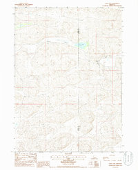 1985 Carr Lake1985 Print · USGSRanching life along the Grant and Hooker County line is captured in the mid-1980s, showing a landscape defined by seasonal water and remote outposts. Genealogists and local historians can trace family-named sites like Carr Ranch, R Carr Ranch, and the waters of Carr Lake.
 - 1985 Map of Arthur
 1985 Arthur1985 Print · USGSThe Nebraska Sandhills in the mid-1980s reveal a landscape of remote cattle ranches and hidden basins between Arthur and Hyannis. Genealogists and historians can trace family-named landmarks and private airfields like the Pioneer Ranch Landing Strip and Haythorn Lake.2 unique versions available
 - 1985 Map of Dismal River
 1985 Dismal River1985 Print · USGSCentral Nebraska's sandhills and river valleys are captured here during the mid-1980s, showing a landscape defined by the Burlington Northern railroad. Researchers can trace rural settlement patterns through places like Thedford and Dunning or find family landmarks at Shimmins Lake and Shanklin Bluff.2 unique versions available
 - 1985 Map of Mullen
 1985 Mullen1985 Print · USGSSettlement in the Nebraska Sandhills followed the rail and river corridors during the mid-twentieth century. Trace the Burlington Northern line through Mullen and Hyannis, or locate family-named landmarks like James Valley and Betsy Creek.2 unique versions available
Showing maps 1-25 of 145
Top cities of Hooker County
Frequently asked questions
- What are the different types of historical maps available for Hooker County?
- What is the oldest map of Hooker County?
- Where can I purchase historical maps of Hooker County for my home or office?
- Where can I download high-res historical maps of Hooker County?
- Are there historical topographic maps available for Hooker County?
- Is there historical aerial imagery available for Hooker County?
- Where are historical maps of Hooker County sourced from?