
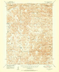
1951 Map of Wright Valley
USGS Topo · Published 1951About this map
Wright Valley and the surrounding Sandhills of western Nebraska appear here as a vast network of family cattle operations and isolated school districts. Surveyed shortly after World War II, the landscape is defined by its named valleys and flats, including Whitewater Flats and the curiously named Dishpan Valley. The map serves as a vital record for genealogists, detailing the exact locations of private holdings such as the Pinkerton Ranch, Huffman Ranch, and Connell Ranch. These ranches, often centered around windmills and local depressions like Big Lamunyon Flats, were the primary anchors of the local economy. The distribution of small rural schoolhouses, including School No 58 and School No 28, highlights the dispersed nature of the community before the consolidation of rural education districts in McPherson County.
Find a feature on this map
37 named features on this map. Tap any name to fly to it.
Don’t see what you’re looking for? This feature index may not catch every label — zoom into the map to look around manually.
Map Details
Editions of this 1951 Wright Valley Map
2 editions found
Other maps of this area

1898 · Paxton
USGS Topo · 1:125,000

1899 · North Platte
USGS Topo · 1:125,000

1901 · Paxton
USGS Topo · 1:125,000

1902 · North Platte
USGS Topo · 1:125,000

1947 · Dismal River Ranch
USGS Topo · 1:62,500

1948 · Carr Lake
USGS Topo · 1:62,500

1949 · Dismal River Ranch
USGS Topo · 1:62,500

1949 · Flats
USGS Topo · 1:62,500

1949 · Wright Valley
USGS Topo · 1:62,500

1950 · Flats
USGS Topo · 1:62,500