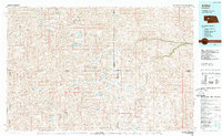
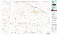
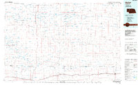
1980s Maps of Hooker County, Nebraska
Explore 28 historic maps of Hooker County from the 1980s. These maps offer a rare glimpse into what life looked like during the 1980s — showing old roads, neighborhoods, homes, and landmarks that have changed or disappeared over time.
Whether you're researching your family's past, planning a metal detecting trip, or studying how Hooker County's landscape evolved across the 1980s, these high-resolution maps are a powerful tool for exploring the history of this region.
- Focus on a specific era: All maps on this page are from the 1980s, giving you a focused view of this time period.
- See what’s changed: Compare century-old streets, trails, and buildings to today's modern landscape using overlays and satellite layers.
- Research with precision: Use these maps for genealogy, historical research, land use analysis, or educational projects.
- View, download, or print: Maps are fully viewable online in high resolution, and can be downloaded or printed for your own records.
Start exploring Hooker County's history through authentic maps from the 1980s. This is your window into the past.
Hooker County, NE maps
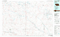
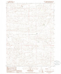
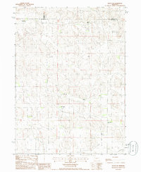
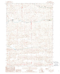
(28)- 1985 Map of Carr Lake
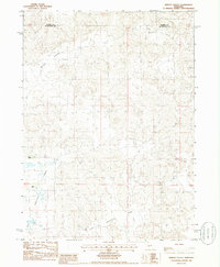
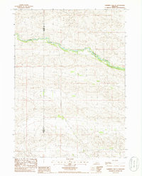
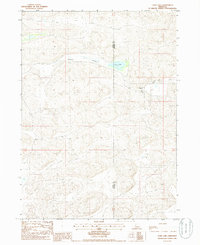 1985 Carr Lake1985 Print · USGSRanching life along the Grant and Hooker County line is captured in the mid-1980s, showing a landscape defined by seasonal water and remote outposts. Genealogists and local historians can trace family-named sites like Carr Ranch, R Carr Ranch, and the waters of Carr Lake.
 - 1985 Map of Arthur
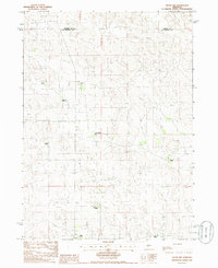
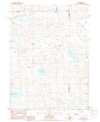
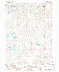
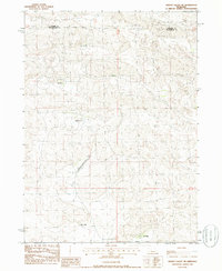
 1985 Arthur1985 Print · USGSThe Nebraska Sandhills in the mid-1980s reveal a landscape of remote cattle ranches and hidden basins between Arthur and Hyannis. Genealogists and historians can trace family-named landmarks and private airfields like the Pioneer Ranch Landing Strip and Haythorn Lake.2 unique versions available
 - 1985 Map of Dismal River
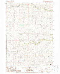
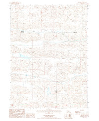
 1985 Dismal River1985 Print · USGSCentral Nebraska's sandhills and river valleys are captured here during the mid-1980s, showing a landscape defined by the Burlington Northern railroad. Researchers can trace rural settlement patterns through places like Thedford and Dunning or find family landmarks at Shimmins Lake and Shanklin Bluff.2 unique versions available
 - 1985 Map of Mullen
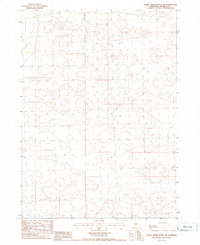
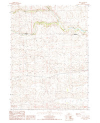
 1985 Mullen1985 Print · USGSSettlement in the Nebraska Sandhills followed the rail and river corridors during the mid-twentieth century. Trace the Burlington Northern line through Mullen and Hyannis, or locate family-named landmarks like James Valley and Betsy Creek.2 unique versions available
 - 1985 Map of Goose Creek
 1985 Goose Creek1985 Print · USGSCentral Nebraska's Sandhills come into focus in the mid-eighties, showing a landscape of remote ranching outposts and wildlife preserves. Trace old rail routes and rural settlements like Brownlee, Seneca, and Purdum along the Goose Creek watershed.2 unique versions available
 - 1985 Map of Tryon NW, 1986 Print
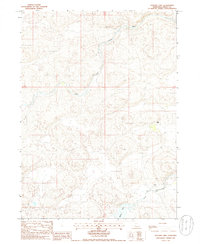
 1985 Tryon NW1986 Print · USGSThe McPherson County Sandhills come into focus in the mid-1980s, revealing a landscape of remote cattle operations and winding prairie tracks. Genealogists can locate specific family-named holdings such as McClintock Ranch, Dobbins Ranch, and Kemp Ranch.
 - 1985 Map of Rosebud Lake, 1986 Print
 1985 Rosebud Lake1986 Print · USGSIn the Nebraska Sandhills during the mid-eighties, this survey reveals a landscape of isolated ranching outposts and winding river valleys. Genealogists and historians can trace the remote M Vinton Ranch, S Bar Ranch, and the waters of Rosebud Lake.
 - 1985 Map of Dismal River Ranch, 1986 Print
 1985 Dismal River Ranch1986 Print · USGSHooker County ranching country is documented here in the mid-1980s, showing the intersection of the Nebraska Sandhills with vital water sources. Researchers can trace the land use around Dismal River Ranch and the winding paths of the North Fork Dismal River and Spring Cr.
 - 1985 Map of Dismal River Ranch NW, 1986 Print
 1985 Dismal River Ranch NW1986 Print · USGSThe Nebraska Sandhills in the mid-1980s show a vast landscape of isolated cattle operations and winding trails. Genealogists and local historians can trace the specific headquarters of family-run outfits like Lattin Ranch, Sexton Ranch, and Maire Ranch.
 - 1985 Map of Shimmins Lake NE, 1986 Print
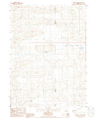
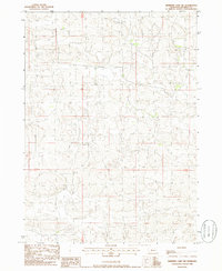
 1985 Shimmins Lake NE1986 Print · USGSThe Nebraska Sandhills come into sharp focus in the mid-1980s along the boundary of Hooker Co and Thomas Co. Researchers can trace the exact topography of this ranching country, where the landscape is defined by sand dunes rather than towns or rails.
 - 1985 Map of Lena, 1986 Print
 1985 Lena1986 Print · USGSThe Nebraska Sandhills ranching community of Lena is captured here in the mid-eighties as a network of family-held lands and seasonal basins. Genealogists can trace property names like Box Lake Ranch and Omara Ranch across a landscape of valleys and landmarks like Baldy Hill.
 - 1985 Map of Jefford Lake, 1986 Print
 1985 Jefford Lake1986 Print · USGSThe Nebraska Sandhills come into focus in the mid-1980s as ranching life centers on the forks of the Dismal River. Genealogists and local historians can trace family land at Gragg Ranch and J Tucker Ranch or locate the small Cem along the river banks.
 - 1985 Map of Wright Valley, 1986 Print
 1985 Wright Valley1986 Print · USGSThe Nebraska Sandhills come into focus in the mid-1980s at the border of Hooker and McPherson counties. Researchers can trace remote ranching outposts like Huffman Ranch and the expansive wetlands of Big Lamunyon Flats.
 - 1985 Map of Shimmins Lake, 1986 Print
 1985 Shimmins Lake1986 Print · USGSHooker County ranching country is captured here in the mid-1980s, showcasing the isolated terrain of the Nebraska Sandhills. Researchers can trace the winding course of the Dismal River and locate remote landmarks like Shimmins Lake amidst the vast network of range trails.
 - 1985 Map of Shimmins Lake NW, 1986 Print
 1985 Shimmins Lake NW1986 Print · USGSThe Nebraska Sandhills in the mid-1980s are preserved in this survey of Hooker County’s ranching country. Researchers can trace the sparse network of trails and unimproved roads that navigate the complex dune terrain between T23N T22N and R32W R31W.
 - 1985 Map of Carr Lake NE, 1986 Print
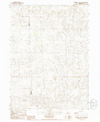
 1985 Carr Lake NE1986 Print · USGSHooker County ranching country is captured here in the mid-1980s, showcasing a landscape of high dunes and isolated outposts. Genealogists and local historians can trace family-named sites like E Carr Ranch and Furrow Ranch along a web of remote trails.
 - 1985 Map of Tryon NE, 1986 Print
 1985 Tryon NE1986 Print · USGSIn the mid-1980s, this portion of the Nebraska Sandhills remained a landscape of storied family cattle operations. Genealogists and local historians can trace the precise locations of the Miller Ranch, Jameson Ranch, and Munson Ranch.
 - 1985 Map of Whitewater Lake, 1986 Print
 1985 Whitewater Lake1986 Print · USGSThe Nebraska Sandhills come into focus in the mid-1980s, showcasing a remote ranching landscape along the Hooker and McPherson county line. Genealogists and local historians can locate family landmarks like Whitewater Ranch, Tucker Ranch, and Stickney Lake.
 - 1985 Map of Dismal River Ranch SW, 1986 Print
 1985 Dismal River Ranch SW1986 Print · USGSHooker County ranching life is preserved in this mid-eighties survey of the Sandhills. Genealogists and local historians can trace established family boundaries at the Hager Ranch, Musser Ranch, and Haney Ranch along the South Fork Dismal River.
 - 1985 Map of Dismal River Ranch NE, 1986 Print
 1985 Dismal River Ranch NE1986 Print · USGSThe Nebraska Sandhills come into sharp focus during the mid-eighties as this ranching landscape was meticulously documented. Researchers can trace the foundational survey lines of T 23 N T 22 N and R 33 W R 32 W across this remote terrain.
 - 1985 Map of Shimmins Lake SE, 1986 Print
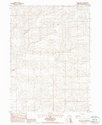
 1985 Shimmins Lake SE1986 Print · USGSThe Nebraska Sandhills come into sharp focus in the mid-1980s as the Dismal River winds through the high plains. Trace the rugged county line between Hooker County and Thomas County across a landscape of remote trails and winding waters.
 - 1985 Map of Wright Valley NE, 1986 Print
 1985 Wright Valley NE1986 Print · USGSThe Nebraska Sandhills come into focus in the mid-1980s, revealing a landscape defined by its remote cattle operations. Researchers can trace family-named holdings like the R Connell Ranch and the isolated Pioneer Ranch Landing Strip.
 - 1987 Map of Hire SW
 1987 Hire SW1987 Print · USGSThe Nebraska Sandhills in the mid-1980s are defined by the winding course of the South Branch Middle Loup River. Researchers can trace the tri-county intersection of Cherry, Grant, and Hooker counties across this remote terrain.
 - 1987 Map of Hecla
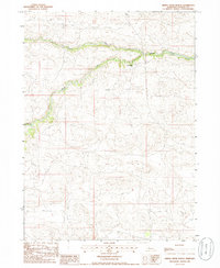
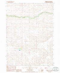
 1987 Hecla1987 Print · USGSThe Nebraska Sandhills come into focus in the 1980s as the Burlington Northern railroad cuts through the river valleys of the High Plains. Researchers can trace the settlement at Hecla and the winding course of the Middle Loup River along the Cherry Co border.
 - 1987 Map of Hire SE, 1988 Print
 1987 Hire SE1988 Print · USGSHooker and Cherry counties are captured in the late 1980s, showcasing the high Nebraska Sandhills at the confluence of the Middle Branch Middle Loup River and South Branch Middle Loup River. Trace the network of 4WD trails and find precise elevation markers like BM 3433.4 across this riverine landscape.
Showing maps 1-25 of 28
Top cities of Hooker County
Frequently asked questions
- What are the different types of historical maps available for Hooker County?
- What is the oldest map of Hooker County?
- Where can I purchase historical maps of Hooker County for my home or office?
- Where can I download high-res historical maps of Hooker County?
- Are there historical topographic maps available for Hooker County?
- Is there historical aerial imagery available for Hooker County?
- Where are historical maps of Hooker County sourced from?