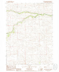
1985 Map of Dismal River Ranch
USGS Topo · Published 1986About this map
Dismal River Ranch is the primary landmark within this section of the Nebraska Sandhills, situated where the high plains terrain meets the distinct drainage of the Dismal River system. The landscape is defined by the convergence of the North Fork Dismal River and the South Fork Dismal River, which carve a winding path through the undulating sand dunes typical of Hooker County. This provisional survey captures the area in the mid-1980s, emphasizing the drainage patterns and sparse pastoral development. In the southwestern reaches, Spring Cr feeds into the network of seasonal and permanent watercourses that have historically supported ranching operations in this remote region.
Find a feature on this map
6 named features on this map. Tap any name to fly to it.
Don’t see what you’re looking for? This feature index may not catch every label — zoom into the map to look around manually.
Map Details
Editions of this 1985 Dismal River Ranch Map
This is the sole edition of this map. No revisions or reprints were ever made.
Other maps of this area

1947 · Dismal River Ranch
USGS Topo · 1:62,500

1949 · Dismal River Ranch
USGS Topo · 1:62,500

1949 · Wright Valley
USGS Topo · 1:62,500

1950 · Shimmins Lake
USGS Topo · 1:62,500

1951 · Tryon
USGS Topo · 1:62,500

1951 · Wright Valley
USGS Topo · 1:62,500

1954 · North Platte
USGS Topo · 1:250,000

1956 · North Platte
USGS Topo · 1:250,000

1957 · North Platte
USGS Topo · 1:250,000

1967 · North Platte
USGS Topo · 1:250,000