
Loading...
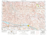
Loading map...1957 Map of North Platte
USGS Topo · Published 1957About this map
The Sand Hills of central Nebraska dominate this mid-century landscape, characterized by a complex network of ranching outposts and remote schoolhouses. Along the southern corridor, the North Platte River and South Platte River converge at North Platte, a vital hub for the Union Pacific railroad. The era's focus on water management and irrigation is evident in the sprawling Lake C W McConaughy and the intricate Sutherland Canal system that feeds the Sutherland Reservoir.
Find a feature on this map
98 named features on this map. Tap any name to fly to it.
Don’t see what you’re looking for? This feature index may not catch every label — zoom into the map to look around manually.
Map Details
Date Portrayed1957
Date Published1957
PublisherU.S. Geological Survey
Map TypeTopographic
Scale1:250,000
Physical Dimensions28.5 x 21.9 inches
Editions of this 1957 North Platte Map
This is the sole edition of this map. No revisions or reprints were ever made.
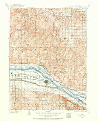
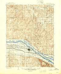
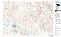
Historical Maps of North Platte Through Time
7 maps found


Featured Locations
Source Details
SourceU.S. Geological Survey
CopyrightPublic Domain