1967 Map of North Platte
USGS Topo · Published 1967About this map
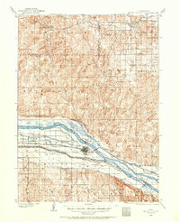
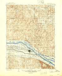
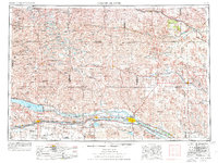
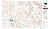
The South Platte and North Platte River converge at the city of North Platte, marking a vital water and transportation corridor through the western Sand Hills. This mid-century landscape is defined by extensive irrigation and power infrastructure, including the massive Lake C W McConaughy held by the Geo P Kingsley Dam, alongside the Sutherland Reservoir and Lake Maloney. The Union Pacific railroad tracks parallel U.S. Highway 30 along the river valley, serving a string of prairie towns from Ogallala to Maxwell. To the north, the terrain transitions into the Nebraska Sand Hills, where the Nebraska National Forest stands near Halsey and the Scott Lookout Tower. This area is characterized by numerous small valley lakes like Diamond Bar Lake and Winnie Valley Lake, alongside remote rural schools such as the Prairie Dell School and McPherson School.
Find a feature on this map
84 named features on this map. Tap any name to fly to it.
Don’t see what you’re looking for? This feature index may not catch every label — zoom into the map to look around manually.
Map Details
Editions of this 1967 North Platte Map
This is the sole edition of this map. No revisions or reprints were ever made.
Historical Maps of North Platte Through Time
7 maps found