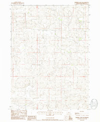
1985 Map of Shimmins Lake NW
USGS Topo · Published 1986About this map
The undulating sandhills of Hooker County, Nebraska, define this mid-1980s landscape, captured during a period of provisional topographic mapping. This specific survey area is characterized by the complex relief of the Nebraska Sandhills, a terrain of stabilization and wind-shaped dunes that dictate the sparse settlement patterns seen here. The map is primarily organized by the public land survey system markers T23n T22n and R32w R31w, showing a region largely devoid of dense infrastructure. Instead, the sheet records a delicate network of unimproved roads and trails that navigate the depressions between the dunes, where water occasionally collects. This document provides a rare look at the ranching interior of the state before modern digital updates, reflecting the isolation and environmental character of the central Sandhills.
Find a feature on this map
2 named features on this map. Tap any name to fly to it.
Don’t see what you’re looking for? This feature index may not catch every label — zoom into the map to look around manually.
Map Details
Editions of this 1985 Shimmins Lake NW Map
This is the sole edition of this map. No revisions or reprints were ever made.
Other maps of this area

1947 · Dismal River Ranch
USGS Topo · 1:62,500

1948 · Seneca
USGS Topo · 1:62,500

1948 · Mullen
USGS Topo · 1:62,500

1949 · Dismal River Ranch
USGS Topo · 1:62,500

1950 · Shimmins Lake
USGS Topo · 1:62,500

1951 · Mullen
USGS Topo · 1:62,500

1951 · Seneca
USGS Topo · 1:62,500

1954 · North Platte
USGS Topo · 1:250,000

1956 · North Platte
USGS Topo · 1:250,000

1957 · North Platte
USGS Topo · 1:250,000