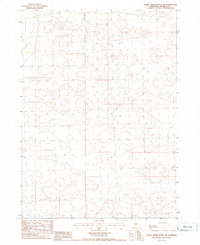
1985 Map of Dismal River Ranch NE
USGS Topo · Published 1986About this map
Sandhills topography and range management define this mid-1980s manuscript-style sheet in the heart of Nebraska's cattle country. The landscape is characterized by the intricate land divisions of the Public Land Survey System, specifically tracking the boundary between T 23 N T 22 N and the range line of R 33 W R 32 W. Produced from 1982 aerial photography and field-checked in 1984, the map focuses on the physical geography and ranching infrastructure rather than concentrated settlements. This provisional edition preserves the original manuscript drawings, providing a raw look at the survey points and elevation data used to manage this vast grassland region before modern digital updates.
Find a feature on this map
2 named features on this map. Tap any name to fly to it.
Don’t see what you’re looking for? This feature index may not catch every label — zoom into the map to look around manually.
Map Details
Editions of this 1985 Dismal River Ranch NE Map
This is the sole edition of this map. No revisions or reprints were ever made.
Other maps of this area

1947 · Dismal River Ranch
USGS Topo · 1:62,500

1948 · Seneca
USGS Topo · 1:62,500

1948 · Mullen
USGS Topo · 1:62,500

1949 · Dismal River Ranch
USGS Topo · 1:62,500

1950 · Shimmins Lake
USGS Topo · 1:62,500

1951 · Mullen
USGS Topo · 1:62,500

1951 · Seneca
USGS Topo · 1:62,500

1954 · North Platte
USGS Topo · 1:250,000

1956 · North Platte
USGS Topo · 1:250,000

1957 · North Platte
USGS Topo · 1:250,000