1980s Maps of Kearney County, Nebraska
Explore 4 historic maps of Kearney County from the 1980s. These maps offer a rare glimpse into what life looked like during the 1980s — showing old roads, neighborhoods, homes, and landmarks that have changed or disappeared over time.
Whether you're researching your family's past, planning a metal detecting trip, or studying how Kearney County's landscape evolved across the 1980s, these high-resolution maps are a powerful tool for exploring the history of this region.
- Focus on a specific era: All maps on this page are from the 1980s, giving you a focused view of this time period.
- See what’s changed: Compare century-old streets, trails, and buildings to today's modern landscape using overlays and satellite layers.
- Research with precision: Use these maps for genealogy, historical research, land use analysis, or educational projects.
- View, download, or print: Maps are fully viewable online in high resolution, and can be downloaded or printed for your own records.
Start exploring Kearney County's history through authentic maps from the 1980s. This is your window into the past.
Kearney County, NE maps
(4)- 1985 Map of Grand Island
 1985 Grand Island1985 Print · USGSThe Platte River valley in the mid-eighties shows a landscape of braided river channels and massive military-industrial sites. Trace the layout of the Cornhusker Ordnance Plant and find family landmarks like Parkview Cem or Good Samaritan Village.2 unique versions available
 - 1985 Map of Red Cloud
 1985 Red Cloud1985 Print · USGSSouth Central Nebraska and the Kansas borderlands appear in high detail during the mid-eighties as a landscape of river-fed agriculture and rail-connected prairie towns. Researchers can trace the Burlington Northern tracks through Red Cloud or locate the extensive Courtland Canal and Superior-Courtland Diversion Dam.2 unique versions available
 - 1985 Map of Kearney
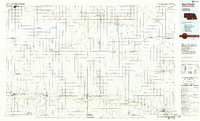
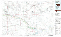
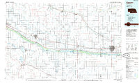 1985 Kearney1985 Print · USGSMid-1980s Nebraska life centers on the fertile Platte River valley during a period of significant agricultural and hydraulic development. Researchers can trace irrigation networks like the Phelps County Canal and find regional landmarks from Johnson Lake to the Union Pacific rail lines.2 unique versions available
 - 1986 Map of Holdrege
 1986 Holdrege1986 Print · USGSSouthern Nebraska and the Kansas borderlands appear here in the mid-eighties as a region defined by river valleys and rail-connected agricultural hubs. Trace local history through settlements like Republican City, the Prairie Home Cem, and the waters of Harlan County Lake.2 unique versions available
End of results
Showing maps 1-4 of 4
Top cities of Kearney County
- Minden historical maps
- Axtell historical maps
- Wilcox historical maps
- Newark historical maps
- Lowell historical maps
- Heartwell historical maps
See more
Frequently asked questions
- What are the different types of historical maps available for Kearney County?
- What is the oldest map of Kearney County?
- Where can I purchase historical maps of Kearney County for my home or office?
- Where can I download high-res historical maps of Kearney County?
- Are there historical topographic maps available for Kearney County?
- Is there historical aerial imagery available for Kearney County?
- Where are historical maps of Kearney County sourced from?