1900s (20th Century) Maps of North Platte, Nebraska
Explore 10 historic maps of North Platte from the 1900s (20th Century). These maps offer a rare glimpse into what life looked like during the 1900s — showing old roads, neighborhoods, homes, and landmarks that have changed or disappeared over time.
Whether you're researching your family's past, planning a metal detecting trip, or studying how North Platte's landscape evolved across the 1900s, these high-resolution maps are a powerful tool for exploring the history of this region.
- Focus on a specific era: All maps on this page are from the 1900s, giving you a focused view of this time period.
- See what’s changed: Compare century-old streets, trails, and buildings to today's modern landscape using overlays and satellite layers.
- Research with precision: Use these maps for genealogy, historical research, land use analysis, or educational projects.
- View, download, or print: Maps are fully viewable online in high resolution, and can be downloaded or printed for your own records.
Start exploring North Platte's history through authentic maps from the 1900s. This is your window into the past.
North Platte, NE maps
(10)- 1902 Map of North Platte
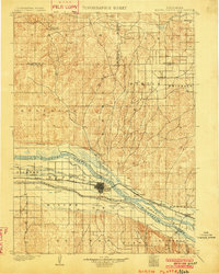 1902 North Platte1902 Print · USGSNorth Platte and the Platte River forks are shown here at the start of the twentieth century, during a period of massive irrigation expansion. Researchers can trace early railroad siding stops like Spuds and Gannett or find old crossroads like Newberries Crossroads.3 unique versions available
 - 1954 Map of North Platte, 1968 Print
 1954 North Platte1968 Print · USGSThe Nebraska Sand Hills and the Platte River valley are captured here during a period of mid-century growth and agricultural expansion. Trace the vast irrigation network of the Sutherland Canal, locate old rural schoolhouses like Rose Hill School, and find family holdings such as Conrey Ranch.3 unique versions available
 - 1956 Map of North Platte
 1956 North Platte1956 Print · USGSThe Nebraska Sand Hills meet the high plains river valleys in the mid-1950s, a period of intensive water management and rail commerce. Genealogists and historians can trace early prairie settlements like Stapleton and Tryon, or follow the industrial corridor of the Union Pacific through North Platte.
 - 1957 Map of North Platte
 1957 North Platte1957 Print · USGSThe Nebraska Sand Hills and the Platte River valley are captured here in the mid-fifties as the ranching and irrigation economy matured. Genealogists and historians can locate family-named schoolhouses like Maire School or trace the railroad hubs at North Platte and the Fort McPherson National Cemetery.
 - 1967 Map of North Platte
 1967 North Platte1967 Print · USGSThe Nebraska Sand Hills and the Platte River valley meet in the 1960s, showing a landscape shaped by water management and rail. Genealogists can trace rural school districts like the Prairie Dell School or find landmarks like the Scott Lookout Tower and Geo P Kingsley Dam.
 - 1970 Map of North Platte East, 1973 Print
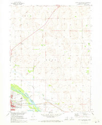 1970 North Platte East1973 Print · USGSNorth Platte expanded into the Nebraska plains during the early seventies, where the river and rail lines converged. Researchers can trace local infrastructure from Lee Bird Field to the Union Pacific tracks, or find community sites like Hall Sch.2 unique versions available
 - 1970 Map of North Platte West, 1973 Print
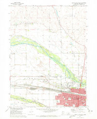 1970 North Platte West1973 Print · USGSNorth Platte flourished as a vital rail and river hub in the early 1970s. Researchers can trace the town's civic growth through Buffalo Bill Ranch State Park, St Patricks Cath Ch, and the sprawling Union Pacific rail yards.2 unique versions available
 - 1970 Map of Maxwell SW, 1973 Print
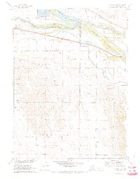 1970 Maxwell SW1973 Print · USGSLincoln County ranching and river transport converge at the Platte confluence in the early seventies. Researchers can trace local landmarks like the Sioux Lookout Historical Mon, Miriam Cem, and the path of the Union Pacific railroad.2 unique versions available
 - 1970 Map of Lake Maloney, 1973 Print
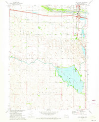 1970 Lake Maloney1973 Print · USGSLincoln County south of North Platte is captured in the early seventies during a period of significant water and power development. Researchers can trace rural landmarks like Miller Sch, St Patricks Cem, and the infrastructure of Lake Maloney.2 unique versions available
 - 1985 Map of North Platte
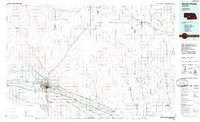 1985 North Platte1985 Print · USGSThe Platte River valley in the mid-1980s reveals a landscape of massive rail yards and vital irrigation works. Trace the Union Pacific lines through North Platte or locate family sites near Stapleton, Gandy, and Fort Mc Pherson National Cemetery.2 unique versions available
End of results
Showing maps 1-10 of 10
Top cities near North Platte
Top neighborhoods of North Platte
Frequently asked questions
- What are the different types of historical maps available for North Platte?
- What is the oldest map of North Platte?
- Where can I purchase historical maps of North Platte for my home or office?
- Where can I download high-res historical maps of North Platte?
- Are there historical topographic maps available for North Platte?
- Is there historical aerial imagery available for North Platte?
- Where are historical maps of North Platte sourced from?