Old Maps of Madison County, Nebraska for Hiking & Exploration
Hike through history with 109 historic maps of Madison County. Explore old trails, ghost towns, and forgotten backroads — perfect for outdoor adventurers and local explorers.
- Rediscover forgotten places: Map out old mining camps, roads, and footpaths that no longer exist on modern maps.
- Layer with modern tools: Combine with LiDAR or satellite views to plan hikes through historical terrain.
- Made for exploration: Popular among hikers, overlanders, and local history lovers.
Use these maps to find adventure and explore the hidden past of Madison County.
Madison County, NE maps
(109)- 1955 Map of Sioux City, 1959 Print
 1955 Sioux City1959 Print · USGSThe Missouri River valley in the mid-fifties is captured here during a time of major engineering and social transition. Genealogists and historians can trace the foundations of Gavins Point Dam, tribal boundaries on the Santee Sioux Indian Reservation, and local landmarks like the Norfolk State Hospital.4 unique versions available
 - 1955 Map of Fremont, 1966 Print
 1955 Fremont1966 Print · USGSEastern Nebraska and the Missouri River border are captured during the mid-fifties, just as the interstate system began to emerge. Researchers can trace the development of Omaha, locate the sprawling Offutt Air Force Base, or study the river-bound ecology of the De Soto National Wildlife Refuge.3 unique versions available
 - 1957 Map of Fremont
 1957 Fremont1957 Print · USGSEastern Nebraska and western Iowa thrive along the Platte and Missouri rivers during the mid-fifties. Genealogists can locate small rural schools like Fairview School and tracing the paths of the Union Pacific through towns like Albion and Humphrey.
 - 1958 Map of Sioux City
 1958 Sioux City1958 Print · USGSThe Missouri River valley in the late fifties was a bustling intersection of tribal lands, rail corridors, and river towns. Genealogists can trace family roots through specific rural sites like Daisy Valley School, St Johns Church and School, and Yankton State Hospital.
 - 1958 Map of Fremont
 1958 Fremont1958 Print · USGSEastern Nebraska in the late fifties is captured here as a thriving corridor of river-valley commerce and rail transport. Researchers can trace the development of Omaha and Fremont or locate local landmarks like Midland College and Offutt Air Force Base.
 - 1959 Map of Sioux City
 1959 Sioux City1959 Print · USGSThe tri-state region surrounding the Missouri River is captured here in the late fifties, showing the convergence of Nebraska, South Dakota, and Iowa. Researchers can trace rural lineages through numerous country schoolhouses like Cemetery School and the many numbered Washington School districts.
 - 1963 Map of Madison, 1964 Print
 1963 Madison1964 Print · USGSThe city of Madison and its surrounding townships are shown in the early 1960s at the height of the regional rail-and-road economy. Researchers can locate family landmarks such as St Leonards Cem and rural schoolhouses like Good Cheer Sch or Dover Sch.
 - 1963 Map of Hoskins, 1964 Print
 1963 Hoskins1964 Print · USGSWayne and Stanton County farmsteads and rural school districts are captured here in the early 1960s. Genealogists can trace family locations near landmarks like Trinity Cem, Peace Ch, and several historic school sites including School No 10.2 unique versions available
 - 1963 Map of Madison SE, 1964 Print
 1963 Madison SE1964 Print · USGSStanton and Madison Counties were home to a dense network of country schoolhouses during the early sixties. Researchers can trace rural family roots and property lines near Union Creek through sites like School No 37, School No 20, and a solitary Gas Well.
 - 1963 Map of Battle Creek, 1964 Print
 1963 Battle Creek1964 Print · USGSBattle Creek and its surrounding Madison County townships are captured in the early sixties as a thriving network of rural communities. Family researchers can trace exact locations for Allbery Cem, Fairview Ch, and several local landmarks like St Peters Sch.2 unique versions available
 - 1963 Map of Pierce SE, 1964 Print
 1963 Pierce SE1964 Print · USGSMadison and Pierce counties come alive in the early sixties, showing the agricultural heartland centered on the Battle Creek community. Genealogists can trace family roots through numerous rural schoolhouses like Dederman Sch and the grounds of St Patricks Cem.2 unique versions available
 - 1963 Map of Emerick, 1964 Print
 1963 Emerick1964 Print · USGSMadison County's rural townships are captured here in the early sixties, showing a landscape defined by traditional Nebraska farming sections. Genealogists can locate specific local landmarks like Hutchins Cem and several country schools including Whitehouse Sch and Brookside Sch.2 unique versions available
 - 1963 Map of Meadow Grove, 1964 Print
 1963 Meadow Grove1964 Print · USGSMeadow Grove and the Elkhorn River valley are captured in the early sixties as a thriving rail and agricultural corridor. Genealogists can locate family landmarks like Lutheran Cem and several rural schoolhouses, including Sullivan Sch and Hughes Sch.
 - 1963 Map of Closter SE, 1964 Print
 1963 Closter SE1964 Print · USGSMadison and Boone counties are captured in the early sixties, showing a landscape of rural schoolhouses and creek-side settlements. Trace family roots at Shell Creek Cem, Trinity Cem, and several numbered schools like School No 38.2 unique versions available
 - 1963 Map of Norfolk, 1964 Print
 1963 Norfolk1964 Print · USGSMid-century Madison County is defined by the convergence of major rail lines and the winding Elkhorn River at a time of steady urban expansion. Trace the footprints of early institutions like the Norfolk State Hospital and Christian College, or locate vanished rural schoolhouses such as School No 20 and School No 1.2 unique versions available
 - 1963 Map of Madison NE, 1964 Print
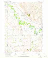 1963 Madison NE1964 Print · USGSThe Elkhorn River valley in Northeast Nebraska is captured here during the early sixties, showing a landscape defined by small-town infrastructure. You can trace the Chicago and North Western rail line and locate rural sites like Pleasant Run Cem or School No 19.3 unique versions available
 - 1963 Map of Enola, 1964 Print
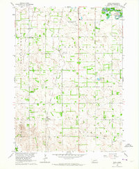 1963 Enola1964 Print · USGSMadison County's agricultural heartland is documented here in the early sixties, showing a landscape shaped by rail and river. Researchers can find old country school sites like Tannehill Sch and trace family roots at Besk Cem or the settlement of Enola.2 unique versions available
 - 1963 Map of Closter NE, 1964 Print
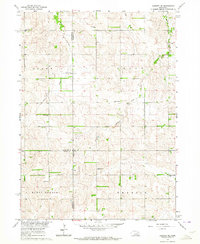 1963 Closter NE1964 Print · USGSMadison and Antelope counties appear here in the early sixties as a landscape defined by traditional rural school districts and family farms. Researchers can trace historic locations like St Pauls Ch, Bunker Hill Sch, and Rolling Prairie Sch.2 unique versions available
 - 1963 Map of Battle Creek SE, 1964 Print
 1963 Battle Creek SE1964 Print · USGSMadison County's rural townships are captured here in the early sixties, showing a landscape of family farms and local school districts. Genealogists can locate family burial sites at Green Garden Cem or trace the early locations of St John Sch and School No 66.2 unique versions available
 - 1963 Map of Battle Creek SW, 1964 Print
 1963 Battle Creek SW1964 Print · USGSMadison County's agricultural heartland is documented here in the early sixties, showing the township boundaries of Emerick and Kalamazoo. Genealogists can trace family footprints across several rural schools and burial sites like Iowa Valley Cem and Chloe Sch.2 unique versions available
 - 1963 Map of Tilden, 1964 Print
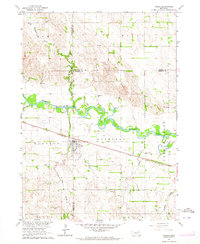 1963 Tilden1964 Print · USGSThe Elkhorn River valley in the early 1960s reveals a landscape of thriving rail towns and rural school districts. Genealogists can trace family roots at St Marys Cem or locate old schoolhouses like Valley View Sch and School No 18.
 - 1966 Map of Newman Grove, 1967 Print
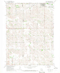 1966 Newman Grove1967 Print · USGSNewman Grove and the surrounding farmsteads of Madison and Platte counties are captured here in the mid-1960s. Researchers can trace the Chicago and North Western line, locate the Happy Hill Sch, or find family roots at Salem Ch.2 unique versions available
 - 1966 Map of Lindsay, 1967 Print
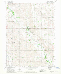 1966 Lindsay1967 Print · USGSLindsay and the surrounding Platte County townships are captured here in the mid-1960s, showing a landscape of fertile creek bottoms and scattered prairie settlements. Genealogists can locate family landmarks like Looking Glass Sch and the Holy Family Cem.2 unique versions available
 - 1966 Map of Creston, 1968 Print
 1966 Creston1968 Print · USGSThe village of Creston and the surrounding farmlands are captured in the mid-1960s at the intersection of four Nebraska counties. Researchers can trace rural landmarks including the Old Railroad Grade, Creston Pioneer Cem, and Boheet Sch.
 - 1966 Map of Cornlea, 1968 Print
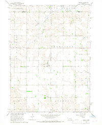 1966 Cornlea1968 Print · USGSPlatte and Madison counties are captured here in the mid-sixties, centered on the settlement of Cornlea. Genealogists can locate the Sacred Heart Cem and Moriah Cem, or trace the path of the Old Railroad Grade across the prairie.2 unique versions available
Showing maps 1-25 of 109
Top cities of Madison County
- Norfolk historical maps
- Madison historical maps
- Battle Creek historical maps
- Newman Grove historical maps
- Meadow Grove historical maps
- Enola historical maps
Frequently asked questions
- What are the different types of historical maps available for Madison County?
- What is the oldest map of Madison County?
- Where can I purchase historical maps of Madison County for my home or office?
- Where can I download high-res historical maps of Madison County?
- Are there historical topographic maps available for Madison County?
- Is there historical aerial imagery available for Madison County?
- Where are historical maps of Madison County sourced from?