2020s Maps of Nuckolls County, Nebraska
Explore 15 historic maps of Nuckolls County from the 2020s. These maps offer a rare glimpse into what life looked like during the 2020s — showing old roads, neighborhoods, homes, and landmarks that have changed or disappeared over time.
Whether you're researching your family's past, planning a metal detecting trip, or studying how Nuckolls County's landscape evolved across the 2020s, these high-resolution maps are a powerful tool for exploring the history of this region.
- Focus on a specific era: All maps on this page are from the 2020s, giving you a focused view of this time period.
- See what’s changed: Compare century-old streets, trails, and buildings to today's modern landscape using overlays and satellite layers.
- Research with precision: Use these maps for genealogy, historical research, land use analysis, or educational projects.
- View, download, or print: Maps are fully viewable online in high resolution, and can be downloaded or printed for your own records.
Start exploring Nuckolls County's history through authentic maps from the 2020s. This is your window into the past.
Nuckolls County, NE maps
(15)- 2021 Map of Guide Rock NE, 2021 Print
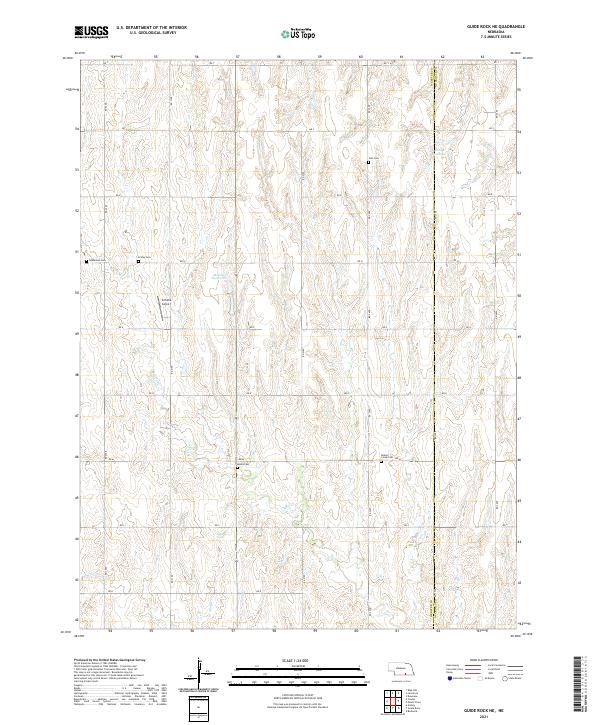 2021 Guide Rock NE2021 Print · USGSWebster and Nuckolls counties meet in this agricultural landscape during the 2020s. Genealogists can trace family heritage through numerous rural burial grounds like Zion Cem and Beaver Creek Cem or locate the Schutte Airport.
 - 2021 Map of Davenport, 2021 Print
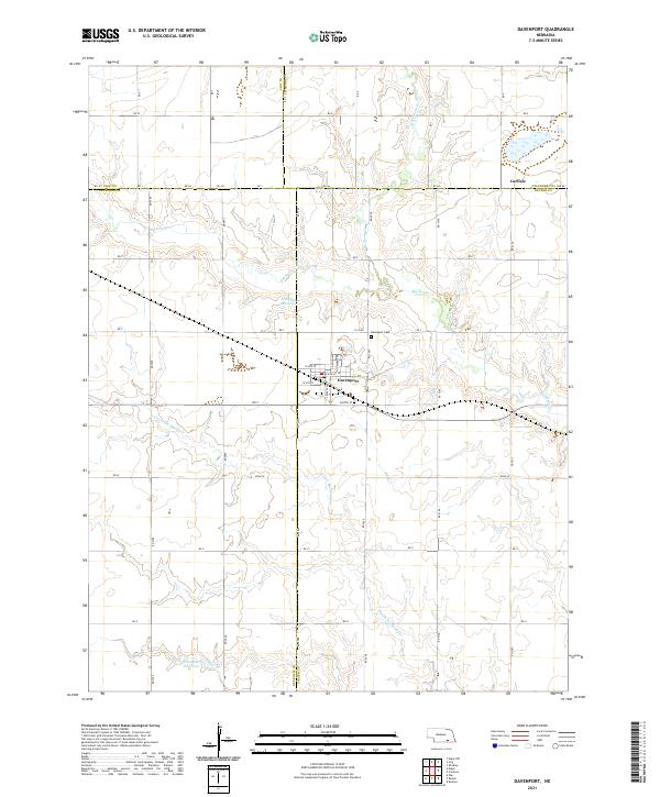 2021 Davenport2021 Print · USGSDavenport and the surrounding Thayer County plains are captured here in the early twenty-first century as a landscape of grid-roads and creek-fed reservoirs. Genealogists can trace property locations along RD 5000 or locate burials at Davenport Cem and the settlement of Carlisle.
 - 2021 Map of Fairfield SE, 2021 Print
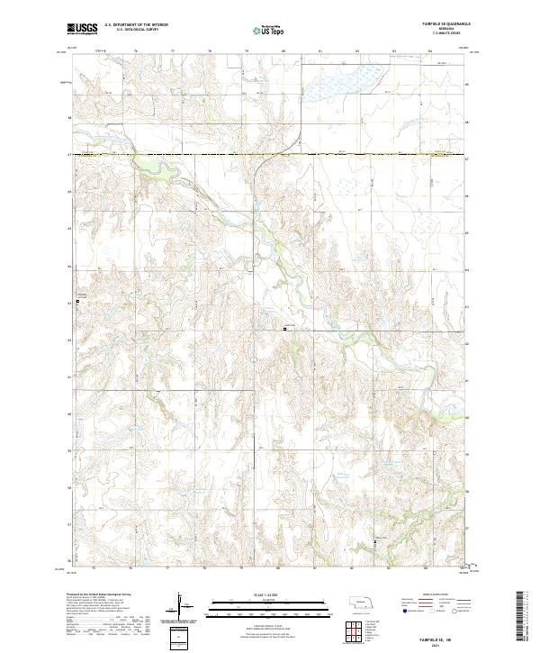 2021 Fairfield SE2021 Print · USGSClay and Nuckolls Counties are captured in this modern survey of Nebraska's rural landscape. Genealogists and local historians can locate Pleasant Hill Cem, Smith Cem, and numerous water features like the Little Blue River and Jones Reservoir.
 - 2021 Map of Byron, 2021 Print
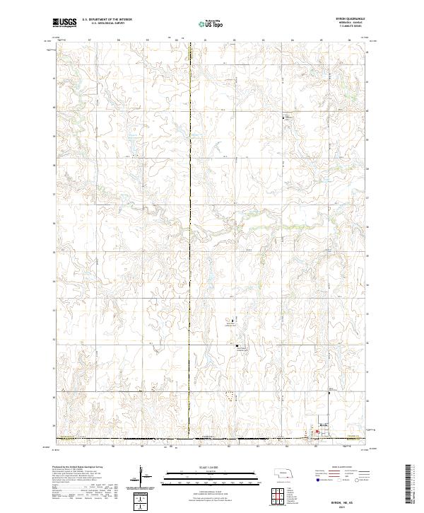 2021 Byron2021 Print · USGSByron and the surrounding Nebraska-Kansas borderlands are shown here in the early twenty-first century as the agricultural heart of Thayer County. Researchers can trace local genealogy through several rural cemeteries including Saint Pauls Cem and Zion Lutheran Cem, or locate family landmarks like Fintel Reservoir.
 - 2021 Map of Edgar, 2021 Print
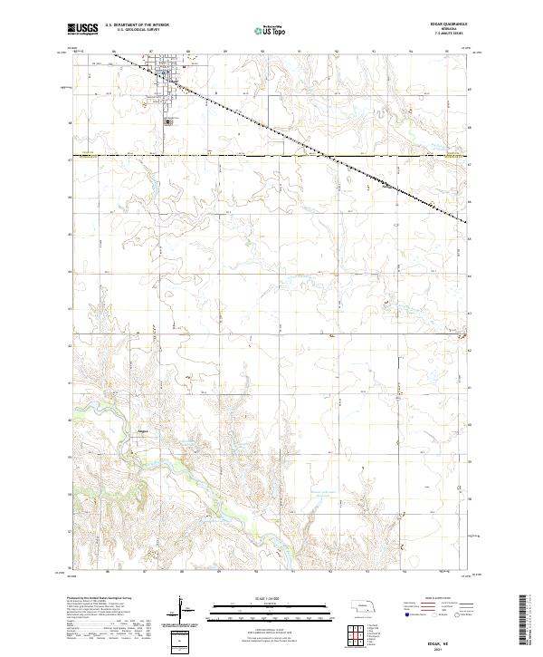 2021 Edgar2021 Print · USGSClay and Nuckolls Counties appear here in a recent detailed survey of south-central Nebraska’s agricultural heartland. Genealogists and local historians can locate the Edgar Cem, trace the course of the Little Blue River, and explore the small settlements of Angus and Sedan.
 - 2021 Map of Oak, 2021 Print
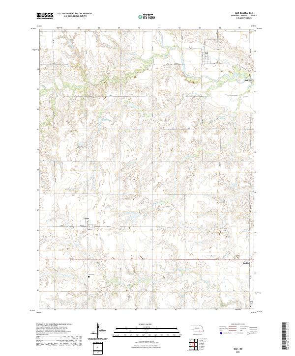 2021 Oak2021 Print · USGSNuckolls County agriculture and water management are clearly visible in this modern survey of south-central Nebraska. Researchers can pinpoint the Nora Cem, the site of Oak Mill, and small settlements like Nora and Oak along the Little Blue River.
 - 2021 Map of Hardy, 2021 Print
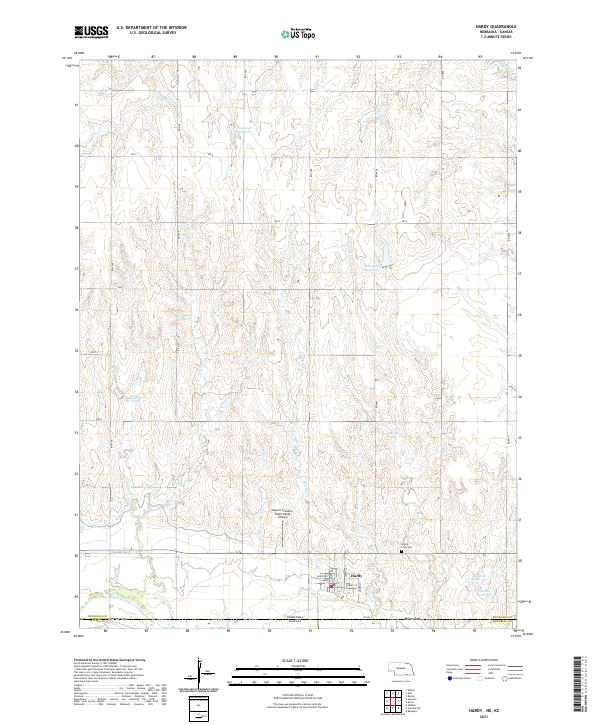 2021 Hardy2021 Print · USGSThe Nebraska-Kansas border region is captured here in the early twenty-first century, centered on the village of Hardy. Researchers can locate the Hardy City Cem, the Meyers Freedom Flight Hardy Airport, and numerous rural water features like Simonsen Reservoir.
 - 2021 Map of Ruskin, 2021 Print
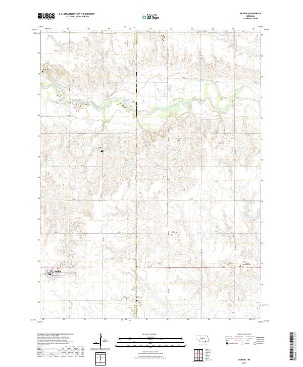 2021 Ruskin2021 Print · USGSThe village of Ruskin and its surrounding grain-growing plains are captured in 2021, showing the modern layout of this Nuckolls County community. Genealogists can locate several historic burial grounds, including Mount Zion Cem and Saint Marks Cem, alongside the waters of Thawes Cr.
 - 2021 Map of Bostwick, 2021 Print
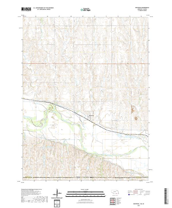 2021 Bostwick2021 Print · USGSThe river valley near Bostwick is captured here during the early twenty-first century, showing a landscape defined by industrial-scale irrigation. Researchers can trace the complex paths of the Superior Canal and Courtland Canal as they parallel the Republican River.
 - 2021 Map of Guide Rock, 2021 Print
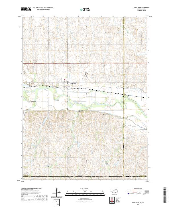 2021 Guide Rock2021 Print · USGSThe Republican River valley and the Nebraska-Kansas border define this agricultural region during the early twenty-first century. Researchers can locate family heritage sites at Guide Rock Cem or trace the path of the Superior Canal and The Guide Rock.
 - 2021 Map of Superior, 2021 Print
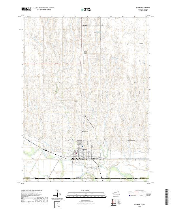 2021 Superior2021 Print · USGSCrossing the border into Kansas, this survey captures the agricultural landscape around Superior and the Republican River in the early 2020s. Researchers can trace rural lineages at Evergreen Cem or locate the smaller settlements of Smyrna and Cadams.
 - 2021 Map of Lawrence, 2021 Print
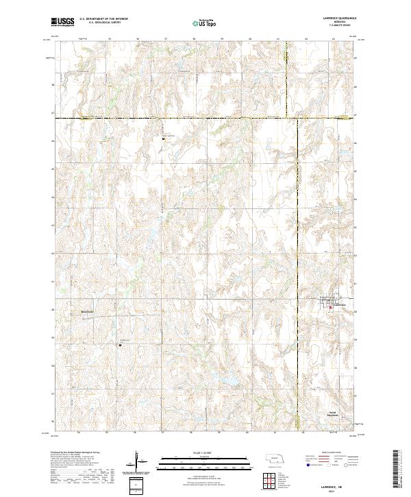 2021 Lawrence2021 Print · USGSThe rural landscape where Nuckolls and Webster counties meet was captured in the early 2020s, showing a region still defined by its agricultural roots and creek drainages. Genealogists can locate family sites near Lawrence, Saint Stephens, or the Oak Creek Cem.
 - 2021 Map of Nelson, 2021 Print
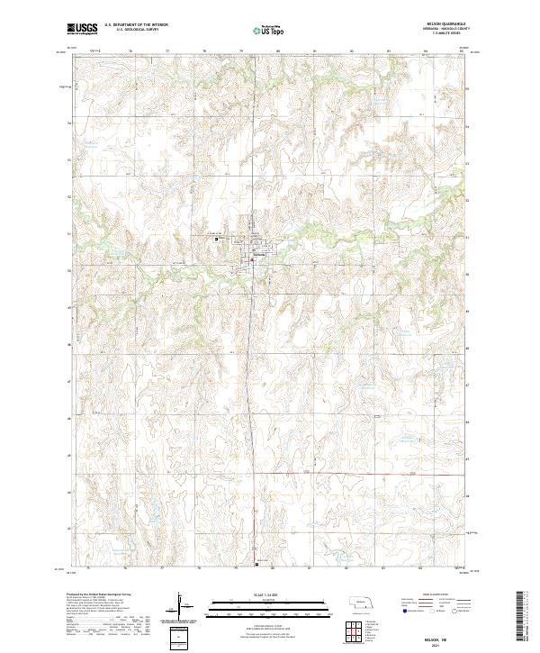 2021 Nelson2021 Print · USGSNelson and the surrounding Nuckolls County plains are shown in detail as they appeared in 2021, centered on the county seat. Genealogists and local historians can trace family locations near Nelson Cem, the Nuckolls County Courthouse, and various reservoirs like Gebhards Reservoir.
 - 2021 Map of Deweese, 2021 Print
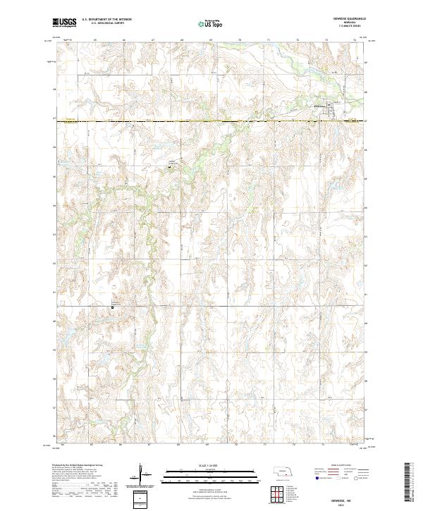 2021 Deweese2021 Print · USGSThe rural landscape surrounding the village of Deweese is captured here in the early 2020s, revealing a region defined by water management and family landmarks. Researchers can locate Liberty Creek Cem, Sacred Heart Cem, and several named impoundments like Skalka Reservoir.
 - 2021 Map of Mount Clare, 2021 Print
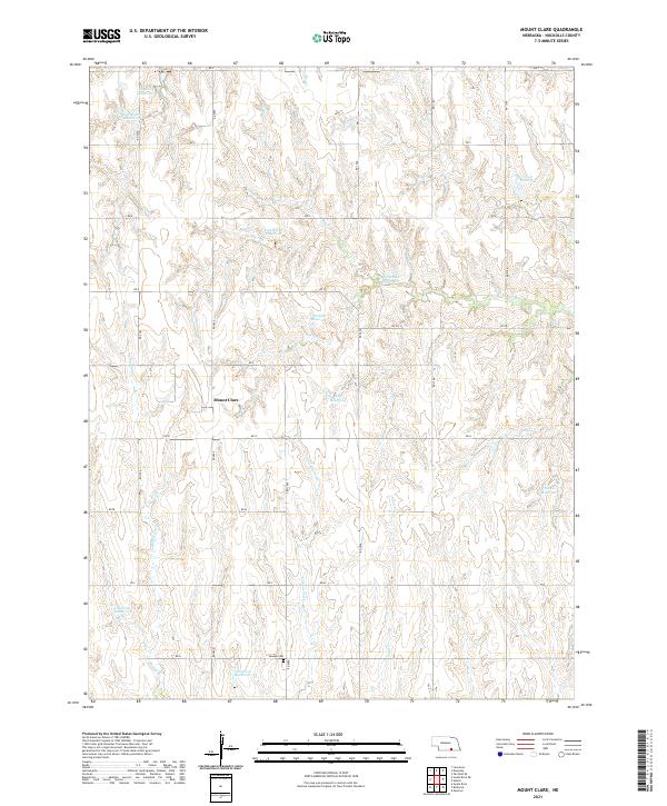 2021 Mount Clare2021 Print · USGSNuckolls County during the early 2020s is defined by its deep-rooted agricultural settlement and managed water resources. Genealogists can locate Beulah Cem or trace family-named water features like Childress Reservoir and Hoelting Reservoir near Mount Clare.
End of results
Showing maps 1-15 of 15
Top cities of Nuckolls County
- Superior historical maps
- Nelson historical maps
- Lawrence historical maps
- Hardy historical maps
- Ruskin historical maps
- Oak historical maps
See more
Frequently asked questions
- What are the different types of historical maps available for Nuckolls County?
- What is the oldest map of Nuckolls County?
- Where can I purchase historical maps of Nuckolls County for my home or office?
- Where can I download high-res historical maps of Nuckolls County?
- Are there historical topographic maps available for Nuckolls County?
- Is there historical aerial imagery available for Nuckolls County?
- Where are historical maps of Nuckolls County sourced from?