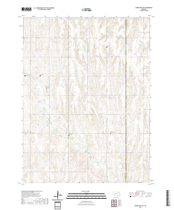
2021 Map of Guide Rock NE
USGS Topo · Published 2021About this map
The Webster and Nuckolls County border divides this agricultural landscape, where the drainage of Beaver Cr and its tributaries like Minnie Cr and Soap Cr has shaped the settlement pattern. This area of south-central Nebraska is characterized by a high density of rural burial grounds, including Zion Cem, Beaver Creek Cem, Immanuel Cem, Eckley Cem, and Monia Cem, reflecting the early pioneer family footprints that established these townships. Local infrastructure is primarily oriented around the section-line road network, punctuated by small private water projects such as Lemke Reservoir and Meents Reservoir. The presence of Schutte Airport amidst these fields highlights the modern agricultural aviation needs of the Republican River valley region.
Find a feature on this map
26 named features on this map. Tap any name to fly to it.
Don’t see what you’re looking for? This feature index may not catch every label — zoom into the map to look around manually.
Map Details
Editions of this 2021 Guide Rock NE Map
This is the sole edition of this map. No revisions or reprints were ever made.
Other maps of this area

1898 · Superior
USGS Topo · 1:125,000

1955 · Grand Island
USGS Topo · 1:250,000

1957 · Grand Island
USGS Topo · 1:250,000

1958 · Grand Island
USGS Topo · 1:250,000

1960 · Deweese
USGS Topo · 1:24,000

1969 · Lawrence
USGS Topo · 1:24,000

1969 · Blue Hill
USGS Topo · 1:24,000
1974 · Amboy
USGS Topo · 1:24,000
1974 · Guide Rock
USGS Topo · 1:24,000
1974 · Mount Clare
USGS Topo · 1:24,000