1960s Maps of Pierce County, Nebraska
Explore 13 historic maps of Pierce County from the 1960s. These maps offer a rare glimpse into what life looked like during the 1960s — showing old roads, neighborhoods, homes, and landmarks that have changed or disappeared over time.
Whether you're researching your family's past, planning a metal detecting trip, or studying how Pierce County's landscape evolved across the 1960s, these high-resolution maps are a powerful tool for exploring the history of this region.
- Focus on a specific era: All maps on this page are from the 1960s, giving you a focused view of this time period.
- See what’s changed: Compare century-old streets, trails, and buildings to today's modern landscape using overlays and satellite layers.
- Research with precision: Use these maps for genealogy, historical research, land use analysis, or educational projects.
- View, download, or print: Maps are fully viewable online in high resolution, and can be downloaded or printed for your own records.
Start exploring Pierce County's history through authentic maps from the 1960s. This is your window into the past.
Pierce County, NE maps
(13)- 1963 Map of Hoskins, 1964 Print
 1963 Hoskins1964 Print · USGSWayne and Stanton County farmsteads and rural school districts are captured here in the early 1960s. Genealogists can trace family locations near landmarks like Trinity Cem, Peace Ch, and several historic school sites including School No 10.2 unique versions available
 - 1963 Map of Pierce NW, 1964 Print
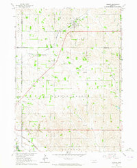
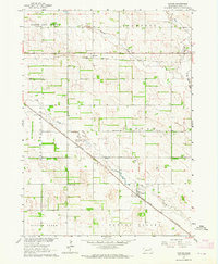
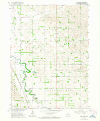
 1963 Pierce NW1964 Print · USGSPierce County farming country is captured here in the early sixties, showing the rural grid of townships and creek valleys. Genealogists can trace family footprints near Lambrecht Cem or old school sites like Tawney Sch and School No 14 R.
 - 1963 Map of Plainview, 1964 Print
 1963 Plainview1964 Print · USGSPlainview stands at the busy crossing of two major railroads in the early 1960s, surrounded by a productive landscape of Nebraska prairie and creeks. Researchers can locate vanished rural landmarks like School No 48 or trace family roots at Pleasant Ridge Cem and Crawford Valley Ch.
 - 1963 Map of Pierce SE, 1964 Print
 1963 Pierce SE1964 Print · USGSMadison and Pierce counties come alive in the early sixties, showing the agricultural heartland centered on the Battle Creek community. Genealogists can trace family roots through numerous rural schoolhouses like Dederman Sch and the grounds of St Patricks Cem.2 unique versions available
 - 1963 Map of Foster, 1964 Print
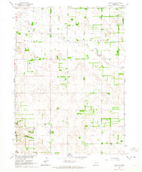
 1963 Foster1964 Print · USGSPierce County farming communities and rail corridors are preserved here as they functioned in the early sixties. Genealogists can trace rural school locations like School No 16 and family burial sites at Zion Cem near the town of Foster.
 - 1963 Map of Meadow Grove, 1964 Print
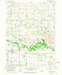 1963 Meadow Grove1964 Print · USGSMeadow Grove and the Elkhorn River valley are captured in the early sixties as a thriving rail and agricultural corridor. Genealogists can locate family landmarks like Lutheran Cem and several rural schoolhouses, including Sullivan Sch and Hughes Sch.
 - 1963 Map of Norfolk, 1964 Print
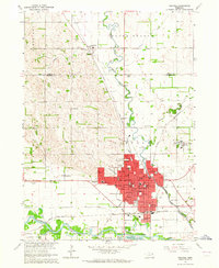 1963 Norfolk1964 Print · USGSMid-century Madison County is defined by the convergence of major rail lines and the winding Elkhorn River at a time of steady urban expansion. Trace the footprints of early institutions like the Norfolk State Hospital and Christian College, or locate vanished rural schoolhouses such as School No 20 and School No 1.2 unique versions available
 - 1963 Map of Osmond, 1964 Print
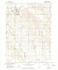 1963 Osmond1964 Print · USGSPierce County farming communities thrived during the early sixties as rail and river shaped the local economy. Genealogists and local historians can trace family locations near Osmond, finding landmark sites like Logan Pride Sch and St Marys Cem.2 unique versions available
 - 1963 Map of Wee Town, 1964 Print
 1963 Wee Town1964 Print · USGSPierce County farming communities and rural school districts are frozen in time during the early sixties. Genealogists can trace family landmarks like Koehler Cem, Zion Cem, and various schoolhouses along the North Fork Elkhorn River.2 unique versions available
 - 1963 Map of Tilden NE, 1964 Print
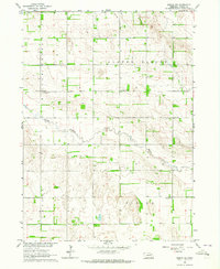
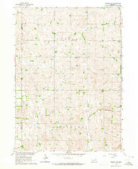
 1963 Tilden NE1964 Print · USGSThe Antelope and Pierce county line runs through this rural Nebraska landscape in the early sixties. Genealogists and local historians can locate several rural landmarks including Stark Valley Ch, Lake Valley Sch, and Rowell Lake.
 - 1963 Map of Pierce, 1964 Print
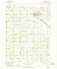
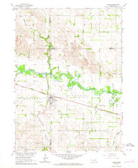
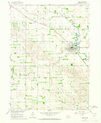 1963 Pierce1964 Print · USGSIn the early sixties, the Pierce area centered on the busy intersection of the Chicago and North Western rail line and the North Fork Elkhorn River. Genealogists can locate family landmarks like Prospect View Cemetery, St Josephs Cem, and rural sites like School No 56.2 unique versions available
 - 1963 Map of Norfolk NE, 1964 Print
 1963 Norfolk NE1964 Print · USGSThe rural border of Pierce and Wayne Counties is shown in the early sixties as a thriving network of prairie farms and townships. Researchers can locate community anchors like Swedish Cemetery, Zion Church, and the Chicago and North Western rail line.2 unique versions available
 - 1963 Map of Tilden, 1964 Print
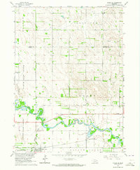
 1963 Tilden1964 Print · USGSThe Elkhorn River valley in the early 1960s reveals a landscape of thriving rail towns and rural school districts. Genealogists can trace family roots at St Marys Cem or locate old schoolhouses like Valley View Sch and School No 18.
End of results
Showing maps 1-13 of 13
Top cities of Pierce County
- Pierce historical maps
- Plainview historical maps
- Osmond historical maps
- Hadar historical maps
- Foster historical maps
- McLean historical maps
See more
Frequently asked questions
- What are the different types of historical maps available for Pierce County?
- What is the oldest map of Pierce County?
- Where can I purchase historical maps of Pierce County for my home or office?
- Where can I download high-res historical maps of Pierce County?
- Are there historical topographic maps available for Pierce County?
- Is there historical aerial imagery available for Pierce County?
- Where are historical maps of Pierce County sourced from?