Old Maps of Ithaca, Nebraska for Hiking & Exploration
Hike through history with 10 historic maps of Ithaca. Explore old trails, ghost towns, and forgotten backroads — perfect for outdoor adventurers and local explorers.
- Rediscover forgotten places: Map out old mining camps, roads, and footpaths that no longer exist on modern maps.
- Layer with modern tools: Combine with LiDAR or satellite views to plan hikes through historical terrain.
- Made for exploration: Popular among hikers, overlanders, and local history lovers.
Use these maps to find adventure and explore the hidden past of Ithaca.
Ithaca, NE maps
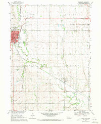
(10)- 1899 Map of Wahoo
 1899 Wahoo1899 Print · USGSSaunders County and its neighbors thrive as a booming rail hub in the 1890s, where the Platte River meets a dense web of iron tracks. Trace the early development of prairie towns like Wahoo, Valparaiso, and the Bohemian settlement at Prague.3 unique versions available
 - 1955 Map of Fremont, 1966 Print
 1955 Fremont1966 Print · USGSEastern Nebraska and the Missouri River border are captured during the mid-fifties, just as the interstate system began to emerge. Researchers can trace the development of Omaha, locate the sprawling Offutt Air Force Base, or study the river-bound ecology of the De Soto National Wildlife Refuge.3 unique versions available
 - 1957 Map of Fremont
 1957 Fremont1957 Print · USGSEastern Nebraska and western Iowa thrive along the Platte and Missouri rivers during the mid-fifties. Genealogists can locate small rural schools like Fairview School and tracing the paths of the Union Pacific through towns like Albion and Humphrey.
 - 1958 Map of Fremont
 1958 Fremont1958 Print · USGSEastern Nebraska in the late fifties is captured here as a thriving corridor of river-valley commerce and rail transport. Researchers can trace the development of Omaha and Fremont or locate local landmarks like Midland College and Offutt Air Force Base.
 - 1969 Map of Wahoo East, 1971 Print
 1969 Wahoo East1971 Print · USGSSaunders County as it appeared in the late sixties reveals a landscape of thriving rail towns and deep-rooted rural communities. Trace the vanished campus of John F Kennedy College or locate ancestral sites like Indian Mound Cem and Alma Cem.2 unique versions available
 - 1982 Map of Fremont
 1982 Fremont1982 Print · USGSEastern Nebraska in the early eighties exhibits a landscape of industrious rail towns and river-fed agriculture. Genealogists and historians can trace the development of Fremont, locate the National Cem, and find landmarks like the Todd Valley.2 unique versions available
 - 2011 Map of Wahoo East, 2011 Print
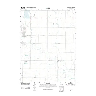 2011 Wahoo East2011 Print · USGSCovers Ithaca, including Wahoo, Swedeburg, and other nearby areas
 - 2014 Map of Wahoo East, 2014 Print
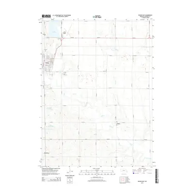 2014 Wahoo East2014 Print · USGSCovers Ithaca, including Wahoo, Swedeburg, and other nearby areas
 - 2017 Map of Wahoo East, 2017 Print
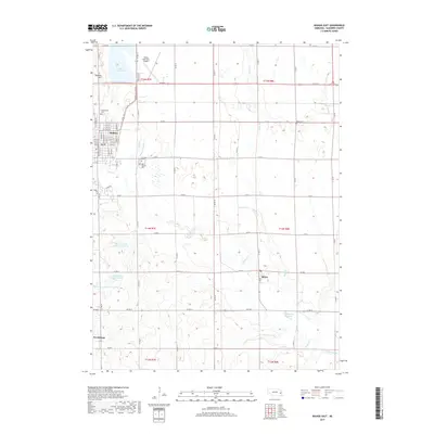 2017 Wahoo East2017 Print · USGSCovers Ithaca, including Wahoo, Swedeburg, and other nearby areas
 - 2021 Map of Wahoo East, 2021 Print
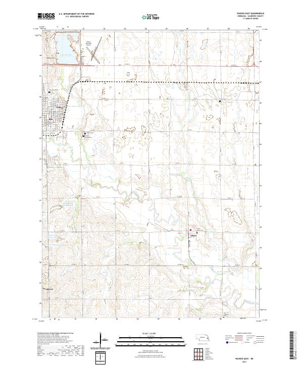 2021 Wahoo East2021 Print · USGSSaunders County is captured here in the early twenty-first century, centered on the growing community of Wahoo. Researchers can trace local history through a high density of rural burial grounds, including Indian Mound Cem and Zion Lutheran Cem.
End of results
Showing maps 1-10 of 10
Top cities near Ithaca
- Wahoo historical maps
- Waverly historical maps
- Ashland historical maps
- Valley historical maps
- Yutan historical maps
- Ceresco historical maps
See more
Frequently asked questions
- What are the different types of historical maps available for Ithaca?
- What is the oldest map of Ithaca?
- Where can I purchase historical maps of Ithaca for my home or office?
- Where can I download high-res historical maps of Ithaca?
- Are there historical topographic maps available for Ithaca?
- Is there historical aerial imagery available for Ithaca?
- Where are historical maps of Ithaca sourced from?