Old Maps of Weston, Nebraska for Genealogy
Trace your family roots with 10 historic maps of Weston. These high-res maps reveal old neighborhoods, homesites, landmarks, and streets — helping you uncover where your ancestors lived and how the area evolved over time.
- Explore historic neighborhoods: Identify where your relatives may have lived in the 1800s or 1900s.
- Compare maps over time: Trace the changes in streets, buildings, and landmarks for multi-generational research.
- Perfect for genealogy & ancestry research: Used by family historians and researchers to map out lineage and migration.
These maps are an incredible resource for exploring your personal connection to Weston's past.
Weston, NE maps
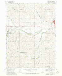
(10)- 1899 Map of Wahoo
 1899 Wahoo1899 Print · USGSSaunders County and its neighbors thrive as a booming rail hub in the 1890s, where the Platte River meets a dense web of iron tracks. Trace the early development of prairie towns like Wahoo, Valparaiso, and the Bohemian settlement at Prague.3 unique versions available
 - 1955 Map of Fremont, 1966 Print
 1955 Fremont1966 Print · USGSEastern Nebraska and the Missouri River border are captured during the mid-fifties, just as the interstate system began to emerge. Researchers can trace the development of Omaha, locate the sprawling Offutt Air Force Base, or study the river-bound ecology of the De Soto National Wildlife Refuge.3 unique versions available
 - 1957 Map of Fremont
 1957 Fremont1957 Print · USGSEastern Nebraska and western Iowa thrive along the Platte and Missouri rivers during the mid-fifties. Genealogists can locate small rural schools like Fairview School and tracing the paths of the Union Pacific through towns like Albion and Humphrey.
 - 1958 Map of Fremont
 1958 Fremont1958 Print · USGSEastern Nebraska in the late fifties is captured here as a thriving corridor of river-valley commerce and rail transport. Researchers can trace the development of Omaha and Fremont or locate local landmarks like Midland College and Offutt Air Force Base.
 - 1969 Map of Wahoo West, 1971 Print
 1969 Wahoo West1971 Print · USGSSaunders County farmland is captured here in the late sixties, showing the rural communities west of the county seat. Genealogists can locate several family-history sites like St Wenceslaus Cem, Czech Ch, and School No 71 among the area's many original township schools.
 - 1982 Map of Fremont
 1982 Fremont1982 Print · USGSEastern Nebraska in the early eighties exhibits a landscape of industrious rail towns and river-fed agriculture. Genealogists and historians can trace the development of Fremont, locate the National Cem, and find landmarks like the Todd Valley.2 unique versions available
 - 2011 Map of Wahoo West, 2011 Print
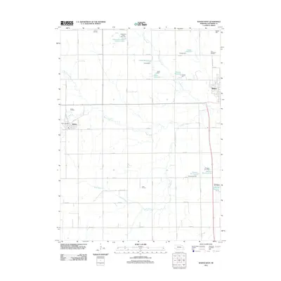 2011 Wahoo West2011 Print · USGSCovers Weston, including Wahoo, Saunders County, and other nearby areas
 - 2014 Map of Wahoo West, 2014 Print
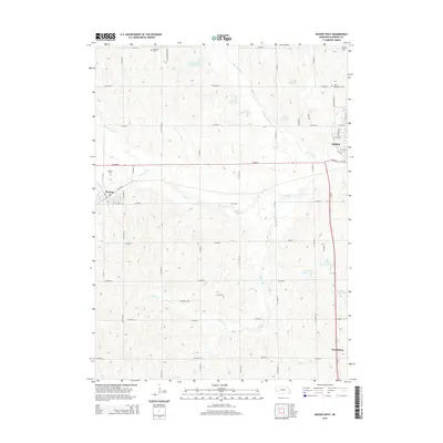 2014 Wahoo West2014 Print · USGSCovers Weston, including Wahoo, Saunders County, and other nearby areas
 - 2017 Map of Wahoo West, 2017 Print
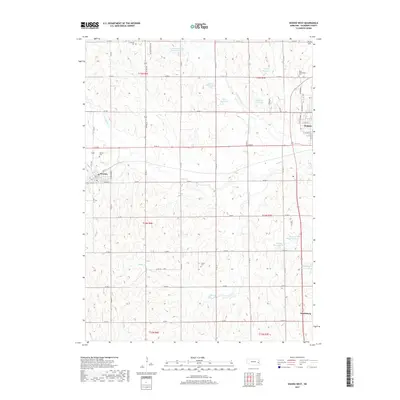 2017 Wahoo West2017 Print · USGSCovers Weston, including Wahoo, Saunders County, and other nearby areas
 - 2021 Map of Wahoo West, 2021 Print
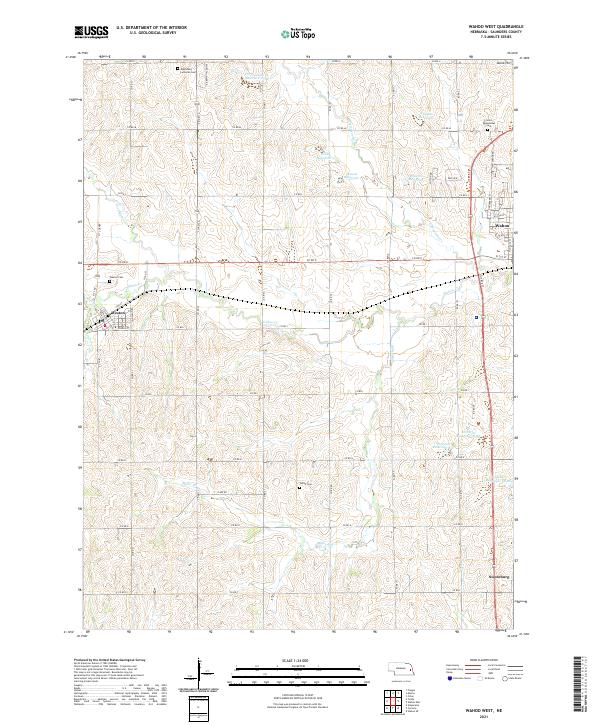 2021 Wahoo West2021 Print · USGSSaunders County farmland and the outskirts of Wahoo appear here in the early twenty-first century. Genealogists can locate family sites at Czech Cem, Weston, and Edensburg Lutheran Cem while tracing the waters of Wahoo Cr.
End of results
Showing maps 1-10 of 10
Top cities near Weston
- Fremont historical maps
- Wahoo historical maps
- Ceresco historical maps
- Valparaiso historical maps
- Prague historical maps
- Ithaca historical maps
See more
Frequently asked questions
- What are the different types of historical maps available for Weston?
- What is the oldest map of Weston?
- Where can I purchase historical maps of Weston for my home or office?
- Where can I download high-res historical maps of Weston?
- Are there historical topographic maps available for Weston?
- Is there historical aerial imagery available for Weston?
- Where are historical maps of Weston sourced from?