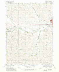
1969 Map of Wahoo West
USGS Topo · Published 1971About this map
The agricultural landscape of Saunders County is defined here by the winding course of Wahoo Creek and its many tributaries, including Miller Branch and the North Fork Wahoo Creek. Just west of the county seat, the village of Weston serves as a local hub along the Union Pacific rail line, which cuts through the central valley. The map reveals a high density of rural infrastructure typical of the late 1960s, featuring numerous one-room schoolhouses such as School No 44 and School No 87 scattered across townships like Mariposa and Stocking.
Find a feature on this map
38 named features on this map. Tap any name to fly to it.
Don’t see what you’re looking for? This feature index may not catch every label — zoom into the map to look around manually.
Map Details
Editions of this 1969 Wahoo West Map
This is the sole edition of this map. No revisions or reprints were ever made.
Other maps of this area

1899 · Wahoo
USGS Topo · 1:125,000

1955 · Fremont
USGS Topo · 1:250,000

1957 · Fremont
USGS Topo · 1:250,000

1958 · Fremont
USGS Topo · 1:250,000
1969 · Malmo
USGS Topo · 1:24,000
1969 · Touhy
USGS Topo · 1:24,000
1969 · Valparaiso
USGS Topo · 1:24,000
1969 · Colon
USGS Topo · 1:24,000
1969 · Prague
USGS Topo · 1:24,000
1969 · Ceresco
USGS Topo · 1:24,000