Old Maps of Sherman County, Nebraska for Hiking & Exploration
Hike through history with 105 historic maps of Sherman County. Explore old trails, ghost towns, and forgotten backroads — perfect for outdoor adventurers and local explorers.
- Rediscover forgotten places: Map out old mining camps, roads, and footpaths that no longer exist on modern maps.
- Layer with modern tools: Combine with LiDAR or satellite views to plan hikes through historical terrain.
- Made for exploration: Popular among hikers, overlanders, and local history lovers.
Use these maps to find adventure and explore the hidden past of Sherman County.
Sherman County, NE maps
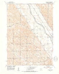
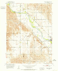
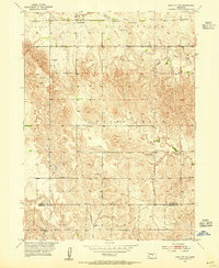
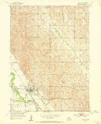
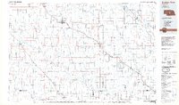
(105)- 1899 Map of Loup
 1899 Loup1899 Print · USGSCentral Nebraska at the end of the century was a land defined by its rivers and expanding rail lines. Genealogists can trace the early pioneer hubs of Dannebrog, Ashton, and Scotia along the Union Pacific RR.2 unique versions available
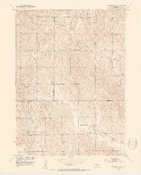
 - 1951 Map of Arcadia SE, 1953 Print
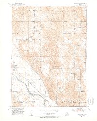
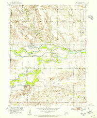
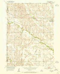
 1951 Arcadia SE1953 Print · USGSSherman County agriculture and transportation are captured here in the early fifties as irrigation projects expanded the valley. Genealogists can locate numerous rural schoolhouses, including Mixed Grove Sch, Bristow Sch, and Sunny Slope Sch.4 unique versions available
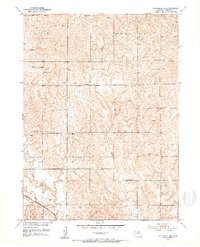
 - 1951 Map of Litchfield SW, 1953 Print
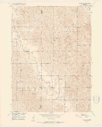
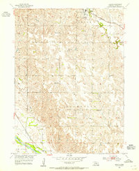
 1951 Litchfield SW1953 Print · USGSSherman County and its neighboring borderlands are shown here in the early fifties during the Missouri River Basin development program. Genealogists can locate old rural landmarks like Pleasant Valley Ch, Union Ridge Sch, and Brown Sch.2 unique versions available
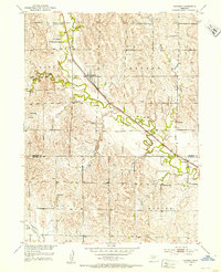
 - 1951 Map of Litchfield NE, 1953 Print
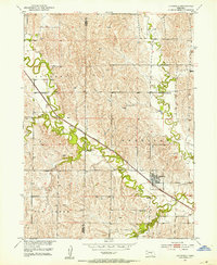
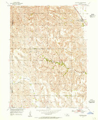
 1951 Litchfield NE1953 Print · USGSSherman County's rural landscape is captured here in the early fifties, showing the density of country schoolhouses and prairie homesteads. Researchers can locate vanished local landmarks like Prairie Hill Sch, Bickel Sch, and the Chicago Burlington and Quincy rail line.3 unique versions available
 - 1951 Map of Hazard, 1953 Print
 1951 Hazard1953 Print · USGSSherman and Buffalo Counties were centered on the railroad and rural school districts during the early fifties. Genealogists can trace family footprints through numerous local landmarks like Hazard Cem, Sweetwater Sch, and the Bentora Sch.3 unique versions available
 - 1951 Map of Arcadia West, 1953 Print
 1951 Arcadia West1953 Print · USGSThe Middle Loup River valley in the early fifties shows a landscape defined by rail, irrigation, and dozens of rural schoolhouses. Trace the path of the Chicago Burlington and Quincy railroad past Arcadia, Sacred Heart Cem, and Knight Sch.3 unique versions available
 - 1951 Map of Arcadia East, 1953 Print
 1951 Arcadia East1953 Print · USGSValley and Sherman Counties come alive in this early postwar record of the Middle Loup River valley. Genealogists and local historians can locate numerous rural schoolhouses like Old Yale Sch and Arbordale Sch or trace the Chicago Burlington and Quincy rail line.3 unique versions available
 - 1951 Map of Arcadia SW, 1953 Print
 1951 Arcadia SW1953 Print · USGSSherman County was a network of rural school districts and small farmsteads in the early fifties. Genealogists can locate family landmarks such as Lone Elm Cem, Union Sch, and the scattered Windmill sites that once sustained this prairie landscape.3 unique versions available
 - 1951 Map of Litchfield, 1953 Print
 1951 Litchfield1953 Print · USGSSherman County and the village of Litchfield are shown here in the early fifties, centered on the vital Chicago Burlington and Quincy rail line. Genealogists and local historians can trace a dense network of rural landmarks, from Gray Cem to numerous local schools like Clear Creek Sch and Willow Bell Sch.2 unique versions available
 - 1953 Map of Loup City NW, 1955 Print
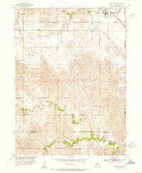
 1953 Loup City NW1955 Print · USGSValley and Sherman Counties were defined by a robust network of rural schoolhouses and small creeks in the early fifties. Researchers can trace ancestral connections through the Davis Creek Cem, Evangelical Ch, and numerous school sites like School No 47.2 unique versions available
 - 1953 Map of Cotesfield, 1955 Print
 1953 Cotesfield1955 Print · USGSHoward and Sherman counties in the early fifties show a dense network of rural schools and Danish-influenced settlements. Genealogists can trace family sites near Dannevirke Cem or locate the rail-side infrastructure of Cotesfield and School No 29.2 unique versions available
 - 1953 Map of North Loup, 1955 Print
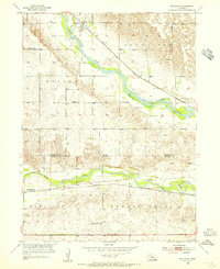
 1953 North Loup1955 Print · USGSNorth Loup and its surrounding townships are shown in the early fifties, capturing a period when rural schoolhouses still dotted the Nebraska landscape. Researchers can trace the Union Pacific rail line and find local landmarks like Hillside Cem, Pleasant Hill Sch, and Deer Creek Sch.2 unique versions available
 - 1953 Map of Rockville, 1955 Print
 1953 Rockville1955 Print · USGSSherman and Buffalo Counties are documented here in the early fifties, showing a rural landscape organized around the Loup River systems. Genealogists can locate family-named landmarks and essential community sites like Hayestown Cem, Coulter Sch, and Nantasket Sch.2 unique versions available
 - 1953 Map of Boelus, 1955 Print
 1953 Boelus1955 Print · USGSHoward County and the surrounding river valleys are captured here in the early fifties during the Missouri River Basin development program. Researchers can find old rural landmarks including Boelus, the Swedish Cem, and numerous schoolhouses like Boesen Sch.2 unique versions available
 - 1953 Map of Scotia, 1955 Print
 1953 Scotia1955 Print · USGSGreeley County and the North Loup River valley are captured in the early fifties as the region's rail and agricultural infrastructure matured. Researchers can locate Scotia and its nearby Mt Hope Cem, or trace the Union Pacific line down to Scotia Junction.2 unique versions available
 - 1953 Map of Ravenna NW, 1955 Print
 1953 Ravenna NW1955 Print · USGSSherman County agriculture and transport thrived along the river valley in the early fifties. Genealogists can trace family footprints through numerous rural landmarks like Verdurette Cem, Hawk Sch, and Fletcher Sch.2 unique versions available
 - 1953 Map of Loup City SE, 1955 Print
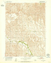 1953 Loup City SE1955 Print · USGSSherman County farming life is captured mid-century, showing a landscape defined by creek valleys and a grid of rural schoolhouses. Genealogists can trace family footprints near Ashton or locate specific local landmarks like Shaupps Sch and School No 77.2 unique versions available
 - 1953 Map of Loup City, 1955 Print
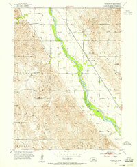
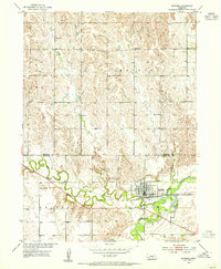
 1953 Loup City1955 Print · USGSLoup City and its surrounding precincts are captured here in the early 1950s at the junction of two major rail lines. Genealogists can trace rural life through numerous numbered landmarks like School No 31 and resting places at Evergreen Cem and St Josephs Cem.2 unique versions available
 - 1953 Map of Farwell, 1955 Print
 1953 Farwell1955 Print · USGSHoward County agricultural life is captured here in the early fifties as rural school districts still dotted the Nebraska prairie. Genealogists can locate family landmarks like Kelso Cem, Farwell (Posen), and numerous local schoolhouses including School No 66.2 unique versions available
 - 1953 Map of Ashton, 1955 Print
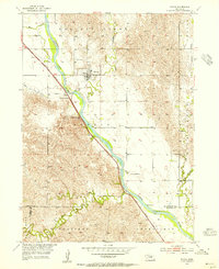
 1953 Ashton1955 Print · USGSSherman County agriculture and transit thrive in the early fifties, anchored by the rail town of Ashton. Local researchers can trace rural school districts like School No 12 and historical church sites such as Immanuel Ch along the prairie creeks.2 unique versions available
 - 1953 Map of Ravenna, 1976 Print
 1953 Ravenna1976 Print · USGSRavenna and the surrounding river valleys are captured here in the early 1950s as a vital railroad and farming hub. Researchers can trace the placement of several rural schoolhouses like Kuhl Sch and Halvik Sch, or locate the Our Lady of Lourdes Cem along the South Loup River.
 - 1955 Map of Broken Bow
 1955 Broken Bow1955 Print · USGSCentral Nebraska in the mid-fifties is defined by the sweeping Sand Hills and the vital river valleys that supported its ranching and rail towns. Researchers can trace the rail corridors of the Union Pacific RR and locate settlements like Dannebrog, Broken Bow, and Brewster.5 unique versions available
 - 1956 Map of Broken Bow
 1956 Broken Bow1956 Print · USGSCentral Nebraska during the mid-fifties reveals a region defined by its river-valley railroads and the rolling Sand Hills. Genealogists and local historians can trace the paths of the Chicago Burlington and Quincy through towns like Broken Bow, Merna, and Anselmo.
 - 1985 Map of St. Paul
 1985 St. Paul1985 Print · USGSCentral Nebraska's river valleys and rail towns are captured here in the mid-eighties, showing the region's agricultural and cultural foundations. Researchers can trace historic communities like Dannebrog, Scotia, and Nysted, or locate landmarks such as Sherman Reservoir and Happy Jack Peak.2 unique versions available
 - 1985 Map of Broken Bow
 1985 Broken Bow1985 Print · USGSCuster County in the mid-1980s displays a landscape of high tablelands and river valleys shaped by the reach of the railroad. Genealogists and researchers can trace the old rail stops along Mud Creek, from Berwyn to Litchfield, or locate land near Redfern Table and West Table.2 unique versions available
Showing maps 1-25 of 105
Top cities of Sherman County
- Loup City historical maps
- Litchfield historical maps
- Ashton historical maps
- Rockville historical maps
- Hazard historical maps
Frequently asked questions
- What are the different types of historical maps available for Sherman County?
- What is the oldest map of Sherman County?
- Where can I purchase historical maps of Sherman County for my home or office?
- Where can I download high-res historical maps of Sherman County?
- Are there historical topographic maps available for Sherman County?
- Is there historical aerial imagery available for Sherman County?
- Where are historical maps of Sherman County sourced from?