
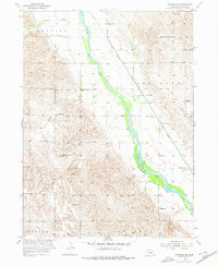
1953 Map of Ravenna NW
USGS Topo · Published 1955About this map
The Middle Loup River carves a fertile valley diagonally across this Sherman County landscape, defining the agricultural and transport patterns of the early 1950s. Parallel to the river's course, the Union Pacific railroad corridor serves as the primary artery for the region, connecting small rural townships such as Webster, Loup City, and Clay. This era is characterized by a dense network of one-room schoolhouses and local landmarks that speak to a closely-knit farming community before the consolidation of rural districts.
Find a feature on this map
23 named features on this map. Tap any name to fly to it.
Don’t see what you’re looking for? This feature index may not catch every label — zoom into the map to look around manually.
Map Details
Editions of this 1953 Ravenna NW Map
2 editions found
Other maps of this area

1899 · Loup
USGS Topo · 1:125,000

1951 · Arcadia SE
USGS Topo · 1:24,000

1951 · Litchfield NE
USGS Topo · 1:24,000

1951 · Hazard
USGS Topo · 1:24,000

1953 · Rockville
USGS Topo · 1:24,000

1953 · Loup City SE
USGS Topo · 1:24,000

1953 · Loup City
USGS Topo · 1:24,000

1953 · Ashton
USGS Topo · 1:24,000

1953 · Ravenna
USGS Topo · 1:24,000

1955 · Broken Bow
USGS Topo · 1:250,000