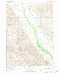
1953 Map of Ravenna NW
USGS Topo · Published 1976About this map
The Middle Loup River valley dominates this Sherman County landscape, where the braided river channel and its wide floodplain are flanked by an intricate network of irrigation infrastructure. This 1953 survey, conducted as part of the Missouri River Basin development program, shows the engineering of Canal No 3 and Canal No 4 cutting across the terrain to support local agriculture. The Union Pacific railroad runs parallel to the river's eastern bank, serving a rural economy anchored by family-named landmarks and local school districts. Genealogists will find a high density of one-room schoolhouses, including Hawk Sch, Austin Sch, and Fletcher Sch, alongside the Austin Cem and Verdurette Cem, providing a detailed look at the mid-century settlement pattern across Webster and Loup City townships.
Find a feature on this map
25 named features on this map. Tap any name to fly to it.
Don’t see what you’re looking for? This feature index may not catch every label — zoom into the map to look around manually.
Map Details
Editions of this 1953 Ravenna NW Map
2 editions found
Other maps of this area

1899 · Loup
USGS Topo · 1:125,000

1951 · Arcadia SE
USGS Topo · 1:24,000

1951 · Litchfield NE
USGS Topo · 1:24,000

1951 · Hazard
USGS Topo · 1:24,000

1953 · Rockville
USGS Topo · 1:24,000

1953 · Ravenna NW
USGS Topo · 1:24,000

1953 · Loup City SE
USGS Topo · 1:24,000

1953 · Loup City
USGS Topo · 1:24,000

1953 · Ashton
USGS Topo · 1:24,000

1953 · Ravenna
USGS Topo · 1:24,000