
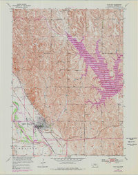
1953 Map of Loup City
USGS Topo · Published 1955About this map
Loup City serves as the focal point of this mid-century survey, situated at the confluence of the Union Pacific and Chicago Burlington and Quincy railroads. The town's infrastructure includes a local Fairground, a Radio Tower, and the Loup City Recreation Area along the banks of the Middle Loup River. The surrounding landscape of Sherman County is divided into the Logan and Loup City precincts, characterized by a series of numbered rural schoolhouses such as School No 52 and School No 81.
Find a feature on this map
30 named features on this map. Tap any name to fly to it.
Don’t see what you’re looking for? This feature index may not catch every label — zoom into the map to look around manually.
Map Details
Editions of this 1953 Loup City Map
2 editions found
Other maps of this area

1899 · Loup
USGS Topo · 1:125,000

1951 · Arcadia SE
USGS Topo · 1:24,000

1951 · Litchfield NE
USGS Topo · 1:24,000

1951 · Arcadia East
USGS Topo · 1:24,000

1953 · Loup City NW
USGS Topo · 1:24,000

1953 · North Loup
USGS Topo · 1:24,000

1953 · Ravenna NW
USGS Topo · 1:24,000

1953 · Loup City SE
USGS Topo · 1:24,000

1953 · Ashton
USGS Topo · 1:24,000

1955 · Broken Bow
USGS Topo · 1:250,000