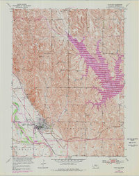
1953 Map of Loup City
USGS Topo · Published 1978About this map
Loup City serves as a vital Sherman County hub at the confluence of rail lines and prairie waterways. The town's grid is anchored by institutions like St Josephs Ch and the Evergreen Cem, while the local economy is framed by the junction of the Burlington Northern and Union Pacific railroads. The landscape is defined by the sweeping Sherman Reservoir to the northeast and the course of the Middle Loup River to the west.
Find a feature on this map
24 named features on this map. Tap any name to fly to it.
Don’t see what you’re looking for? This feature index may not catch every label — zoom into the map to look around manually.
Map Details
Editions of this 1953 Loup City Map
2 editions found
Other maps of this area

1899 · Loup
USGS Topo · 1:125,000

1951 · Arcadia SE
USGS Topo · 1:24,000

1951 · Litchfield NE
USGS Topo · 1:24,000

1951 · Arcadia East
USGS Topo · 1:24,000

1953 · Loup City NW
USGS Topo · 1:24,000

1953 · North Loup
USGS Topo · 1:24,000

1953 · Ravenna NW
USGS Topo · 1:24,000

1953 · Loup City SE
USGS Topo · 1:24,000

1953 · Loup City
USGS Topo · 1:24,000

1953 · Ashton
USGS Topo · 1:24,000