1980s Maps of Sheep Creek Precinct, Nebraska
Explore 8 historic maps of Sheep Creek Precinct from the 1980s. These maps offer a rare glimpse into what life looked like during the 1980s — showing old roads, neighborhoods, homes, and landmarks that have changed or disappeared over time.
Whether you're researching your family's past, planning a metal detecting trip, or studying how Sheep Creek Precinct's landscape evolved across the 1980s, these high-resolution maps are a powerful tool for exploring the history of this region.
- Focus on a specific era: All maps on this page are from the 1980s, giving you a focused view of this time period.
- See what’s changed: Compare century-old streets, trails, and buildings to today's modern landscape using overlays and satellite layers.
- Research with precision: Use these maps for genealogy, historical research, land use analysis, or educational projects.
- View, download, or print: Maps are fully viewable online in high resolution, and can be downloaded or printed for your own records.
Start exploring Sheep Creek Precinct's history through authentic maps from the 1980s. This is your window into the past.
Sheep Creek Precinct, NE maps
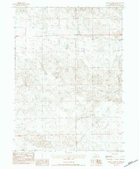
(8)- 1983 Map of University Lake SE, 1984 Print
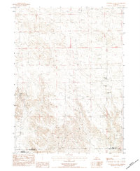 1983 University Lake SE1984 Print · USGSSioux and Scotts Bluff counties are shown in the early eighties as a landscape of remote cattle operations and protected prairie. Genealogists and local historians can locate specific family holdings like Prickett Ranch and the various Applegate properties.
 - 1983 Map of Kilpatrick Lake NW, 1984 Print
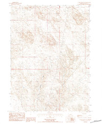
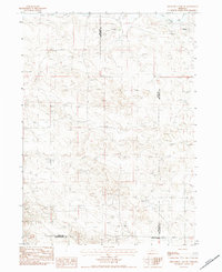
 1983 Kilpatrick Lake NW1984 Print · USGSThe high plains on the Sioux and Box Butte county line appear here in the early 1980s as a land of expansive cattle operations. Genealogists and local historians can trace legacy family holdings such as the Hood Ranch, Locker Ranch, and I B Henderson Ranch along the winding Snake Creek.
 - 1983 Map of Chalk Buttes NE, 1984 Print
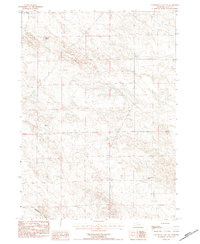
 1983 Chalk Buttes NE1984 Print · USGSSioux County ranching country is captured here in the early eighties as a network of creek beds and high-ground markers. Researchers can trace the path of Dry Spottetail Creek or locate utility landmarks like the Radio Tower and Gravel Pit.
 - 1983 Map of University Lake NW, 1984 Print
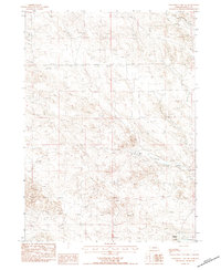
 1983 University Lake NW1984 Print · USGSSioux County ranching country is captured here during the early eighties, showing the spread of family operations across the high plains. Researchers can locate specific homesteads like the Watson Ranch and Spear-Diamond Ranch or trace the course of Spottedtail Creek.
 - 1983 Map of University Lake NE, 1984 Print
 1983 University Lake NE1984 Print · USGSSioux County ranchlands are captured here in the early 1980s, showcasing the high-plains terrain of the Nebraska Sandhills. Researchers can trace the layout of the Elliott Ranch and Henderson Ranch, as well as a lonely Grave and the headwaters of Mud Spr Cr.
 - 1983 Map of Whistle Creek SW, 1984 Print
 1983 Whistle Creek SW1984 Print · USGSSioux County's high plains were a landscape of managed water and ranching during the early 1980s. Researchers can locate the Johnson Ranch and trace the paths of Coyote Springs Creek and the expansive Royville Flat.
 - 1983 Map of Kilpatrick Lake SW, 1984 Print
 1983 Kilpatrick Lake SW1984 Print · USGSSioux County ranching country is captured in the early eighties as family-owned operations defined the Nebraska panhandle landscape. Genealogists and historians can locate established holdings like the Nerud Ranch, Denton Ranch, and R Henderson Ranch.
 - 1985 Map of Hemingford, 1986 Print
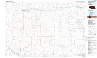 1985 Hemingford1986 Print · USGSThe Nebraska panhandle comes into sharp focus during the mid-1980s, revealing a landscape of remote ranching outposts and paleontological significance. Researchers can trace the Niobrara River to the Agate Fossil Beds National Monument or locate early settlements like Nonpareil and Marsland.2 unique versions available
End of results
Showing maps 1-8 of 8
Top cities near Sheep Creek Precinct
Top neighborhoods of Sheep Creek Precinct
Frequently asked questions
- What are the different types of historical maps available for Sheep Creek Precinct?
- What is the oldest map of Sheep Creek Precinct?
- Where can I purchase historical maps of Sheep Creek Precinct for my home or office?
- Where can I download high-res historical maps of Sheep Creek Precinct?
- Are there historical topographic maps available for Sheep Creek Precinct?
- Is there historical aerial imagery available for Sheep Creek Precinct?
- Where are historical maps of Sheep Creek Precinct sourced from?