Old Maps of Cold Springs, Nevada for Metal Detecting
Plan your next treasure hunt with 8 historic maps of Cold Springs. Find old homesites, ghost towns, trails, and gathering spots that may be lost to time — perfect for identifying promising metal detecting locations.
- Locate forgotten sites: Uncover places like long-lost settlements, abandoned rail lines, or gathering spots.
- Plan better hunts: Use map overlays combined with LiDAR or satellite views to narrow in on historically rich areas.
- Made for detectorists: Thousands of hobbyists use these maps to discover relics, coins, and hidden history.
Use these historic maps to boost your research and find new opportunities beneath the surface of Cold Springs.
Cold Springs, NV maps
(8)- 1955 Map of Millett, 1963 Print
 1955 Millett1963 Print · USGSCentral Nevada in the mid-fifties is a landscape of high-desert basins and remote outposts. Researchers can trace historic ranching sites like Petersons Mill and Grass Valley Ranch or locate the McCoy Mining Camp.4 unique versions available
 - 1959 Map of Millett
 1959 Millett1959 Print · USGSThe high basins and ranges of central Nevada are captured here in the late fifties, showcasing a landscape of remote cattle ranches and high-altitude mining. Researchers can trace historic family holdings like McLeod Ranch or locate the McCoy Mining Camp and the Austin Summit mountain pass.2 unique versions available
 - 1969 Map of Cold Springs, 1972 Print
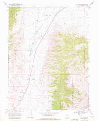 1969 Cold Springs1972 Print · USGSNevada's high desert reveals its frontier history in the late sixties, where the Old Overland Road meets the Desatoya Mts. Researchers can locate historic sites like the Old Telegraph Station and Alpine Ranch.3 unique versions available
 - 1985 Map of Smith Creek Valley
 1985 Smith Creek Valley1985 Print · USGSCentral Nevada in the mid-eighties shows a high-desert landscape of isolated mining sites and remote rangeland. Researchers can trace old operations like the Double Eagle Mine and Hasbrouck Mine or locate the Yomba Indian Reservation and Peterson Station.2 unique versions available
 - 2012 Map of Cold Springs, 2012 Print
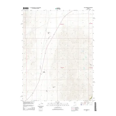
 2012 Cold Springs2012 Print · USGSCovers Cold Springs, including Churchill County, Lander County, and other nearby areas
 - 2014 Map of Cold Springs, 2014 Print
 2014 Cold Springs2014 Print · USGSCovers Cold Springs, including Churchill County, Lander County, and other nearby areas
 - 2018 Map of Cold Springs, 2018 Print
 2018 Cold Springs2018 Print · USGSCovers Cold Springs, including Churchill County, Lander County, and other nearby areas
 - 2021 Map of Cold Springs, 2021 Print
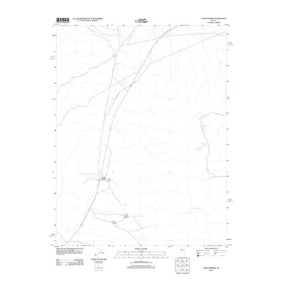
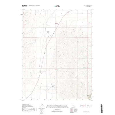
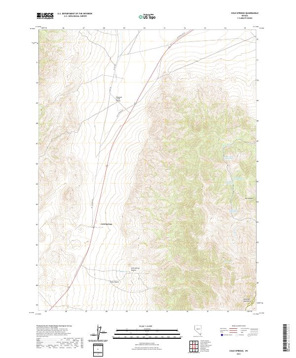 2021 Cold Springs2021 Print · USGSThe Nevada desert at the base of the Desatoya Mountains reveals a landscape of historic transit and vital water sources. Trace the legacy of the Old Overland Rd and locate the numbered chain of Cedar Springs in the hills above Cold Springs.
End of results
Showing maps 1-8 of 8
Frequently asked questions
- What are the different types of historical maps available for Cold Springs?
- What is the oldest map of Cold Springs?
- Where can I purchase historical maps of Cold Springs for my home or office?
- Where can I download high-res historical maps of Cold Springs?
- Are there historical topographic maps available for Cold Springs?
- Is there historical aerial imagery available for Cold Springs?
- Where are historical maps of Cold Springs sourced from?