
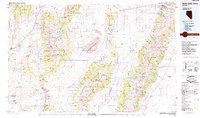
1985 Map of Smith Creek Valley
USGS Topo · Published 1985About this map
The Shoshone Mountains and Toiyabe Range dominate this mid-1980s landscape, framing the expansive Smith Creek Valley and the Big Smoky Valley to the east. This central Nevada basin-and-range topography is defined by its arid hydrological features, including the seasonal Reese River and various alkali flats like the Salt Marsh in the northeast. Human presence is scattered but significant, with the Yomba Indian Reservation situated along the river and the historical Peterson Station marking an earlier era of transit.
Find a feature on this map
72 named features on this map. Tap any name to fly to it.
Don’t see what you’re looking for? This feature index may not catch every label — zoom into the map to look around manually.
Map Details
Editions of this 1985 Smith Creek Valley Map
2 editions found
Other maps of this area

1907 · Tonopah
USGS Topo · 1:250,000

1908 · Tonopah
USGS Topo · 1:250,000

1908 · Carson Sink
USGS Topo · 1:250,000

1909 · Hawthorne
USGS Topo · 1:250,000

1910 · Carson Sink
USGS Topo · 1:250,000

1911 · Hawthorne
USGS Topo · 1:250,000

1915 · Hawthorne
USGS Topo · 1:250,000

1926 · Roberts Mountains
USGS Topo · 1:250,000

1929 · Roberts Mountains
USGS Topo · 1:250,000

1948 · Paradise Peak
USGS Topo · 1:62,500