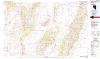
1985 Map of Smith Creek Valley
USGS Topo · Published 1985About this map
The Yomba Indian Reservation lies at the southern heart of this high-desert landscape, tucked between the towering peaks of the Toiyabe National Forest and the Shoshone Mountains. This 1980s-era map captures a remote section of the Great Basin where life follows the narrow ribbons of water and the legacy of precious metal extraction. Sparse settlements like Cold Springs and Peterson Station punctuate the vast valleys, while the Reese River and Smith Creek define the primary drainage patterns through the arid basins.
Find a feature on this map
55 named features on this map. Tap any name to fly to it.
Don’t see what you’re looking for? This feature index may not catch every label — zoom into the map to look around manually.
Map Details
Editions of this 1985 Smith Creek Valley Map
2 editions found

Other maps of this area

1907 · Tonopah
USGS Topo · 1:250,000

1908 · Tonopah
USGS Topo · 1:250,000

1908 · Carson Sink
USGS Topo · 1:250,000

1909 · Hawthorne
USGS Topo · 1:250,000

1910 · Carson Sink
USGS Topo · 1:250,000

1911 · Hawthorne
USGS Topo · 1:250,000

1915 · Hawthorne
USGS Topo · 1:250,000

1926 · Roberts Mountains
USGS Topo · 1:250,000

1929 · Roberts Mountains
USGS Topo · 1:250,000

1948 · Paradise Peak
USGS Topo · 1:62,500