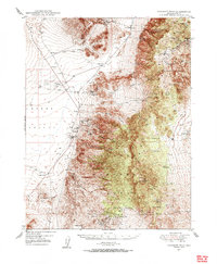
1948 Map of Paradise Peak
USGS Topo · Published 1948About this map
Mining operations and remote settlements define this high-desert landscape in the late 1940s, anchored by the industrial activities at Gabbs and the Sierra Magnesite Camp. The map documents a rugged transition from the flat expanses of Gabbs Valley and Lodi Valley to the steep elevations of the Toiyabe National Forest. Evidence of a booming mineral economy is everywhere, from the Victory Tungsten Mine to the Holly Mine and Sherman Mine, which are tucked into the canyons of the Paradise Range.
Find a feature on this map
49 named features on this map. Tap any name to fly to it.
Don’t see what you’re looking for? This feature index may not catch every label — zoom into the map to look around manually.
Map Details
Editions of this 1948 Paradise Peak Map
2 editions found

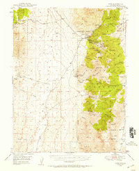
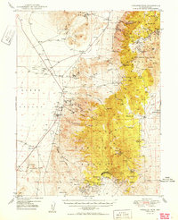
Other maps of this area

1907 · Tonopah
USGS Topo · 1:250,000

1908 · Tonopah
USGS Topo · 1:250,000

1908 · Carson Sink
USGS Topo · 1:250,000

1909 · Hawthorne
USGS Topo · 1:250,000

1910 · Carson Sink
USGS Topo · 1:250,000

1911 · Hawthorne
USGS Topo · 1:250,000

1915 · Hawthorne
USGS Topo · 1:250,000

1948 · Walker Lake
USGS Topo · 1:250,000
1948 · Ione
USGS Topo · 1:62,500
1950 · Paradise Peak
USGS Topo · 1:62,500