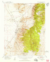
1948 Map of Paradise Peak
USGS Topo · Published 1956About this map
Gabbs Valley and the Lodi Valley define the western reaches of this 1948 survey, where the extraction of magnesium and tungsten drove the local economy. The town of Gabbs and the nearby Brucite settlement serve as the primary hubs, supporting extensive operations at the Brucite Mine and the Sierra Magnesite Mine. High in the mountains of the Toiyabe National Forest, numerous mining sites such as the Victory Tungsten Mine and the Illinois Mine dot the slopes of Paradise Peak and Sherman Peak.
Find a feature on this map
62 named features on this map. Tap any name to fly to it.
Don’t see what you’re looking for? This feature index may not catch every label — zoom into the map to look around manually.
Map Details
Editions of this 1948 Paradise Peak Map
2 editions found
Other maps of this area

1907 · Tonopah
USGS Topo · 1:250,000

1908 · Tonopah
USGS Topo · 1:250,000

1908 · Carson Sink
USGS Topo · 1:250,000

1909 · Hawthorne
USGS Topo · 1:250,000

1910 · Carson Sink
USGS Topo · 1:250,000

1911 · Hawthorne
USGS Topo · 1:250,000

1915 · Hawthorne
USGS Topo · 1:250,000

1948 · Paradise Peak
USGS Topo · 1:62,500

1948 · Walker Lake
USGS Topo · 1:250,000

1948 · Ione
USGS Topo · 1:62,500