1950s Maps of Las Vegas, Nevada
Explore 7 historic maps of Las Vegas from the 1950s. These maps offer a rare glimpse into what life looked like during the 1950s — showing old roads, neighborhoods, homes, and landmarks that have changed or disappeared over time.
Whether you're researching your family's past, planning a metal detecting trip, or studying how Las Vegas's landscape evolved across the 1950s, these high-resolution maps are a powerful tool for exploring the history of this region.
- Focus on a specific era: All maps on this page are from the 1950s, giving you a focused view of this time period.
- See what’s changed: Compare century-old streets, trails, and buildings to today's modern landscape using overlays and satellite layers.
- Research with precision: Use these maps for genealogy, historical research, land use analysis, or educational projects.
- View, download, or print: Maps are fully viewable online in high resolution, and can be downloaded or printed for your own records.
Start exploring Las Vegas's history through authentic maps from the 1950s. This is your window into the past.
Las Vegas, NV maps
(7)- 1952 Map of Corn Creek Springs, 1953 Print
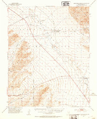 1952 Corn Creek Springs1953 Print · USGSThe northern Las Vegas Valley is captured here in the early 1950s, highlighting the vital water sources and ranching outposts of the Mojave desert. Trace the path of the Dismantled Railroad and locate historic sites like Tule Springs Ranch and Corn Creek Springs.3 unique versions available
 - 1952 Map of Gass Peak, 1953 Print
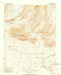 1952 Gass Peak1953 Print · USGSIn the early fifties, the high desert north of Las Vegas was becoming a critical zone for national defense and conservation. You can trace the expansion of Nellis Air Force Base alongside historic water sources like Mormon Wells and the June Bug Mine.4 unique versions available
 - 1952 Map of Blue Diamond, 1953 Print
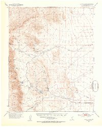 1952 Blue Diamond1953 Print · USGSBlue Diamond and the surrounding Nevada desert appear here in the early fifties during a period of active quarrying and ranching. Genealogists and historians can trace family-named outposts like Bar Nothing Ranch or Oliver Ranch and locate early industry at the Blue Diamond Mine.5 unique versions available
 - 1952 Map of Las Vegas, 1956 Print
 1952 Las Vegas1956 Print · USGSLas Vegas and its early suburbs are captured here in the early fifties during a period of rapid post-war aviation and industrial expansion. Researchers can trace family-named sites like Warm Springs Ranch and vanished landmarks like the Las Vegas Race Track or Mc Carran Field.
 - 1954 Map of Las Vegas
 1954 Las Vegas1954 Print · USGSLas Vegas and the Mojave Desert are shown in the early fifties as the region's military and recreational footprint expanded. Genealogists and historians can trace the early layout of North Las Vegas, the sites of Indian Springs Air Force Base, and long-established towns like Bunkerville.5 unique versions available
 - 1957 Map of Las Vegas
 1957 Las Vegas1957 Print · USGSSouthern Nevada in the mid-fifties is a landscape of massive federal ranges and the early growth of Las Vegas. Researchers can trace the development of McCarran Field, the expansive Lake Mead National Recreation Area, and the industrial footprint of Henderson.
 - 1959 Map of Las Vegas
 1959 Las Vegas1959 Print · USGSSouthern Nevada in the late fifties was a landscape of rapid suburban growth and massive federal installations. Genealogists and historians can trace early housing at Victory Village, the grounds of Camp Desert Rock, and the remote Tule Springs Ranch.
End of results
Showing maps 1-7 of 7
Top cities near Las Vegas
- Henderson historical maps
- North Las Vegas historical maps
- Enterprise historical maps
- Spring Valley historical maps
- Sunrise Manor historical maps
- Paradise historical maps
See more
Top neighborhoods of Las Vegas
- Lower Kyle Canyon historical maps
- Summerlin West historical maps
- East Las Vegas historical maps
- Five Points historical maps
- Twin Lakes historical maps
- West Las Vegas historical maps
See more
Frequently asked questions
- What are the different types of historical maps available for Las Vegas?
- What is the oldest map of Las Vegas?
- Where can I purchase historical maps of Las Vegas for my home or office?
- Where can I download high-res historical maps of Las Vegas?
- Are there historical topographic maps available for Las Vegas?
- Is there historical aerial imagery available for Las Vegas?
- Where are historical maps of Las Vegas sourced from?