Old Maps of Las Vegas, Nevada for Hiking & Exploration
Hike through history with 25 historic maps of Las Vegas. Explore old trails, ghost towns, and forgotten backroads — perfect for outdoor adventurers and local explorers.
- Rediscover forgotten places: Map out old mining camps, roads, and footpaths that no longer exist on modern maps.
- Layer with modern tools: Combine with LiDAR or satellite views to plan hikes through historical terrain.
- Made for exploration: Popular among hikers, overlanders, and local history lovers.
Use these maps to find adventure and explore the hidden past of Las Vegas.
Las Vegas, NV maps
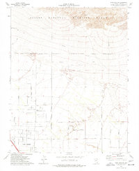
(25)- 1907 Map of Las Vegas, 1956 Print
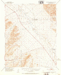
 1907 Las Vegas1956 Print · USGSSouthern Nevada is shown at a pivotal moment in the early 1900s as the rail network began to transform the desert landscape. Genealogists and historians can locate early homesteads and landmarks like Las Vegas Ranch, Mormon Well, and the Stirling Mine.
 - 1908 Map of Las Vegas
 1908 Las Vegas1908 Print · USGSSouthern Nevada was a frontier of rail and ranching in the years before major desert expansion. Trace the early footprints of Las Vegas and its surrounding outposts like Arden, Bracken, and the Stirling Mine.4 unique versions available
 - 1952 Map of Corn Creek Springs, 1953 Print
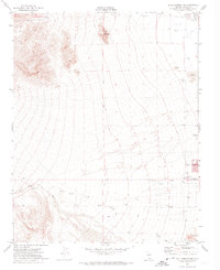
 1952 Corn Creek Springs1953 Print · USGSThe northern Las Vegas Valley is captured here in the early 1950s, highlighting the vital water sources and ranching outposts of the Mojave desert. Trace the path of the Dismantled Railroad and locate historic sites like Tule Springs Ranch and Corn Creek Springs.3 unique versions available
 - 1952 Map of Gass Peak, 1953 Print
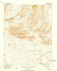 1952 Gass Peak1953 Print · USGSIn the early fifties, the high desert north of Las Vegas was becoming a critical zone for national defense and conservation. You can trace the expansion of Nellis Air Force Base alongside historic water sources like Mormon Wells and the June Bug Mine.4 unique versions available
 - 1952 Map of Blue Diamond, 1953 Print
 1952 Blue Diamond1953 Print · USGSBlue Diamond and the surrounding Nevada desert appear here in the early fifties during a period of active quarrying and ranching. Genealogists and historians can trace family-named outposts like Bar Nothing Ranch or Oliver Ranch and locate early industry at the Blue Diamond Mine.5 unique versions available
 - 1952 Map of Las Vegas, 1956 Print
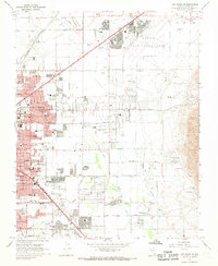
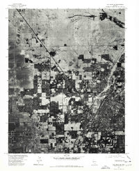
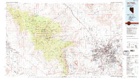
 1952 Las Vegas1956 Print · USGSLas Vegas and its early suburbs are captured here in the early fifties during a period of rapid post-war aviation and industrial expansion. Researchers can trace family-named sites like Warm Springs Ranch and vanished landmarks like the Las Vegas Race Track or Mc Carran Field.
 - 1954 Map of Las Vegas
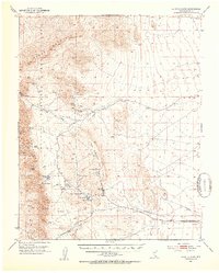
 1954 Las Vegas1954 Print · USGSLas Vegas and the Mojave Desert are shown in the early fifties as the region's military and recreational footprint expanded. Genealogists and historians can trace the early layout of North Las Vegas, the sites of Indian Springs Air Force Base, and long-established towns like Bunkerville.5 unique versions available
 - 1957 Map of Las Vegas
 1957 Las Vegas1957 Print · USGSSouthern Nevada in the mid-fifties is a landscape of massive federal ranges and the early growth of Las Vegas. Researchers can trace the development of McCarran Field, the expansive Lake Mead National Recreation Area, and the industrial footprint of Henderson.
 - 1959 Map of Las Vegas
 1959 Las Vegas1959 Print · USGSSouthern Nevada in the late fifties was a landscape of rapid suburban growth and massive federal installations. Genealogists and historians can trace early housing at Victory Village, the grounds of Camp Desert Rock, and the remote Tule Springs Ranch.
 - 1962 Map of Las Vegas
 1962 Las Vegas1962 Print · USGSSouthern Nevada is captured here during a period of significant military and industrial growth in the early sixties. Researchers can trace the development of Las Vegas alongside the Magnesium Plant in Henderson and the expansive Nellis Air Force Base.
 - 1967 Map of Las Vegas NW, 1968 Print
 1967 Las Vegas NW1968 Print · USGSMid-century Nevada comes alive in this survey of the desert metropolis during its rapid post-war expansion. Local historians can trace the foundations of modern neighborhoods through dozens of schools like Culley Sch and landmarks such as the North Las Vegas Air Terminal.6 unique versions available
 - 1967 Map of Las Vegas NE, 1968 Print
 1967 Las Vegas NE1968 Print · USGSGreater Las Vegas undergoes rapid suburban expansion in the late sixties, with residential grids reaching toward the desert foothills. Researchers can trace the mid-century city layout through Sunrise Acres, the Frenchman Mine, and dozens of local schools.6 unique versions available
 - 1972 Map of Blue Diamond NE, 1974 Print
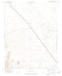
 1972 Blue Diamond NE1974 Print · USGSThe western edges of Clark County are captured here in the early 1970s, as the desert terrain met the first signs of urban growth. Researchers can trace the early path of Charleston Blvd and find landmarks like Memory Gardens (Cem) and Lone Mountain.3 unique versions available
 - 1972 Map of La Madre Mtn, 1974 Print
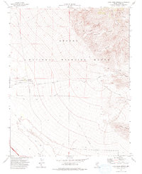
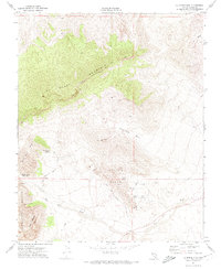 1972 La Madre Mtn1974 Print · USGSThe high desert of Clark County is captured here in the early 1970s, featuring the rise of public recreation. Trace the paths of the Red Rock Scenic Drive past Turtlehead Mtn and the springs of the Calico Basin.4 unique versions available
 - 1973 Map of Las Vegas NE, 1977 Print
 1973 Las Vegas NE1977 Print · USGSThe Mojave Desert meets rapid urban growth in the early 1970s as the Las Vegas valley expands toward the northeast. Trace the early development of North Las Vegas and the sprawling footprint of Nellis Air Force Base before the modern housing boom.
 - 1973 Map of Las Vegas NW, 1978 Print
 1973 Las Vegas NW1978 Print · USGSThe Nevada desert meets rapid suburban expansion in the early 1970s as residential grids push across the valley floor. Trace the development of Las Vegas and North Las Vegas, including the runways of the North Las Vegas Air Terminal.
 - 1974 Map of Corn Creek Springs, 1976 Print
 1974 Corn Creek Springs1976 Print · USGSThe northern Mojave Desert near the Sheep Range is captured here in the mid-1970s. Researchers can trace the legacy of early transit along the Old Railroad Grade and locate the historic waters of Corn Creek Springs.
 - 1974 Map of Tule Springs Park, 1977 Print
 1974 Tule Springs Park1977 Print · USGSThe northern edge of the Las Vegas valley in the mid-1970s shows a desert landscape shaped by resource extraction and early conservation efforts. Trace the Old Railroad Grade or locate the various Gravel Pits and Prospects near Tule Springs Park.3 unique versions available
 - 1974 Map of Grapevine Spring, 1977 Print
 1974 Grapevine Spring1977 Print · USGSClark County, Nevada, is shown during the mid-seventies as a region of mineral exploration and high desert canyons. Researchers can trace the path of a Jeep Trail leading toward Open Pit Mines, Prospects, and vital water sources like Grapevine Spring.
 - 1974 Map of Gass Peak SW, 1977 Print
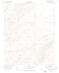
 1974 Gass Peak SW1977 Print · USGSLas Vegas began its northward expansion into the high desert during the 1970s, as shown in this detailed survey. Researchers can trace the early city grid along Rainbow Blvd or locate local landmarks like the Home of the Good Shepherd and the June Bug Mine.3 unique versions available
 - 1986 Map of Las Vegas
 1986 Las Vegas1986 Print · USGSThe Mojave Desert landscape around mid-1980s Las Vegas reveals a city in transition, surrounded by vast federal preserves and the high peaks of the Spring Mountains. Trace the development of Henderson and Arden, or locate remote landmarks like Gagnier Station and the Calico Hills.4 unique versions available
 - 2021 Map of La Madre Mountain, 2021 Print
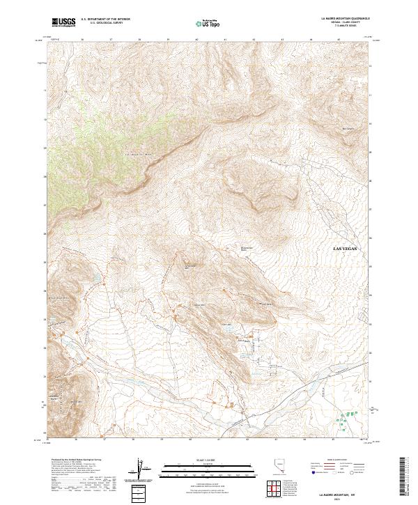 2021 La Madre Mountain2021 Print · USGSThe western edge of the Mojave Desert meets the expanding outskirts of Las Vegas in this 2021 study of the Red Rock region. Hikers and historians can trace the paths of the Keystone Thrust Trl, find remote desert water at Ash Creek Spring, or locate the Sandstone Bluffs.
 - 2021 Map of Las Vegas NE, 2021 Print
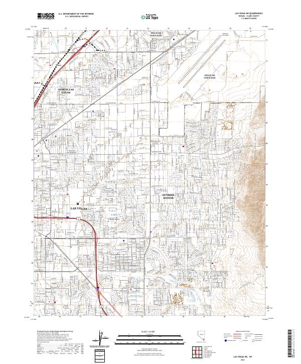 2021 Las Vegas NE2021 Print · USGSThe northeast Las Vegas Valley is shown here in the modern era, where suburban growth meets the Mojave Desert. Researchers can trace the development of North Las Vegas and Sunrise Manor alongside landmarks like Nellis Air Force Base and the Frenchman Range.
 - 2023 Map of Blue Diamond NE, 2023 Print
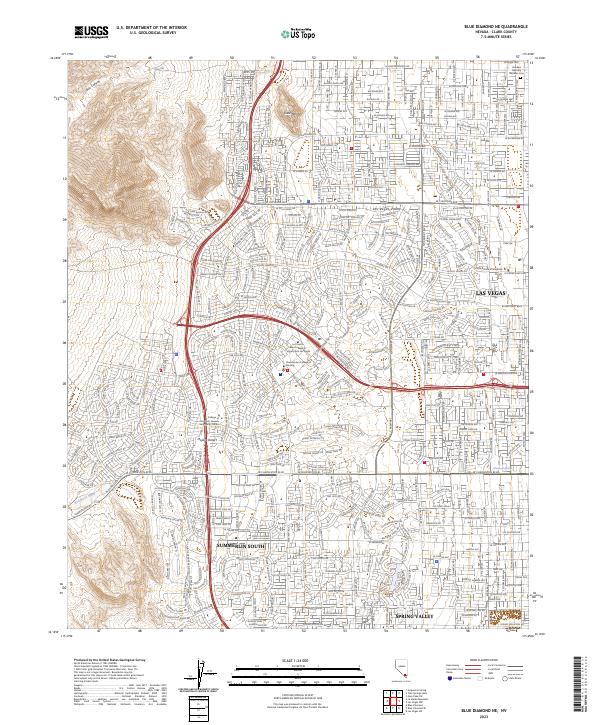 2023 Blue Diamond NE2023 Print · USGSThe western Las Vegas suburbs meet the Mojave Desert in this detailed 2023 survey. Researchers can trace modern expansion through Summerlin South and Spring Valley or locate landmarks like Lone Mtn and Whitehead Springs.
 - 2023 Map of Las Vegas NW, 2023 Print
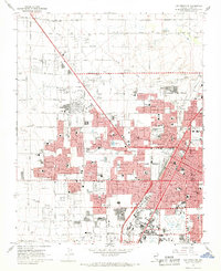
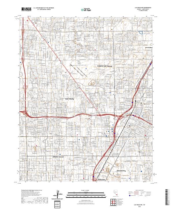 2023 Las Vegas NW2023 Print · USGSThe Clark County metropolitan area is shown here in its modern complexity as it reaches across the floor of the Las Vegas Valley. Researchers can trace specific landmarks from the North Las Vegas Airport to the Woodlawn Cem and the Union Pacific Railroad corridor.
End of results
Showing maps 1-25 of 25
Top cities near Las Vegas
- Henderson historical maps
- North Las Vegas historical maps
- Enterprise historical maps
- Spring Valley historical maps
- Sunrise Manor historical maps
- Paradise historical maps
See more
Top neighborhoods of Las Vegas
- Lower Kyle Canyon historical maps
- Eastland Heights historical maps
- Skye Canyon historical maps
- Centennial Hills historical maps
- Summerlin West historical maps
- East Las Vegas historical maps
See more
Frequently asked questions
- What are the different types of historical maps available for Las Vegas?
- What is the oldest map of Las Vegas?
- Where can I purchase historical maps of Las Vegas for my home or office?
- Where can I download high-res historical maps of Las Vegas?
- Are there historical topographic maps available for Las Vegas?
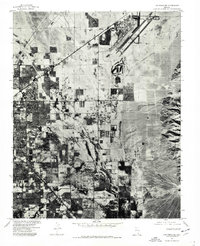
- Is there historical aerial imagery available for Las Vegas?
- Where are historical maps of Las Vegas sourced from?