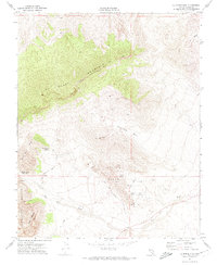
1972 Map of La Madre Mtn
USGS Topo · Published 1974About this map
La Madre Mountain dominates this portion of the Mojave Desert, showcasing a landscape defined by dramatic geological transitions in the early 1970s. The survey illustrates the stark contrast between the high limestone ridges and the colorful formations of the Calico Hills and Sandstone Bluffs to the south. Critical water sources, essential for both wildlife and human activity in this arid environment, are meticulously noted, including White Rock Spring, Red Spring, and Ash Creek Spring. The emergence of modern recreation is evident through the marking of the Red Rock Scenic Drive and the Willow Spring Picnic Area, while the presence of a Quarry and various Prospect points hints at the area's mineral exploration. Features like Icebox Canyon and Brownstone Basin highlight the intricate drainage patterns that lead into the Red Rock Wash.
Find a feature on this map
24 named features on this map. Tap any name to fly to it.
Don’t see what you’re looking for? This feature index may not catch every label — zoom into the map to look around manually.
Map Details
Editions of this 1972 La Madre Mtn Map
4 editions found
Other maps of this area

1907 · Las Vegas
USGS Topo · 1:250,000

1908 · Las Vegas
USGS Topo · 1:250,000

1952 · Corn Creek Springs
USGS Topo · 1:62,500

1952 · Blue Diamond
USGS Topo · 1:62,500

1954 · Las Vegas
USGS Topo · 1:250,000

1957 · Las Vegas
USGS Topo · 1:250,000

1957 · Charleston Peak
USGS Topo · 1:62,500

1957 · Mountain Springs
USGS Topo · 1:62,500

1959 · Las Vegas
USGS Topo · 1:250,000

1962 · Las Vegas
USGS Topo · 1:250,000