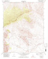
1972 Map of La Madre Mtn
USGS Topo · Published 1986About this map
La Madre Mountain dominates this portion of the Mojave Desert, a high-elevation landscape defined by the sharp transition between the White Rock Hills and the striking formations of the Calico Hills. In the early 1970s, the area's geological and recreational character was already well-established, marked by the presence of a Sandstone Quarry and the winding Red Rock Scenic Drive. This terrain is a network of essential water sources in an arid environment, including Ash Creek Spring, Willow Spring, and Red Spring, which historically dictated movement through the canyons. The map also captures the Sandstone Bluffs and Icebox Canyon, providing a clear record of the access points and landmarks as they existed before significant regional development expanded from the Las Vegas valley to the east.
Find a feature on this map
27 named features on this map. Tap any name to fly to it.
Don’t see what you’re looking for? This feature index may not catch every label — zoom into the map to look around manually.
Map Details
Editions of this 1972 La Madre Mtn Map
4 editions found
Other maps of this area

1907 · Las Vegas
USGS Topo · 1:250,000

1908 · Las Vegas
USGS Topo · 1:250,000

1952 · Corn Creek Springs
USGS Topo · 1:62,500

1952 · Blue Diamond
USGS Topo · 1:62,500

1954 · Las Vegas
USGS Topo · 1:250,000

1957 · Las Vegas
USGS Topo · 1:250,000

1957 · Charleston Peak
USGS Topo · 1:62,500

1957 · Mountain Springs
USGS Topo · 1:62,500

1959 · Las Vegas
USGS Topo · 1:250,000

1962 · Las Vegas
USGS Topo · 1:250,000