1900s (20th Century) Maps of Owyhee, Nevada
Explore 6 historic maps of Owyhee from the 1900s (20th Century). These maps offer a rare glimpse into what life looked like during the 1900s — showing old roads, neighborhoods, homes, and landmarks that have changed or disappeared over time.
Whether you're researching your family's past, planning a metal detecting trip, or studying how Owyhee's landscape evolved across the 1900s, these high-resolution maps are a powerful tool for exploring the history of this region.
- Focus on a specific era: All maps on this page are from the 1900s, giving you a focused view of this time period.
- See what’s changed: Compare century-old streets, trails, and buildings to today's modern landscape using overlays and satellite layers.
- Research with precision: Use these maps for genealogy, historical research, land use analysis, or educational projects.
- View, download, or print: Maps are fully viewable online in high resolution, and can be downloaded or printed for your own records.
Start exploring Owyhee's history through authentic maps from the 1900s. This is your window into the past.
Owyhee, NV maps
(6)- 1939 Map of Owyhee, 1965 Print
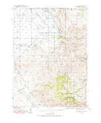 1939 Owyhee1965 Print · USGSThe Nevada-Idaho borderlands come into focus in the late 1930s, centered on the Duck Valley Indian Reservation and the vital Owyhee River. Researchers can trace early irrigation works like China Dam and find vanished points of interest such as Number One Settlement and the Idaho-Nev Shaft.
 - 1942 Map of Owyhee
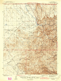 1942 Owyhee1942 Print · USGSThe high desert borderlands of Nevada and Idaho come alive in this pre-war survey of the Duck Valley Indian Reservation. Researchers can trace early irrigation systems and ranching landmarks like Lamb Reservoir, the Number One Settlement, and the Idaho-Nev Shaft mine.3 unique versions available
 - 1955 Map of McDermitt
 1955 McDermitt1955 Print · USGSNorthern Nevada in the mid-fifties shows a landscape of mining camps and vast cattle ranges. Trace the early footprints of Tuscarora or the remote Cordero Mine and National Mine tucked into the high desert peaks.3 unique versions available
 - 1959 Map of McDermitt
 1959 McDermitt1959 Print · USGSThe high-desert borderlands of northern Nevada and southern Oregon are captured here in the late fifties. Researchers can trace historic mining operations at the Cordero Mine and Getchell Mine, or locate settlements like Paradise Valley and Tuscarora.2 unique versions available
 - 1971 Map of Owyhee, 1974 Print
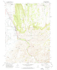 1971 Owyhee1974 Print · USGSLife on the Nevada-Idaho border in the early seventies centered on the Duck Valley Indian Reservation and its lifeline of canals. Researchers can trace the layout of Owyhee, identify the George Washington Cem, and locate landmarks like China Dam and the Rodeo Grounds.
 - 1982 Map of Bull Run Mts
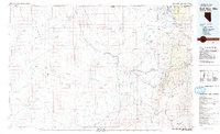 1982 Bull Run Mts1982 Print · USGSElko County and the Idaho borderlands are shown here in the early eighties as a hub of mining and water management. Researchers can trace historic extraction sites like the Edgemont Mine and Cornucopia Mine alongside the Owyhee River and the settlement of Tuscarora.2 unique versions available
End of results
Showing maps 1-6 of 6
Top cities near Owyhee
Frequently asked questions
- What are the different types of historical maps available for Owyhee?
- What is the oldest map of Owyhee?
- Where can I purchase historical maps of Owyhee for my home or office?
- Where can I download high-res historical maps of Owyhee?
- Are there historical topographic maps available for Owyhee?
- Is there historical aerial imagery available for Owyhee?
- Where are historical maps of Owyhee sourced from?