Old Maps of Eureka, Nevada for Genealogy
Trace your family roots with 10 historic maps of Eureka. These high-res maps reveal old neighborhoods, homesites, landmarks, and streets — helping you uncover where your ancestors lived and how the area evolved over time.
- Explore historic neighborhoods: Identify where your relatives may have lived in the 1800s or 1900s.
- Compare maps over time: Trace the changes in streets, buildings, and landmarks for multi-generational research.
- Perfect for genealogy & ancestry research: Used by family historians and researchers to map out lineage and migration.
These maps are an incredible resource for exploring your personal connection to Eureka's past.
Eureka, NV maps
(10)- 1953 Map of Eureka, 1955 Print
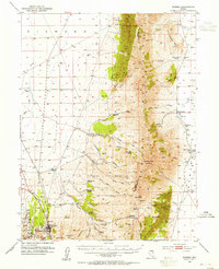 1953 Eureka1955 Print · USGSThe Nevada mining town of Eureka is shown at mid-century during a period of transition for the high desert silver-lead district. Genealogists and historians can locate numerous family holdings such as Palmer Ranch and trace the path of the Eureka Nevada RR past the historic Charcoal Kiln.3 unique versions available
 - 1956 Map of Ely, 1968 Print
 1956 Ely1968 Print · USGSEastern Nevada in the mid-fifties is a land of massive mountain ranges and silver-boom history. Trace the legacy of mining ruins at Hamilton and Treasure City or follow the path of the Nevada Northern RR through Ely.5 unique versions available
 - 1959 Map of Ely
 1959 Ely1959 Print · USGSEastern Nevada's high desert reveals its mining heart and pioneer ranching outposts during the late fifties. Genealogists and historians can trace family-named outposts like Goicoechea Ranch or explore the ruins of former silver-mining hubs like Hamilton and Treasure City.2 unique versions available
 - 1963 Map of Ely
 1963 Ely1963 Print · USGSEastern Nevada's high basins and mountain ranges are captured here in the early sixties, showing a landscape defined by mining and ranching. Trace family roots at the Thompson Ranch or follow the Nevada Northern Railroad through Steptoe Valley.
 - 1985 Map of Newark Lake
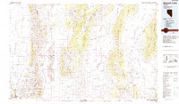 1985 Newark Lake1985 Print · USGSCentral Nevada's high desert reveals its network of remote wells and mining outposts during the mid-1980s. Researchers can locate ranching landmarks like Maple Syrup Well, the historic settlement of Eureka, and industrial sites like the Bay State Mine.
 - 1990 Map of Eureka
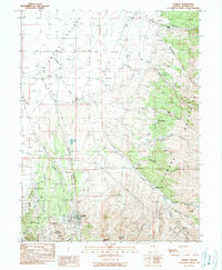 1990 Eureka1990 Print · USGSEureka and its surrounding mining districts are captured here in the late twentieth century, showing a landscape defined by deep shafts and high-desert ranching. Genealogists and historians can trace family-named sites like Palmer Ranch or locate old industrial markers including the Ruby Hill area and the Old Railroad Grade.
 - 2012 Map of Eureka, 2012 Print
 2012 Eureka2012 Print · USGSCovers Eureka, including Eureka County, United States, and other nearby areas
 - 2014 Map of Eureka, 2014 Print
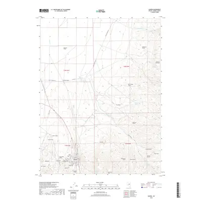
 2014 Eureka2014 Print · USGSCovers Eureka, including Eureka County, United States, and other nearby areas
 - 2018 Map of Eureka, 2018 Print
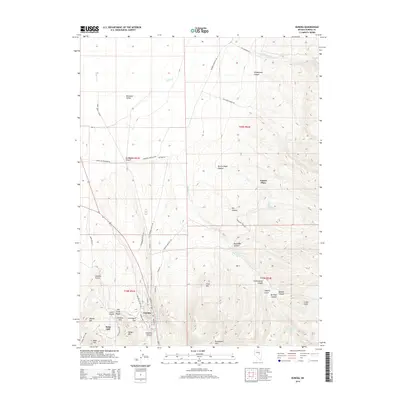
 2018 Eureka2018 Print · USGSCovers Eureka, including Eureka County, United States, and other nearby areas
 - 2021 Map of Eureka, 2021 Print
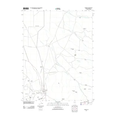
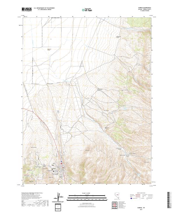 2021 Eureka2021 Print · USGSThis part of Nevada in the early twenty-first century reveals a landscape shaped by historical mining and high-desert terrain. Genealogists can trace family names at the Cedar Hills Cem or Schwab Cem, and explore the area around the Eureka County Court House.
End of results
Showing maps 1-10 of 10
Frequently asked questions
- What are the different types of historical maps available for Eureka?
- What is the oldest map of Eureka?
- Where can I purchase historical maps of Eureka for my home or office?
- Where can I download high-res historical maps of Eureka?
- Are there historical topographic maps available for Eureka?
- Is there historical aerial imagery available for Eureka?
- Where are historical maps of Eureka sourced from?