
1953 Map of Eureka
USGS Topo · Published 1955About this map
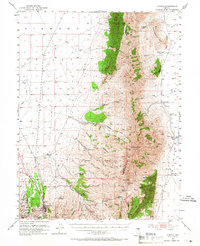
Eureka serves as the focal point of this Nevada survey, showing the town's dense network of mining shafts including the Richmond Shaft and Fad Shaft. The map traces the industrial heritage of the Diamond Mountains through remains like a Charcoal Kiln, Smelter Ruins, and a Smelter Stack, which illustrate the heavy metal extraction that once dominated the local economy. Transport into the high desert landscape is marked by the legendary Lincoln Highway and an Old Railroad Grade, showing how the town connected to the wider territory.
Find a feature on this map
85 named features on this map. Tap any name to fly to it.
Don’t see what you’re looking for? This feature index may not catch every label — zoom into the map to look around manually.
Map Details
Editions of this 1953 Eureka Map
3 editions found
Other maps of this area

1926 · Roberts Mountains
USGS Topo · 1:250,000

1929 · Roberts Mountains
USGS Topo · 1:250,000

1949 · Garden Valley
USGS Topo · 1:62,500

1951 · Garden Valley
USGS Topo · 1:62,500

1951 · Pancake Summit
USGS Topo · 1:62,500

1953 · Pinto Summit
USGS Topo · 1:62,500

1955 · Millett
USGS Topo · 1:250,000

1956 · Bellevue Peak
USGS Topo · 1:62,500

1956 · Whistler Mtn
USGS Topo · 1:62,500

1956 · Ely
USGS Topo · 1:250,000