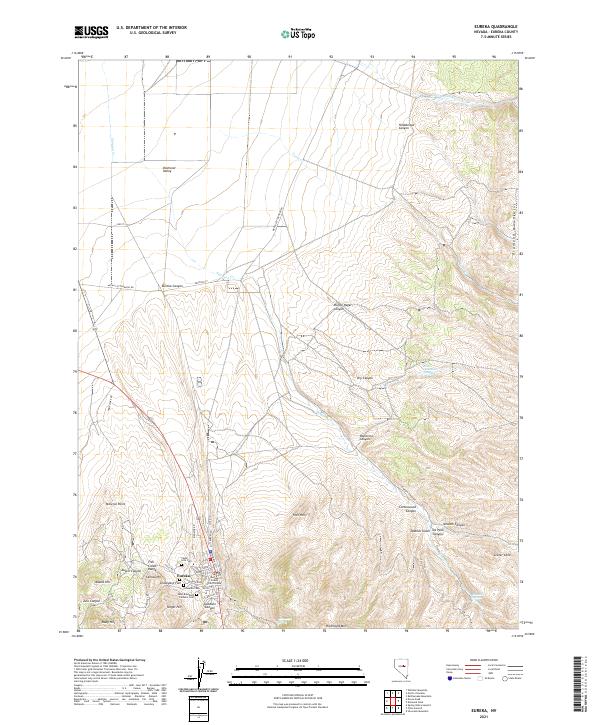
2021 Map of Eureka
USGS Topo · Published 2021About this map
Eureka serves as the central hub of this Nevada landscape, where the historic Eureka County Court House stands amidst a cluster of local landmarks. The town is situated between the rising slopes of the Fish Creek Range to the west and the Diamond Mountains to the east, reflecting its origins as a mining center. Several burial sites, including Cedar Hills Cem, Schwab Cem, and Saint Brendans Catholic Cem, are clustered near the settlement, offering significant points of interest for genealogists tracing early families. To the south and east, the terrain becomes increasingly complex with features like Ruby Hill, Target Hill, and the volcanic Crater Cone. Water sources are sparse but vital in this arid environment, evidenced by named locations such as Four-eyed Nicks Springs and Simpson Springs which break the dry canyons of the interior.
Find a feature on this map
54 named features on this map. Tap any name to fly to it.
Don’t see what you’re looking for? This feature index may not catch every label — zoom into the map to look around manually.
Map Details
Editions of this 2021 Eureka Map
This is the sole edition of this map. No revisions or reprints were ever made.
Other maps of this area

1926 · Roberts Mountains
USGS Topo · 1:250,000

1929 · Roberts Mountains
USGS Topo · 1:250,000

1953 · Pinto Summit
USGS Topo · 1:62,500

1953 · Eureka
USGS Topo · 1:62,500

1955 · Millett
USGS Topo · 1:250,000

1956 · Bellevue Peak
USGS Topo · 1:62,500

1956 · Whistler Mtn
USGS Topo · 1:62,500

1956 · Ely
USGS Topo · 1:250,000

1959 · Ely
USGS Topo · 1:250,000

1959 · Millett
USGS Topo · 1:250,000