Old Maps of Lockes, Nevada for Metal Detecting
Plan your next treasure hunt with 9 historic maps of Lockes. Find old homesites, ghost towns, trails, and gathering spots that may be lost to time — perfect for identifying promising metal detecting locations.
- Locate forgotten sites: Uncover places like long-lost settlements, abandoned rail lines, or gathering spots.
- Plan better hunts: Use map overlays combined with LiDAR or satellite views to narrow in on historically rich areas.
- Made for detectorists: Thousands of hobbyists use these maps to discover relics, coins, and hidden history.
Use these historic maps to boost your research and find new opportunities beneath the surface of Lockes.
Lockes, NV maps
(9)- 1956 Map of Lund, 1963 Print
 1956 Lund1963 Print · USGSEastern Nevada and the Utah borderlands are mapped here during the mid-fifties, showing a landscape of high-desert ranches and mountain mining camps. Genealogists and historians can trace family locations through sites like Bristol Silver Mines, Lund, and the Sunnyside Whipple Ranch.2 unique versions available
 - 1960 Map of Lund
 1960 Lund1960 Print · USGSEastern Nevada and the Utah borderlands are mapped here during the mid-twentieth century, showing a landscape of high peaks and isolated ranching outposts. Researchers can locate remote mining sites like the Tungsten Queen Mine and early settlements including Lund and Shoshone.
 - 1968 Map of Portuguese Mtn, 1971 Print
 1968 Portuguese Mtn1971 Print · USGSNye County, Nevada, is captured here in the late 1960s, showing a remote landscape defined by high-desert basins and the volcanic topography of the Pancake Range. Genealogists and historians can trace old water sources like Lockes and the Etcheverria Well.
 - 1968 Map of Lockes, 1973 Print
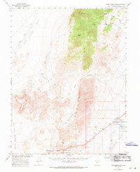
 1968 Lockes1973 Print · USGSRailroad Valley in the late sixties remains a landscape of isolated springs and high-desert ranges. Genealogists and desert researchers can trace the settlement at Lockes and find vital water sources like Big Spring and Reynolds Springs near the Pancake Range.2 unique versions available
 - 1980 Map of Duckwater, 1981 Print
 1980 Duckwater1981 Print · USGSNye County and White Pine County are shown here in the early eighties as a landscape of isolated valleys and high mountain ranges. Genealogists and researchers can trace remote settlements like Duckwater, locate the Gold Point Mine, or find the unique Meteorite Crater.2 unique versions available
 - 2012 Map of Lockes, 2012 Print
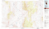
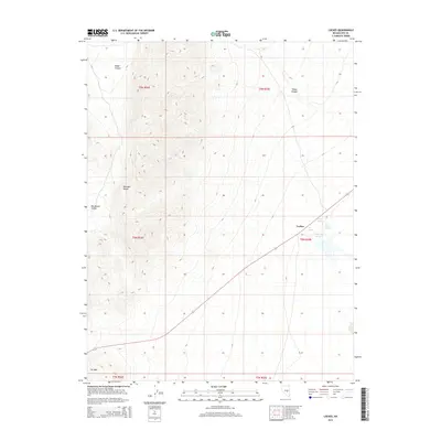
 2012 Lockes2012 Print · USGSCovers Lockes, including Nye County, United States, and other nearby areas
 - 2014 Map of Lockes, 2014 Print
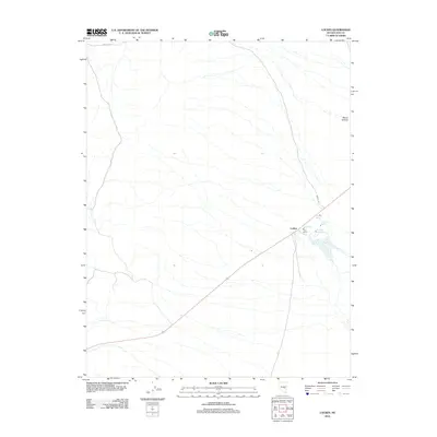
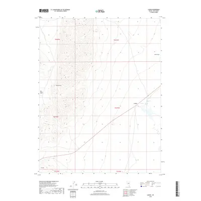
 2014 Lockes2014 Print · USGSCovers Lockes, including Nye County, United States, and other nearby areas
 - 2018 Map of Lockes, 2018 Print
 2018 Lockes2018 Print · USGSCovers Lockes, including Nye County, United States, and other nearby areas
 - 2021 Map of Lockes, 2021 Print
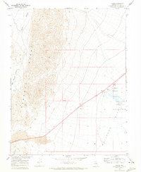
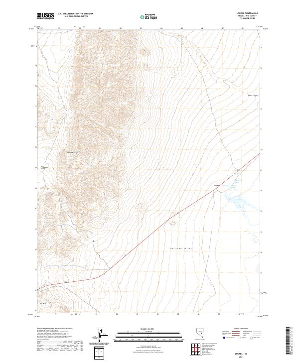 2021 Lockes2021 Print · USGSNye County's high desert landscape and vital water sources are documented here in the early twenty-first century. Researchers can locate the settlement of Lockes and trace the proximity of life-sustaining water at Big Spring, North Spring, and Reynolds Springs.
End of results
Showing maps 1-9 of 9
Frequently asked questions
- What are the different types of historical maps available for Lockes?
- What is the oldest map of Lockes?
- Where can I purchase historical maps of Lockes for my home or office?
- Where can I download high-res historical maps of Lockes?
- Are there historical topographic maps available for Lockes?
- Is there historical aerial imagery available for Lockes?
- Where are historical maps of Lockes sourced from?