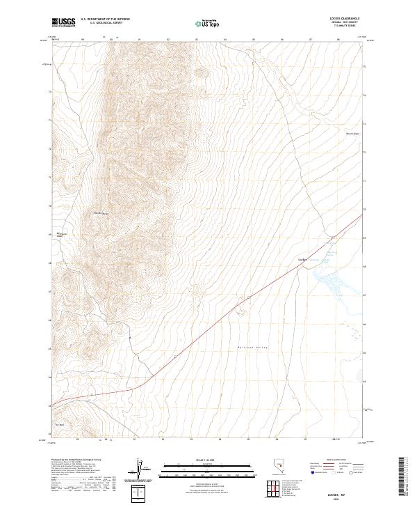
2021 Map of Lockes
USGS Topo · Published 2021About this map
Lockes sits at the intersection of high desert topography and critical water sources in eastern Nevada. This part of Nye County is defined by the contrast between the high elevations of the Pancake Range and the broad, flat expanse of Railroad Valley to the south and east. The map captures a landscape where life and travel are dictated by specific springs, including Big Spring, Reynolds Springs, and Hay Corral Spring, which emerge near the base of the mountains.
Find a feature on this map
17 named features on this map. Tap any name to fly to it.
Don’t see what you’re looking for? This feature index may not catch every label — zoom into the map to look around manually.
Map Details
Editions of this 2021 Lockes Map
This is the sole edition of this map. No revisions or reprints were ever made.
Other maps of this area

1956 · Lund
USGS Topo · 1:250,000

1960 · Lund
USGS Topo · 1:250,000

1964 · Blue Eagle Springs
USGS Topo · 1:62,500

1964 · Troy Canyon
USGS Topo · 1:62,500

1968 · Portuguese Mtn
USGS Topo · 1:62,500

1968 · The Wall
USGS Topo · 1:62,500
1968 · Black Rock Summit
USGS Topo · 1:24,000

1968 · Portuguese Mtn
USGS Topo · 1:24,000
1968 · The Wall
USGS Topo · 1:24,000
1968 · Portuguese Mtn NW
USGS Topo · 1:24,000