
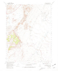
1968 Map of The Wall
USGS Topo · Published 1971About this map
The high desert basin of Railroad Valley and the formidable ridges of The Wall Range dominate this late 1960s survey, conducted in cooperation with the Atomic Energy Commission. The landscape is defined by its isolation and the necessity of water management in a harsh environment, evidenced by scattered improvements such as Feroy Well, Pigeon Well, and the Stone Corral Well. Near the small settlement of Nyala at the valley's edge, the terrain transitions into a designated Wildlife Management Area. To the west, the volcanic character of the region is clear, with fields of Lava and Cinder Pits near Lunar Lake. The prevalence of Prospects and numerous Drill Holes points to an era of geological exploration and resource assessment in this corner of Nye County.
Find a feature on this map
26 named features on this map. Tap any name to fly to it.
Don’t see what you’re looking for? This feature index may not catch every label — zoom into the map to look around manually.
Map Details
Editions of this 1968 The Wall Map
2 editions found
Other maps of this area

1956 · Lund
USGS Topo · 1:250,000

1956 · Tonopah
USGS Topo · 1:250,000

1959 · Tonopah
USGS Topo · 1:250,000

1960 · Lund
USGS Topo · 1:250,000

1962 · Tonopah
USGS Topo · 1:250,000

1964 · Blue Eagle Springs
USGS Topo · 1:62,500

1964 · Troy Canyon
USGS Topo · 1:62,500

1967 · Lunar Crater
USGS Topo · 1:62,500

1967 · Moores Station
USGS Topo · 1:62,500

1967 · Moores Station SE
USGS Topo · 1:24,000